Contact
Booking.com
Home | Travel Australia | Travel By Road | 4 Wheel Drive | Outback Highways and Tracks

4wd: Outback Highways and Tracks


Outback Highways – Sealed

Gulf Experimental Road (Qld)

This road forms the first section of The Savannah Way when travelling from Queensland. It can be accessed from the coast of Far North Queensland from Cairns via Atherton Tablelands and Kennedy Highway, or from Townsville via Charters Towers on the Gregory Development Road. The drive west along the Gulf Developmental Road passes through treeless plains of Mitchell grass to Georgetown (gemstone fossicking), Gilbert River, Croydon (old gold mining town) and on to Normanton and Karumba on the Gulf of Carpentaria. The unsealed Kennedy Development Road from Hughenden links to the Overlander’s Way and the fascinating Dinosaur history of central Queensland. Porcupine Gorge is a renowned walking track.

Matilda Highway (Qld)

This is a great 2WD bitumen North-South route through central Queensland passing several places of historical significance and some great outback pubs.
  • ExploreOz track notes


  • Kidman Way (NSW/Qld/Vic)

    This bitumen route is also the shortcut from Victoria, through the heart of western NSW, up to Central Qld where it meets the Matilda Highway at Cunnamulla. Banjo Drive on the Alpine Way at Kasees in winter.
    • ExploreOz track notes


    • Alpine and Kosciusko (NSW/Vic)

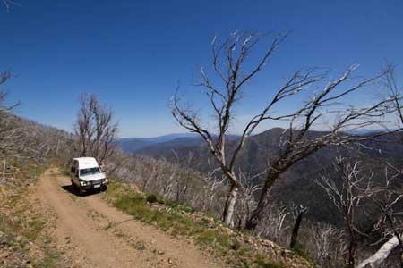
      This trek traverses through state forest, Victoria’s Alpine NP, Kosciusko NP in NSW and then follows the Great Dividing Range to Cooma. Many sections are narrow, twisting, steep and very slippery after rain.
      • ExploreOz track notes


      • West Macdonnell Ranges (NT)


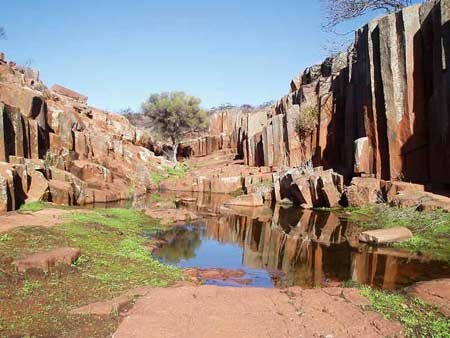
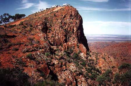
        The West Macdonnell Ranges in the heart of Australia’s red centre stretch for 400km from east-west as a series of parallel ranges. Within the ranges are magnificent gaps and gorges, dramatic scenery, great bush camping and walks.
        • ExploreOz track notes


        • The Savannah Way (Qld/NT/WA)

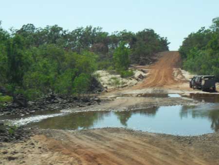
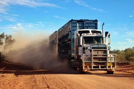
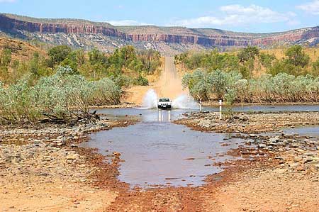
          The Savannah Way is one of Australia’s ultimate adventure drives with large sections suitable for both 2 and 4 wheel drive vehicles. Stretching across far northern Australia through the Gulf Savannah of Queensland, the Top End of the Northern Territory and the Kimberley region of Western Australia, the Savannah Way is a combination of sealed and unsealed major outback roads and covers the 3700km from Cairns via Borroloola and Katherine to Broome in the west.

          Darling River Run (NSW)


          The Darling River is one of the outback’s most famous rivers. Starting near Bourke in central NSW and draining into the Murray in Victoria the Darling River Run snakes itself through black soil farming country.
          • ExploreOz track notes


          • Kakadu (NT)

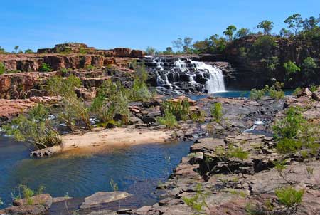
            World renown Kakadu has plenty to offer the international and local tourist. The diversity and many attractions including amazing rock formations, rare wildlife, Aboriginal art and fascinating escarpments are all part of Kakadu National Park.
            • ExploreOz track notes


            • Outback Highways – Unealed

              Gunbarrel Highway (WA/NT)


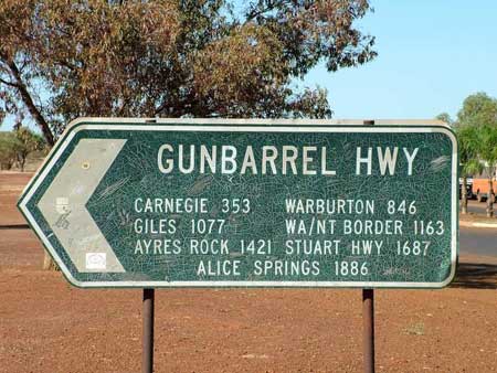
              The Gunbarrel Highway was built by Len Beadell (1923-1995), a Surveyor with the Australian Army, and the Gunbarrel Road Construction Party. It runs trough central Australia from WA to the Northern Territory and is so named because Len favoured the rectilinear propagation of roads and vehicles. The Highway links Carnegie Station in central Western Australia with the Meteorological Station at Giles just west of the Northern Territory border. The original highway then extends south east to Mabel Park Station in South Australia. It was completed in 1958 after three years. The roads were cut by a small team of men to provide a way of retrieving rocket parts from the Woomera Rocket range. The team worked alone and a full account of their trials and tribulations is written in the book “Too Long in the Bush” by Len Beadell.
              • ExploreOz track notes


              • The Outback Highway (Qld/WA.NT)

                The Outback Highway is a series of roads and dirt tracks linking Winton, Queensland and Laverton, Western Australia. At 2,800 km, it traverses the inhospitable arid heart of Australia, the great outback. It passes through Queensland, the Northern Territory and Western Australia. It is being developed to provide an inland route between southern Western Australia and northern Queensland as an alternative to the National Highway 1 along either coast.

                Canning Stock Route (WA)


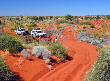
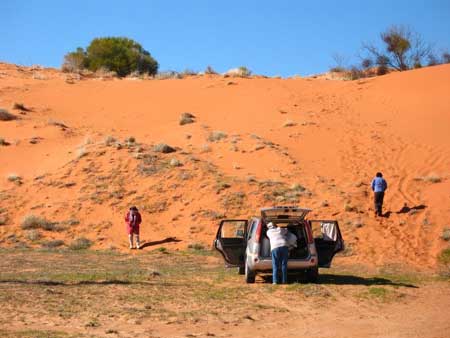
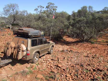
                The Canning Stock Route was surveyed for the purpose of droving cattle from the Kimberley region of Western Australia south to the goldfields. Wells were constructed one day’s travel apart for a mob of cattle. The wells were timbered and provided with A-frames to lift water to troughs. They have fallen into disrepair although some may have been restored. The route is one of the classic four wheel drive adventures – and one that must not to be taken lightly. Navigation is hard, there are sand dunes and other difficult terrain, and it is very, very remote. The entire “track” is too long for most vehicles to carry all of their own fuel so it is common practice to arrange for a fuel drop to be from Newman.
                • ExploreOz track notes


                • Anne Beadell Highway (SA/WA)

                  The Anne Beadell Highway itself stretches for 1025km and is the major track from Coober Pedy in South Australia to Laverton in Western Australia. The name ‘highway’ is a little misleading as the trip traverses little used tracks that are often very narrow, twisty and sandy. The road was constructed by Len Beadell (1923-1995) and the Gunbarrel Road Construction Party over a period of about nine years commencing in 1953, Len named this track after his wife, Anne (right). Several of the roads and tracks that his team built were named after family members. The Anne Beadell Highway is considered to be the four wheel drivers alternative to the Nullarbor Plain. It is the most direct route, east to west, or visa versa, across the Great Victoria Desert.
                  • ExploreOz track notes


                  • Oodnadatta Track (SA)


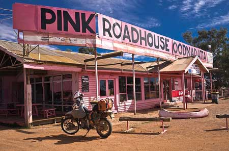
                    The Oodnadatta Track runs through the northern parts of South Australia – remote desert country and up into the Northern Territory. Without rain the main route can be undertaken in a conventional vehicle although you may wish to explore some of the historical points of interest in the surrounding areas, in which case you will definitely need a four wheel drive vehicle. The track once formed the main route into Central Australia and the Northern Territory. Its popularity as a main access route has diminished but it has gained tremendous popularity with many as one of Australia’s easier 4wd trips.
                    • ExploreOz track notes


                    • Tanami Track (NT/WA)

                      The Tanami Track is essentially a great short-cut linking the Red Centre to the Kimberley of Western Australia (The alternative route is to take the Stuart Highway up to Dunmarra then strike north-west along the Buchanan and Duncan Highways). Although once a notorious 4WD track, it is now a graded dirt highway. Although the track traverses one of Australia’s great deserts – The Tanami Desert – it is in fact a relatively easy route for travellers with 4WD and a comparatively safe introduction to remote, arid area travel.
                      • ExploreOz track notes


                      • Birdsville Track (SA/Qld)


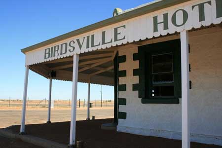
                        Established during the 1880s, the Birdsville Track was the main stock route between Marree in South Australia and Birdsville in Queensland. Usually taking about a month to complete, the route was long and extremely harsh and cattle often didn’t survive the trip. Camel trains fared better. Until the 1930s these animals were used as the major transporters into a largely inaccessible region, but were released into the wild when road transport took over. Nowadays, the track is passable to conventional vehicles for most of the year.
                        • ExploreOz track notes


                        • Plenty Highway (Qld/NT)

                          The is the most direct route from central Queensland across to Alice Springs in central Australia. It is a wide stretch of very red sandy soil that when wet can be impassible and is therefore a 4WD track only. The Plenty Highway really doesn’t begin until you reach the NT border, but to get there you travel from Boulia in outback Queensland along the Donohue Highway (just a track).
                          • ExploreOz track notes


                          • Connie Sue Highway (WA/SA)


                            The Connie Sue Highway is another bush “highway” constructed by Len Beadell and the Gunbarrel Road Construction Party in 1962. It was named after Beadell’s daughter, Connie Sue. She began her desert life when she was only 5 months old; along with her mother Anne, accompanying Len on a 5-month expedition to perform reconnaissance for the Connie Sue and Anne Beadell Highways in the Great Victoria Desert. These days, she conducts outback tours along the routes pioneered by her father. The highway named in her honour runs from Rawlinna on the Trans Australia Railway north for 650 km to Warburton on the Great Central Road. The southern 350 km section stretches from the Nullarbor plain through to Neale Junction in the Great Victoria Desert. It provides an almost straight line shortcut to Warburton providing quick access to the myriad of wonderful desert tracks in the area.
                            • ExploreOz track notes


                            • Corner Country (NSW/SA/Qld)


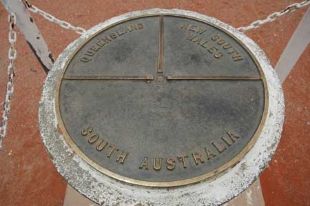
                              North of Broken Hill the bitumen gives way to dirt. Here you’ll find Mootwingee NP, the opal-mining town of White Cliffs, one-pub towns like Milparinka, Tibooburra and finally Cameron Corner where the 3 states of NSW, SA & Qld meet.
                              • ExploreOz track notes


                              • Boggy Hole (NT)

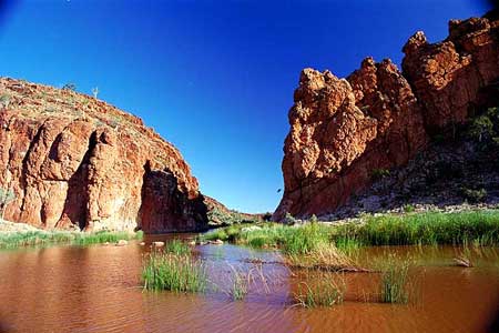
                                Finke Gorge is located within the Finke Gorge NP south of the West Macdonnell Ranges in the Alice Springs region. The most popular attraction is Boggy Hole, a permanent billabong of the Finke River. This is a good 4WD route to Uluru and/or Kings Canyon.
                                • ExploreOz track notes


                                • Hay River (NT)

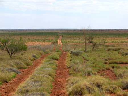
                                  Suitable only to 4WDers with a strong sense of adventure and experience in remote desert travel. This track is largely unmarked and good map-reading skills are essential.
                                  • ExploreOz track notes


                                  • Old Andado Track (NT)


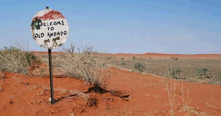
                                    The Old Andado Track traverses fascinating terrain that includes mountain ranges, rocky gibber plains, desert sand dunes and floodplains in the Red Centre just south of Alice Springs.
                                    • ExploreOz track notes


                                    • Roper Bar (NT)

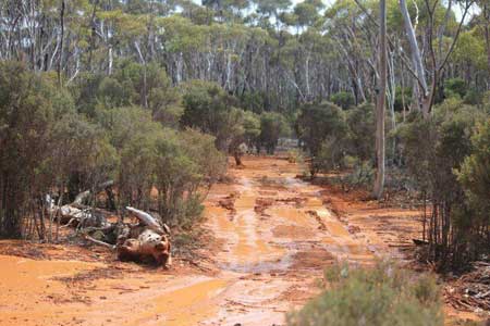
                                      This part of Australia is extremely remote and uninhabited. A 4WD trek through these parts can be an extension of the Gulf Track on your way further up North to Darwin or Arnhem Land.
                                      • ExploreOz track notes


                                      • Bloomfield Track (Qld)


                                        The Bloomfield Track offers a delightful Trek though the World Heritage listed Rainforest area of Far North Queensland on an unsealed track and provides a link between Cape Tribulation and Cooktown.
                                        • ExploreOz track notes


                                        • Burke Developmental Road (Qld)

                                          This trek heads inland through the Atherton Tablelands toward Chillagoe along the bulldust track called the Burke Developmental Road in the lower region of the Cape York Peninsula. Passing Staaten River NP, Mitchell and Alice NP and Dorunda on-route to the Gulf.
                                          • ExploreOz track notes


                                          • Cape York (Qld)


                                            Experience the thrill of standing at the most northern tip of Australia, visit gorges and waterfalls and enjoy the challenge of a 4WD adventure just to get there.
Outback Tracks – Unsealed

Gulf Track (Qld)


This track follows the Gulf of Carpentaria from Karumba – Borroloola in one of Australia’s most harshest outback areas. At first it appears a dry and barren place but if you take a few side diversions you’ll find gorges of paradise and rivers of barramundi.
  • ExploreOz track notes


  • Winton to Innamincka (Qld/SA)

    Beginning in the open plains around Winton and ending in the Mars like gibber plains around Innamincka, this trek will take you to some of the most remarkable country in Qld’s outback before crossing into the famous Cooper Creek region at Innamincka.
    • ExploreOz track notes


    • Gawler Ranges (SA)


      This rarely used route is a great alternative to crossing the Eyre Highway from Fowlers Bay through to Port Augusta. Passing through the ranges and saltbush country there is the option to head further north to Kingoonya & onto Coober Pedy.
      • ExploreOz track notes


      • Googs Track (SA)

        A most adventurous short-cut for those travelling from the west to Coober Pedy & the Alice. Excellent views & plenty of wildlife, featuring Googs Lake and Mt. Finke.
        • ExploreOz track notes


        • Arkaroola (SA)


          The Arkaroola-Mt Painter Wilderness Sanctuary provides some of the most exciting off-road tracks in SA. The Echo Camp Track and backtracks wind their way through the impossibly steep mountains and deep gorges and will keep the 4WD enthusiast happy.
          • ExploreOz track notes


          • Nilpena (SA)

            This is one of the few access tracks to the shores of Lake Torrens. It is accessible via Nilpena Station.
            • ExploreOz track notes


            • Skytrek (SA)

              Of all tracks that comprise the great 4WD Journeys of the Flinders Ranges, the Skytrek on Willow Springs Station is arguably the most popular.
              • ExploreOz track notes


              • Warraweena – Copper Track (SA)

                This track connects three historic copper mines, Sliding Rock, Nuccaleena and Blinman mine. This is a, not too difficult, one-way drive, along the foothills and creeks of the Flinders Ranges.
                • ExploreOz track notes


                • Old Angepena Goldfield Track (SA)

                  This unique loop track was established in partnership with four neighbouring landholders: Maynards Well Station, Angepena Station, Pinda Spring Reserve and Narrina Station.
                  • ExploreOz track notes


                  • Warraweena – Old Coach Road (SA)

                    This track does a 39km loop and takes in Warraweena Private Conservation Park, Maynard’s Well Station and Angepena Station. The track follows the route of the Old Coach Road and in and along creek beds where magnificent River Red Gums flourish.
                    • ExploreOz track notes


                    • Bore Track (SA)

                      The Bore Track is an access road for oil company vehicles and for property owners. This track is a great alternative to the wide gravel road of the Strzelecki Track which is more a highway than a track.
                      • ExploreOz track notes


                      • Simpson Desert French Line (SA)


                        The French Line is the most direct route across the desert and traverses directly across the tops of over 1200 red sand dunes, with Big Red being the major challenge.
                        • ExploreOz track notes


                        • Simpson Desert Rig Road (SA)

                          The Rig Road is the most southern access across the Simpson Desert. It is a longer route because it winds along the edge of dunes and crosses at the lowest points. Old clay-topped track is now eroding, but was once used for moving heavy equipment.
                          • ExploreOz track notes


                          • Strzelecki Track (SA)


                            The Stzrelecki Track is strictly the route form Lyndhurst to Innamincka, however the trek notes are for travellers coming up out of the Flinders Ranges wishing to pick up the Stzrelecki in the last 264km near Mt. Hopeless.
                            • ExploreOz track notes


                            • Victorian’s High Country (Vic)


                              This is a great trek through the Victorian High Country where you’ll experience some of our most spectacular mountain areas. See high country huts, spectacular views and participate in challenging four-wheel driving.
                              • ExploreOz track notes


                              • Border Track (Vic)

                                This track follows a section of the state border between Victoria and South Australia. A mostly sandy track with dunes provides you with a remote location for testing self and equipment without travelling deeper into the outback.
                                • ExploreOz track notes


                                • Gibb River Road (WA)


                                  The Gibb River Road is the 4WD option of the two main routes crossing the Kimberley from east to west (or vice versa) and provides access to the numerous gorges that are the main highlight.
                                  • ExploreOz track notes


                                  • Mitchell Plateau (WA)

                                    The major attraction of the northern Kimberley region is the majestic Mitchell Falls. Access by 4WD is challenging on both vehicle and occupants as this is a remote area. No food, fuel or mechanical services are available at Mitchell Falls itself.
                                    • ExploreOz track notes


                                    • Kalumburu Road (WA)


                                      Kalumburu is a unique aboriginal settlement in the far northern Kimberley. With an entry permit, the Kalumburu community welcome visitors and invite you to visit their beaches and enjoy bountiful reef and river fishing.
                                      • ExploreOz track notes


                                      • Callawa Road (WA)

                                        This route follows the Old Telegraph Road (Callawa road) that used to follow the telegraph line from Marble Bar to Broome along the Great Sandy Desert.
                                        • ExploreOz track notes


                                        • Lakewood Woodlines (WA)

                                          The Lakewood woodline area is located south of Boulder and east of Norseman and has hundreds of kilometres of bush tracks. You will see the remains of old railway formations, lines of rotting sleepers and evidence of woodcutter’s camps.
                                          • ExploreOz track notes


                                          • Paraburdoo to Murchison via Mt. Augustus (WA)

                                            This trek cuts straight down the middle from Paraburdoo to Murchison. It is a great scenic alternative from the North West Coastal Highway and the Great Northern Highway although it will take a while longer to drive.
                                            • ExploreOz track notes


                                            • Holland Track (WA)


                                              A 500km track from Broome Hill to Coolgardie that was built in the gold rush as a shortcut to the Goldfields. Hardly ever visited for nearly 100 years it was re-cut as a 4WD track in 1992 and is a popular trip with locals.
                                              • ExploreOz track notes


                                              • David Carnegie Road (WA)

                                                The David Carnegie Road is a little travelled track between the Great Central Road and the Gunbarrel Hwy. It is a spectacular piece of country with rocky outcrops, spinifex plains and breakaways and in parts challenging 4WDing with deep ruts and washaways.
                                                • ExploreOz track notes


                                                • Eagle Hwy (WA)


                                                  The Eagle Hwy is a very isolated track in the Gibson Desert. At the northern end it can take you to the Gary Highway or the Talawanna Track and the southern end finishes at the Gunbarrel Hwy.
                                                  • ExploreOz track notes


                                                  • Hunt Oil Road (WA)


                                                    This remote trek links the Gunbarrel Hwy with the Great Central Road. It passes via Mt. Worsnop and past the Hunt Oil road camps and drilling sites.
                                                    • ExploreOz track notes


                                                    • West Great Victoria Desert (WA)

                                                      This trek covers the western section of the Great Victoria Desert and is definitely 4WD country. If you take this route you will follow in the footsteps of explorers Frank Hann, The Elder Expedition and Len Beadell.
                                                      • ExploreOz track notes


                                                      • Puntawarri Track (WA)


                                                        The Puntawarri Track is an east-west track situated between Jigalong and the Canning Stock Route (CSR). The track joins the CSR at Canning’s Cairn in the Durba Hills.
                                                        • ExploreOz track notes


                                                        • Great Central Road (WA)

                                                          The Great Central Road is the main thoroughfare through Central Australia and links WA to NT. It is widely used by buses, trucks, 4WD and occasionally 2WD vehicles.

This website is published as information only. Please direct enquiries about places and services featured to the relevant service provider. | About Us | Email us

Design and concept © 2019 Australia For Everyone |

Booking.com
Booking.com