|
![]()
![]()
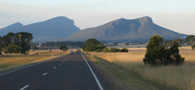
Mt. Abrupt
![]()
MacKenzie Falls
![]()
The Balconies
![]()
Taipan Walls
![]()
Hollow Mountain
![]()
Grand Canyon
![]()
Mt. Frederick
|
Grampians National Park is the third largest in Victoria. An area of valleys, mountains and woodlands set amid three stark and spectacular ridges of upthrust sandstone, some 90 kilometres in length and rising in peaks to a height of 1070 metres, it's the perfect place for camping, hiking, picnicking, sightseeing, driving, cycling, rock climbing. Swimming, angling, and boating are popular on Lake Wartook. Nature study is another attraction with superb wildflowers, many birds, and kangaroos and koalas easily seen from many popular areas.
The town of Halls Gap is the tourist centre for the mountains. Brambuk - The National Park & Cultural Centre, at Halls Gap, has a comprehensive range of visitors material including maps and park guides.
The Grampians are rich in native flora and fauna - herds of acclimatised deer roam the hills and duck-billed platypuses still inhabit the streams - the form and mood of these mountains is different from any other in Australia. All sections of the Grampians offer fascinating walks for the nature lover - and some challenging country for rock climbers - but less energetic visitors are well catered for with good access roads from the surrounding towns of Dunkeld, Stawell and Horsham, which give access to the many lookouts, waterfalls, picturesque vistas and Aboriginal art sites found within The Grampians.
In the wild: Of the 395 species of indigenous birds identified in Victoria, more than 100 have been reported in The Grampians. In the Victoria and Wartook Valleys kangaroos range in mobs of up to 50 and several koala colonies have established themselves near Halls Gap. Duck-billed platypuses still inhabit the streams. There are also herds of acclimatized deer in the hills. However, it is for wildflowers that The Grampians are famous. More than 700 species of flowering plants have been catalogued in the area. The higher tops carry only harsh, scrubby vegetation and heaths and the forests at lower levels have been and continue to be repeatedly ravaged by bushfires, but the region is nevertheless rich in flora and fauna.
Scenery: There are far too many scenic attractions to list all of them here. These are our selection "Must-See" places
- Reed Lookout: From this lookout there are panoramic views over the Victoria Valley and to Lake Wartook. The 2km easy return walk to The Balconies starts from Reed Lookout Carpark. There are no picnic or toilet facilities at this site.
- MacKenzie Falls: The track to the base of MacKenzie Falls is relatively inaccessible due to steep sections, but MacKenzie Falls Loop Walk is a wheelchair accessible track beginning at the car park and winding through the bush to a viewing platform overlooking the Falls. The picnic area has a kiosk, picnic benches and accessible toilets.
- Aboriginal Heritage: For many thousands of years Aboriginal people have lived in the Grampians, and they named their mountain home Gariwerd. Today many Aboriginal art sites have been identified in and around the National Park. Several art sites are open to the public and all are easily accessible. More ...
- Boroka Lookout: The track to Boroka Lookout from the car park is sealed, and is 100 metres return. The view is highly recommended, and although there is a constant gradient, accessibility is good. This track is detailed in the "Wheelchair Accessible Tracks" booklet, available at Brambuk - The National Park and Cultural Centre. Access to toilets is via a sealed path with a short steep gradient.
- Beehive Falls: can be reached from the Beehive Falls Carpark, Roses Gap road. The walk is 2.8km return and will take 1-1.5 hours. This gently undulating walk is spectacular during the spring wildflower season. The falls are best viewed after rain.
- The Balconies: one of the most famous spots in the Grampians and consist of a particularly distinctive rock formation jutting out from a sheer cliff face. There are fantastic panoramic views of the Victoria Valley. The easy walk to the lookout takes you through beautiful gum tree forests; keep a lookout for wildflowers in spring.
- Lake Bellfield: a pleasant spot for swimming and picnicking in the summer months. Power boats are permitted but have restrictions on size and engine power. Canoeing, sailing or yachting across the expanse of the lakes offers unobstructed views of the mountain ranges. Fishing is allowed.
![]()
Mt. William Plains
The Best Time To Visit
Spring and summer - in these seasons, thousands of hectares are clothed with brilliant heaths, flowering peas, wild fuchsias, boronia, thryptomene, ground orchids and wattle.
How to get there
By car: The 260 km drive from Melbourne along the Western or Glenelg Highways takes about 3.5 hours. There are approaches to Halls Gap (Vic Roads Touring Guide 56-A4) via Stawell, Ararat, Horsham or Dunkeld.
What to wear and take if walking/hiking
Stout comfortable walking boots or shoes are essential, even for the short walks. Hats, sunglasses, sunscreen and light clothing can be useful even in winter (north of the divide) but night are often cold and frosty, so take adequate sleeping bags and warm clothing if camping. In the south and in the mountains it can be cool and wet even in summer - so pack a waterproof parka.
Camping areas in the parks and reserves are generally some distance from towns and shops, so you will need food supplies and a way to keep them fresh. Torches are always handy, as is a camp stove or barbecue. Remember that dead wood on the ground is habitat for many creatures, so use as little firewood as possible. Water supplies are available at most camp sites, as are toilets.
Background
The ranges were named in 1836 by Surveyor General of New South Wales Sir Thomas Mitchell after the Grampian Mountains in his native Scotland, but are also known by the name Gariwerd, from one of the local Australian Aboriginal languages, either the Jardwadjai or Djabwurung language. After a two-year consultation process, the park was renamed Grampians (Gariwerd) National Park in 1991, however this controversial formality was reversed after a change of state government in 1992.
Geography: The general form that the ranges take is, from the west, a series of low-angled sandstone ridges running roughly north-south. The eastern sides of the ridges, where the sedimentary layers have faulted, are steep and spectacular, beyond the vertical in places - notably at Hollow Mountain near Dadswell's Bridge at the northern end of the ranges. The most popular walking area for day trippers is the Wonderland area near Halls Gap. In summer the ranges can get very hot and dry. Winter and spring are the best times for walking. In spring the Grampians wildflowers are a major attraction. The area is a noted rock climbing destination, and it is popular with campers and bushwalkers for its many spectacular views and unspoilt nature. However this is under increasing threat by inappropriate development of the area.
Mount William is known within the gliding community as the epicentre of the 'Grampians Wave', a weather phenomenon enabling glider pilots to reach extreme altitudes above 28,000ft. This predominantly occurs during the months of May, June, September and October when strong westerly winds flow at right angles to the ridge, and produce a large-scale standing wave (Mountain Lee Wave).
Geology: The rock material that composes the high peaks is sandstone which was laid down from rivers during the Devonian era 380 million years ago. This sediment slowly accumulated to a depth of 7 km; this was later raised and tilted for its present form. Forty million years ago the Southern Ocean reached the base of the northern and western base of the mountain range, the deposition from the range forming the sea floor which is now Little Desert National Park. The highest peak is Mount William at 1167 metres. Numerous waterfalls are found in the park and are easily accessible via a well developed road network.
|