Narwee - from the Aboriginal word for the sun. Narwee Primary School is built on land given in 1809, to Richard Podmore, a free settler, who came to New South Wales as a soldier in the NSW Corps in 1792, on the ship Pitt. Land between today's Penshurst Road and King Georges Road belonged to Richard Tuckwell, another soldier from the same Company. At the time of the land grant, the area was covered with a very thick Ironbark forest.
Tuckwell and Podmore sold their grants to Patrick Moore and Robert Gardner, both ex-convicts, in 1819 and 1820, and Bob the Gardener, as he was known, began to clear trees and develop a farm on Podmore's grant, which he called Sunning Hill Farm. The property was later extended to cover Emery's 30 acre grant next door. Narwee did not exist as a locality; it was called Bob the Gardner's Farm, and there were so few people living in the area that bushrangers could easily hide for weeks in the forest without being discovered. In the 1830's, the Sydney Hunt Club used to hold its hunting meetings in this area. The land south of Broadarrow Road was given to Dr. Robert Townson as sheep grazing land in 1809. When rumours that a new railway would be built through the district began to spread in Sydney, a land speculator called William Graham Cameron persuaded the family to sell Sunning Hill. In 1885, however, the Minister for Public Works, decided on a more northerly route, and Cameron was unable to sell his land. For this reason, he became one of the most vocal opponents of the railway to Burwood Road (now Belmore). The property was eventually subdivided by the Inter Colonial Investment Land and Building Company Ltd. in 1912, and sold as the ten-acre farms of the "Graham Park Estate", each costing between 65 Pounds and 142 Pounds 10 Shillings.
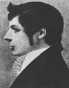
 Nelson - named after Admiral Horatio Nelson (right), First Viscount Nelson, the hero of the Battle of Trafalgar. Governor William Bligh served under his command at the Battle of Copenhagen (1801) and received a land grant in this area which he named 'Copenhagen Farm' in honour of the battle. It was never developed and reverted to the Crown.
Neutral Bay - in 1789, a time when England was at war with France, this bay was set aside by Governor Phillip as a safe haven for neutral ships which could anchor here in safety.
Brief history - Neutral Bay remained dense bushland, except for a military road which passed through it, until the turn of the 20th century when subdivision and development commenced.
Newport / Newport Beach - describing a new port for steamers carrying passengers and cargo.
Brief history: Newport developed as a drop off point particularly for smuggled goods in the first half of the 19th Century. Many shipbuilding and repair facilities were also established to service the many cargo vessels plying the Hawkesbury. When the river trade fell into decline, less and less vessels called at Newport and it reverted to be first a holiday resort and later a locality favoured by retirees.
Newtown - named after John and Eliza Webster's New Town Store. For around 80 years Newtown was a small village which had developed around the corner where the road to Canterbury left the main south road. It was not until the boom building period of the 1880s that Newtown was given its present name, the land was subdivided and rows and rows of working class terrace houses built.
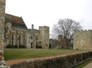
St. Steven's Church was built between 1870 and 1874 to a design by Edmund Blackett, a distinguished architect who designed the buildings of the University of Sydney. The land was the gift of Elizabeth Bligh, widow of the form Governor, William Bligh. The adjoining cemetery contains the grave of many early pioneers and notable citizens, including Edmund Blackett himself, members of the Chisholm, Farmer and Horden families, and explorer Sir Thomas Mitchell.
In 1794 and 1799 the Superintendent of Convicts, Nicholas Devine, was given two adjoining land grants totalling 210 acres which covers most of today's suburb of Erskineville and almost all of Newtown east of King Street. Here he grew apples and oranges and also attempted to grow tobacco and start one of Australia's first vineyards. On Devine's death at 104 in 1830, the property was subdivided and sold. 22 years later, Nicholas' grand-nephew, John Devine, arrived in Sydney on behalf of the Devine clan back in Ireland to make a claim in the courts to the whole of the area. He stated that Bernard Rochford, Nicholas Devine's servant, had illegally claimed his employer's estate. The long running legal case which became known as the Newtown Ejectment Case started in 1852 and went back and forth between England and Australia seven times. He made three unsuccessful attempts to take possession of the land and eventually a settlement was reached after the residents established a fund and paid him off.
Normanhurst - named after Norman Selfe, who settled in the area in the 1880s and campaigned for a railway station at Hornsby. The name was chosen by local residents in 1898 in preference to Pearce's Corner and Hornsby Junction, two names in common use at the time. Selfe was an engineer who installed the mining equipment for the Hartley Shale Mine and designed the scenic railway at Katoomba in the Blue Mountains.
Brief history - settled by Samuel Horne, who planted the area's first orchard. Part of Samuel Henry Horne's property, it was subdivided into small farms after his death in the 1860s. Street names
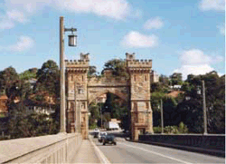 Northbridge - named after a suspension bridge called North Sydney Bridge (right). The bridge over the Flat Rock Creek valley was built by a land development company at a cost of £100,000 to make the sale of a new subdivision north of Flat Rock Creek more attractive. By the time it was opened, the land sales boom of the 1880s had burst and disappointing sales sent the company to the wall. Attempts to re-sell the new estate commenced again after World War I but development remained slow until after World war II.
Northmead - describes the north 'mead' or meadow of the governor's domain or park in Parramatta.
Brief history: as its name suggests, Northmead is part of a large tract of land set aside near Parramatta as the governor's domain. Like Mays Hill which was also part of the domain, it was sold off for orchards and poultry farming in the 1850s. A private railway line from Parramatta to Baulkham Hills came through the area in 1923 but was closed nine years later due to lack of custom.
 North Rocks - recalls a massive sandstone outcrop which gave its name to the suburb of North Rocks. The area was originally known as Jerusalem Rocks. The rock outcrop, which was north of Parramatta, was used to build Parramatta Gaol and the wall for the Lake Parramatta dam (right).
Brief history: fruit growing and small farms in the 1880s marked the first entry by white settlers to the area. It remained semi-rural until the development of the existing suburban areas after World War II.
North Ryde - named for a new post office in 1885.
Ryde was one of the first areas on the North Shore to be developed by white settlers. North Ryde followed soon after and had many small farms and orchards scattered throughout its wooded forests well into the 20th century.
North Sydney - the whole of the Lower North Shore was originally known as Hunters Hill after the property of Thomas Muir (1765-99), one of the five Scottish Martyrs who were transported to NSW in 1792 as traitors of the British Crown for advocating democracy and parliamentary reform. Not convicts in the true sense, they were given relative freedom in Sydney. Muir bought land and built a house near where the north-east pylon of the Harbour Bridge now stands, and named it Huntershill after his boyhood home. Muir escaped the colony in 1796 but the name of his property came into common usage for the whole of the Lower North Shore to the west of Dawes Point until settlers such as Alexander Berry, Edward Wollstonecraft and James Milson settled the area and their names came into common usage. The name North Sydney came into use in the 1930s, first to describe the whole area immediately to the north of Sydney on the Harbour's north shore, and later from 1890 as the name of the municipality which was created to care for it and for the locality which now bears that name.
Northwood - named after Mrs. Jane Davey's Northwood House.
In the 1850s Northwood was first known as Penry, or Pendray Point, after a military pensioner who had settled here. The Davey family bought his property and Jane Davey commissioned Edmund Blackett (1817-83) to build them a new home, after which the area was later named. Other names that have been used are Reid, after an early settler, James Reid, and Gore Bay, after the nearby cove which recalls another early landowner, William Gore (1765-1845) who was Provost-Marshall under Gov. William Bligh. Nearby Gore Hill, which was a major part of his holding, is named after him.
Oakdale - named taken from a locality in the area, The Oaks. The area was acquired by Landcom in the late 1980's and was subdivided, with some given to the Department of Housing and the rest sold to developers in a bid to create a large, diverse neighbourhood.
Oakville - named because of the abundance of timber in the area's natural bush, in particular the she-oak.
Brief history: timber cutting was the principle activity that supported the early settlers. Early documentation of the area described the country as 'middlings forest' being treed with she-oaks, ironbarks, grey box with forest red gums along the creeks. The timber cutter's tracks along the ridges became the roads of today.
The Oaks - recalls the Australian Casuarina, or "she -oaks" (not the English Oak), dense forests of which once covered the area.
 Oatlands - Named after Oatlands House (right), built by Captain Percy Simpson, and later owned by his son Sir George Bowen Simpson, Judge of the Colony. The name is derived from Oatlands Park in England, which is near the land of Lord Dundas, after whom the adjacent suburb was named.
Oatley / Oatley West - named after James Oatley, a convict clock maker. As a convict, Oatley erected the clock still in use on the front of Hyde Park Barracks.
Brief history: after being pardoned, Oatley was granted and acquired various tracts of land in Sydney's south, among them was what is now the suburb of Oatley, a 175 acre grant which he received in 1831. Oatley called it Needwood Forest, after woodlands in his native Warwickshire, England. He never lived here, choosing instead to build his home near Beverly Hills. When the railway came to Oatley in the 1880s, it was decided to name the station here after him, though his property had been sold and subdivided by his son some years earlier.
Oran Park - this locality's main feature used to be its motorsport racetrack. The facility was established by the Singer Car Club in the early 1960s. In its early days it would host one race per day. The circuit initially consisted only of the current south circuit, with the extended Grand Prix figure-8 layout not being incorporated into the track until the 1970s.
 Orchard Hills - This area was formerly known as Frogmore, which is the name of a grant given to Mary O'Connell (right), daughter of Governor Bligh. This locality also included the York Estate which was owned by the York family. The York Estate was subdivided in the late 1880's. On 17 October, 1910, a public meeting of residents was called to "consider the advisability or otherwise of changing the name of the locality". Several names were submitted for consideration, a vote was taken and Orchard Hills was decided upon by residents.
Brief history: orchards were an early feature of the locality, especially after the subdivision of the York Estate in the late 1880's. Many orchards still exist today and can easily be seen from the F4 Western Freeway as one travels between Penrith and St. Marys.
Oxford Falls - name to replace Bloodwood Gully. Believed to be taken from the name of a large subdivision of land near Frenchs Forest offered for sale in 1885.
Brief history: the first recorded dwelling in the area was that of Alexander Bowman who, in 1878, took over a 200 acre grant for timber getting which he named Bloodwood Gully, presumably after the Bloodwood trees found in abundance here which he targeted in his timber cutting venture. The present name is taken from Oxford Falls, located with the locality on Middle Creek, which has the highest waterfall of any location in the Sydney metropolitan area.
 Oxley Park - named after John Oxley (1785?-1828), First Officer on HMS Porpoise which returned to England with the deposed Governor Bligh. Appointed Surveyor-General of Lands in 1812 and subsequently led explorations into the interior of New South Wales subsequently suggesting the existence of a vast inland sea. He resided at "Kirkham" near Camden, where he died on 16 May 1828.
Brief history: Oxley was granted 600 acres in the St. Marys area in 1823, the present site of Oxley Park. Oxley never lived here nor was any homestead built for occasional stays. After Oxley's death, his property at St. Marys was purchased by Phillip Parker King. Ann Josepha King, Phillip's mother chose a site on this land for the St. Mary Magdalene Anglican Church, giving rise to the locality name of St Marys. After World War I this land was subdivided into five acre lots and named Oxley Park.
Oxley Park street names
Oyster Bay - named for the area's abundant oyster harvests. The name first appeared on Surveyor Wells' map of 1840. A 1925 map of the Parish of Sutherland shows the village of Oyster Bay. Subdivision of what was part of Thomas Holt's estate began in 1901. In 1912, the 'By The Water Estate', including the area east of Carina Road, was subdivided into residential lots.
History of Oyster Bay
 Paddington - used by the area's first residents, presumably recalling the name of the London borough of Paddington, England (right).
First granted - by Governor Bourke in 1820s for residential development.
Brief history - in the 1830s, weekend retreats owned by Sydney's rich and famous dotted the area's sandy scrub-covered hills and hollows, but the arrival of hundreds of tradesmen employed to build Victoria Barracks in 1838 led to an influx of permanent residents. The weekend retreats were knocked down to make way for the famous terrace houses of Paddington, which were built as cheap working class housing. Meticulous renovation has turned these homes into desirable residences and Paddington into a fashionable inner city suburb.
Subdivided for residential development - 1840s.
 Padstow / Padstow Heights - named after Padstow Park Estate, a town in Cornwall, England (right).
Brief history: mixed farming was practised in the Padstow area until the arrival of the railway in December 1931, after which time the area underwent major residential development. Padstow Park was the name of the first residential estate here in which land was subdivided into suburban lots.
Pagewood - honours FJ Page, a member of the Botany Council.
Pagewood was subdivided for residential development under the name of Daceyville No. 2, to distinguish it from the Mascot scheme. It was an extension of the suburb of Daceyville, and was created in 1919 to ease the housing shortage in Sydney after World War I. Its name was changed to Pagewood in 1929 when local residents lobbied for a less clinical name. Attempts to change it to East Botany in the early 1960s were stopped by residents who argued that the current name should be retained for the locality's residential area and use East Botany for the industrial area, so as to differentiate the two.
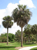 Palm Beach - it is assumed the beach was thus named because of the extensive cabbage palm trees (right) which were common here among the native vegetation. Fisherman and market gardeners have occupied the area since the turn of the 19th Century and it is probably after an unsociable one of these that the original name for the area - Cranky Alice Beach - came into common use. Farming and maritime activities practised here such as whaling, boatbuilding and repairs and fish drying by Chinese settlers continued well into the 20th Century when subdivision and land sales saw a change away from industry towards residential.
Panania - said to be an an Aboriginal word meaning 'sun rising in the east and shining on the hills'.
Brief history: part of a much larger district known as East Hills, the first Europeans in the area were timber-cutters. Operators of small farms moved in during the 1890s and they were replaced by residential homes after the arrival of the railway in 1931. It was at this time that various names, including Nioka, Elmswood and Linden Park, were suggested for the new station and the locality, but Panania was the popular choice. A section of the new suburb, Picnic Point, was to later take the name of the geographical feature on the Georges River which forms one of its boundaries.
Parklea - origin of the name is unknown.
Parklea is located on the line of the newer Great North Road, which led from Sydney to the Hawkesbury district. It was subdivided for farming in the 1890s at which time the name was first used, however why it was thus named and by who is not known. Parklea is one of the more recent suburban areas created as part of the Blacktown suburban development scheme.

Parramatta Park
Parramatta - from an Aboriginal word meaning 'head of the river' or 'place where the eels lie down'
Brief history - realising the need for good agricultural land, Phillip set about organising a series of expeditions to explore the region. In April 1788, the Parramatta River was explored as far as the present site of Parramatta. Phillip established the settlement at Rose Hill on 2 November, 1788 (The name was not changed to Parramatta until 4 June, 1791.).
Australia's first inland town, the settlement at Rose Hill was located in what is now Parramatta Park. In March, 1789, Gov. Phillip's butler, Edward Dodd, an avid gardener, was sent to Rose Hill with one hundred convicts under his supervision. Land was cleared, crops were planted and buildings constructed.
Laid out by First Fleeter Lieut. Dawes near the original Rose Hill, Parramatta quickly became a thriving township following a successful first harvest of grain in 1790. Development of Parramatta outstripped that of Sydney. By the end of 1791, the population had increased to 1,818, of whom 1,669 were convicts. So confident was Phillip in its future, he almost transferred the seat of government of the colony from Sydney to Parramatta. St. John's cemetery is the oldest surviving cemetery in Australia, and contains the graves of many who arrived as part of the First Fleet in 1788. Parramatta Road, commissioned by Gov. Phillip in 1790, was the colony's first inland thoroughfare. The rail link between Sydney and Parramatta was opened in September 1855.
Payten's Hill: Nathaniel Payten, his wife, Susannah, and their eleven children lived at Woodbine Cottage on Campbelltown Road (now Sydney Road) where the suburb of Woodbine now stands. The Paytens played an important role in the development of the Campbelltown community. Alfred Payten was an architect who designed many local buildings including the old fire station and the Menangle Park Racecourse. His daughter, Sara, collected and preserved much of her family's history. James' daughter, Rose (Babe) Payten was an acclaimed tennis player and Campbelltown's first major sports star. She held the Tennis Association's Triple Crown from 1901-04 and again in 1907, being simultaneously the singles, women's doubles and mixed doubles champion. Rose lived at Woodbine until her death in 1951. The old cottage was demolished in the 1960's. A decade late, the treeless hill that stood behind the old Payten farm was re-developed as the residential area of Woodbine by Landcom.
Peakhurst - named after John Peake, an early resident
Peake had one of the smallest properties in the area, near the Junction of Forest Road and Henry Lawson Drive, but his name has been immortalised in the name of the suburb no doubt because, in 1855, he gave the land to the Wesleyan Church on which they built the church that still stands today. Most of Peakhurst was within the boundaries of Robert Townson's grant of 1808. Timber cutting became the main source of income for residents of Peakhurst, the turpentine trees of its dense high forests were in big demand for paving blocks and wharf piles. As the land was cleared, orchardists replaced the timber cutters. Because the railway bypassed Peakhurst, the neighbouring suburbs on the railway - Mortdale and Oatley - developed as residential suburbs, leaving sections of Peakhurst to light industry.
Pearces Corner - named after Aaron Pierce, a timber-getter who built a slab hut on land purchased in 1835. It was his presence that resulted in the initial naming of the township of Pearce's Corner which developed at the intersection of the present day Pacific Highway and Pennant Hills Road. The transformation from Pierce to Pearce (and the loss of the apostrophe) seems to have occurred mid century. It is said that, timber-getting being thirsty work, illicit stills developed around the area. As happened elsewhere, when the timber-getters moved to areas on the south and north coasts of New South Wales where suitable timber was more accessible, and transport by sea was available, they were replaced by orchardists.
Pendle Hill - named after Pendleton (below) in Lancashire, the centre of England's cotton industry.

Brief history: during the 19th Century, many poultry farms were established here. In 1932, George Bond established a cotton spinning mill here and requested that the railway station be built near his mill and that it be named after Pendleton in Lancashire, England, the centre of Britain's cotton industry. Bond's manufacturing business grew into one of Australia's most well known clothing brands.
 Pennant Hills - origin is unknown, however it seems likely that it honours Thomas Pennant (1726 - 1798), a noted Welsh naturalist and traveller (right), one of the foremost zoologists of his time. He was a friend of both Joseph Banks and the father of Francis Grose, the Lieutenant-Governor of NSW in the 1790s. The Pennant Hills area was explored extensively during Grose's term of office.
Brief history - the hill for which Pennant Hills is named is Mount Wilberforce, and is said to have been used in the early days of the colony as a signalling post, being a location from which both Sydney and Parramatta, the locations of the governor's places of residence, could be seen. Other signalling posts were at One Tree Hill (Ermington) and May's Hill (Parramatta). Extensively cultivated for citrus fruit growing before the arrival of suburbia, the first orchard in the district was planted by George Suttor.
Street names
 Penrith - named by Governor Macquarie in 1818 after Penrith in Cumberland, England (right), the district of which he believed it resembled. Both Penriths are in counties called Cumberland.
Brief history: this area was called Evan By Gov. Phillip in 1788 when the area was first explored and the Nepean River named. In 1818 Macquarie named the settlement that had grown here Penrith which had become and remains today the business centre of the Greater West and an important stopping place on the way the Blue Mountains.
 Penshurst - named after Penshurst Place in Kent, England (right).
Brief history: part of Robert Townson's grant of 1808 which extended from Forest Road to the Georges River. John Connell took possession of the property in 1830, his name being remembered in Connells Point in Penshurst's south. When subdivided into small farms in 1869, the western part was bought by Thomas Mort and became Mortdale. The eastern section was called Connell's Bush until the arrival of the railway in 1886. When a platform was built here, it was named Penshurst. From that time the new name was used in preference to Connell's Bush, which was not considered suitable to a developing residential area. It is not known what prompted the selection of the name, however it has been noted that Penshurst in Kent has the same mystic quality of Sydney's Penshurst when the southerlies blow a sea mist across Oatley Bay in winter.

Petersham Hotel, near Richmond in Surrey, England
Petersham - originally named Peters-Ham in memory of Major Grose' place of birth near Richmond in Surrey, England.
Brief history: though he never owned land here, Petersham was named by Major Grose when he sent a group of convicts to establish a farm to relieve the food shortage in the colony during the 1790s. In 1803 the farmers of Petersham won a prize offered to Sydney's farming communities for the best produce yield. It was a popular spot for kangaroo hunting and Toot-Hill, a locality remembered today in the name of Toothill Street, recalls the rally cry to the huntsmen issued from the location. Farms in the area were many and prosperous and remained so until the arrival of the railway when farmers were driven further afield, their land was sold for subdivision and the encroachment of suburbia. The name once referred to a large area covering Leichhardt, Lewisham, Petersham, Enmore, Stanmore and Marrickville.
Phillip Bay: Yarra Bay was marked on early maps as Phillip Bay, being named after Gov. Arthur Phillip who came ashore here on 24 January 1788, upon arrival with the First Fleet in search of the lush meadows Joseph Banks had spoken of. The name has been adopted for the nearby suburb but dropped for the bay itself which is known as Yarra Bay.
 Pittwater - recalls William Pitt the Younger (right), Prime Minister of Britain when it was named by Gov. Phillip in 1788. Sighted by Captain Cook in 1770, Pitt Water was earmarked though never used by Capt. Arthur Phillip as an alternative settlement site for the First Fleet if Botany Bay proved impractical. It did, but on his way to Pitt Water, he discovered Port Jackson (Sydney Harbour) which Cook had not bothered to explore, and chose Sydney Cove as the site for the new colony. Phillip explored the area in February 1788, describing it as "a great inlet ... the finest piece of water I ever saw, which I have honoured with the name of Pitt Water."
Pitt Town / Pitt Town Bottoms - one of the five towns established by Gov. Lachlan Macquarie, it is named in honour of William Pitt the Younger, British Prime Minister 1783-1801 and 1804-1806. Macquarie wrote in 1810: "The township of the Nelson District I have named Pitt Town in honour of the immortal memory of the late great William Pitt, the Minister who originally planned this Colony.
Pleasure Point - A suburb of City of Liverpool bounded by Georges River, Deadmans Creek, Heathcote Road and Williams Creek. Its extent was reduced by formation of the suburb of Voyager Point in 1987. The name was coined for the first subdivision and sale of land there.
 Plumpton - Walter Lamb (1825-1906) established a cannery, fruit preserving works and a coursing (greyhound racing) track on his property Woodstock. The area was initially known as Woodstock, but when a post office was established in 1889, there was confusion over this Woodstock and a railway station on the Blayney-Harden line, also called Woodstock. Greyhound coursing in England was conducted at Plumpton, so that name replaced Woodstock.
Brief history: Plumpton is the actual location of Black's Town, a reserve set aside by Gov. Macquarie for Sydney's remaining Aboriginal population that had lost access to their traditional tribal lands. The township that grew here was moved 8 km to the present site of Blacktown when the railway west was built. In the second half of the 19th Century, orchards and small farms were common in the area, and these were serviced by a canning factory built by Lamb. Plumpton retained its rural aspect into the 1970s when it began to be incorporated in the urban sprawl of the Blacktown district housing development scheme.
Point Piper - recalls Scottish born Captain John Piper (1773-1851), a military officer who arrived in Sydney in 1792 and built a mansion here. He was the Collector of Customs & Harbour Dues under Macquarie's governorship. Originally known as Eliza or Elizabeth Point after Captain Piper's wife, it was renamed Elizabeth Henrietta Point after Governor Macquarie's wife, so as to avoid confusion with nearby Elizabeth Bay. It late became Point Piper.
Brief history: Piper's Henrietta Villa, completed in 1822 at a cost of £10,000, remained the sole house on the point for many years. After getting into financial difficulties through mismanagement of his own as well as military and business finances, Piper tried unsuccessfully to drown himself in the harbour. His property was sold to businessmen Solomon Levy and Daniel Cooper in 1826. In 1883, the villa was demolished and Woollahra House built in its place, by which time subdivision and the first sale of residential blocks on the point had commenced.
Port Hacking - named after First Fleeter Henry Hacking. In 1794 – Hacking made an unsuccessful attempt to cross the Blue Mountains. Hacking was one of just a handful of military officers who came out with the first fleet and settled in Australia. He arrived as quartermaster on the HMS Sirius, returning to England in the Waakamdeid in 1890 and returning two months later on the Royal Admiral. He obtained land at Port Jackson and was with the party who found the cattle that had been missing since the First Fleet landing. In 1796 Hacking was up on an assault charge but was acquitted.
In 1799 he was sent to Norfolk Island for perjury. He was later pardoned. He served as a pilot on the "Porpoise" at Port Jackson during 1801-2 and was later made 1st Mate on the "Lady Nelson" when she was dispatched to take Collins from Port Phillip. Collins later made him pilot of all boats and crews in Hobart Town. He retired on a pension in 1816. His records show he was "useless as a pilot from drunkenness and infirmities". He died in Hobart in 1831 aged 81.
Brief history: the suburb of Port Hacking is a small locality near Dolans Bay which takes its name from the waterway which forms its boundary on three sides. It developed as a suburb in its own right after World War II when residential development in the area enjoyed boom times.
Potts Hill - recalls Joseph Hyde Potts, after whom Potts Point is also named. Potts was a foundation employee of the Bank of New South Wales which began trading in 1717. His 625 acre grant in the area became known as Potts Hill, the highest point of which was later used by the Water Board as a location for two large water storage tanks.

Potts Point
Potts Point - named after Joseph Hyde Potts, who was employed as a porter and servant of the Bank of New South Wales when it opened for business in 1817. His role as guard of the strong box required him initially to sleep on the premises and to remain single. When he tried to persuade the bank to change this, having fallen in love with one of his female customers, they refused and Potts broke off of the relationship rather than lose his job. He worked his way up to become the Head Accountant, by which time the marital restriction previously placed on him was lifted. While on holidays, he met and married Emma Bates, a recent arrival to the colony. Potts bought a small parcel of land from Judge Wilde which he called Potts Point. Later in life he bought extensive tracts of land in the Lidcombe area. Prior to Pott's arrival the point which now bears his name had been known by the names Paddy's Point, Kurrajeen (also spelt Currageen) and Yarrandabbi, said to be the point's Aboriginal name. Paddy was in fact Patrick Walsh who had received a 30 acre grant in 1809 between Gov. Bligh's departure and Gov. Macquarie's arrival. Potts Point ceased to be a point in 1942 when the Captain Cook Graving Dock was built, linking Garden Island with the mainland.
Prairiewood - named after Prairiewood Estate, the name of one of the original subdivisions when the locality was being divided for farming and orcharding.
Prestons - named after a local family which operated the post office around the turn of the 20th Century. At the time, Prestons was a small community close to Horningsea, the former home of Joshua John Moore who in 1819 had received the 500 acre grant on which the homestead was built. The Preston family operated a store which included a post office on the corner of Bringelly and Ash Roads, which was known to the locals as Preston's.
Prospect - in 1789 Captain Watkin Tench led an expedition through the area. Upon arrival at the top of the hill, he looked west and was taken by the plain he saw that appeared perfect for agriculture, he named the place Prospect Hill. Upon his recommendation, Gov. Phillip settled 12 convict families here, granting them land. On his visit to the farms in 1810, Gov. Macquarie remarked on how well the settlement was progressing. At that time, William Lawson, who was one of the original explorers to cross the Blue Mountains, had taken up a grant that included Prospect Hill. The hill is now the site of a reservoir.
Punchbowl / Punchbowl South - "The Punch Bowl" was the name that early settlers gave the almost circular valley surrounding the place where the old road to Georges River crossed Cooks River at a ford. This is now where Georges River Road becomes Punchbowl Road (the road to "The Punch Bowl"). When Surveyor Charles Grimes surveyed the area in 1798, he noted thick bush growing along most of the road, with Ironbark, Turpentine and Bloodwood trees, as well as Stringybarks and Angophoras. The old road to Georges River was probably one of the Aboriginal pathways through the area before white settlement. The people who used these tracks were limited in the amount of food and water they could carry, and thus they followed rivers or waterholes in their journey. Interestingly, the place after which the suburb was named is in fact not in Punchbowl but some 3.5 km to the east of its eastern boundary, on the border of Belfield and South Enfield.
The first land granted in this forest around the Punch Bowl was along the lowest branch of Salt Pan Creek. There were four farms measured to the north of this creek, (now the canal along Wiggs Road), 50 acres to Thomas Moxon, 120 acres to Frederick Meredith, 50 acres to William Bond and 60 acres to Richard Calcott. Bond and Moxon were emancipists., and Calcott and Meredith were free settlers. These farms were granted in 1809 by Lieutenant-Governor Paterson, head of the rebel NSW Corps Government. Bond and Meredith had attempted to settle on their properties, and had an exciting brush with Tedbury and other aborigines of the Botany Bay Tribe, the Gweagal. In the ensuing battle, one spear went close enough to graze Frederick Meredith's ear, and the new settlers retreated 'with a providential escape for their lives'. After the aborigines had moved on, however, the farmers returned. In 1841, James Gorman, a publican, purchased the last property near Forest Grove, which had by then begun to take over from Salt Pan Creek as the locality name. The district grew very slowly in population until after Canterbury Road was cut through from Cooks River to join Punch-Bowl Road in 1855. During the 1860's, the roads used by the sawyers of Salt Pan Creek (Bonds Road and Belmore Road) were opened officially for traffic. About 1869, the district adopted the name "Belmore" after the Earl of Belmore, Governor of New South Wales at the time, and this remained the name used to describe the area until the opening of the railway to Bankstown in 1909.
 Putney - named after the suburb in London, England. A vehicular ferry crosses the river between Putney Point and Mortlake. This service commenced operation in 1926 and remains the last such ferry in the Sydney area. Kissing Point Bay stretches to the west of Putney Point. Around 1900, on its western shore, Christian Nielsen operated a boatshed and built racing sculls, fours and eights. Nielsen was born in Denmark in 1860. He ran away to sea at 16 and eventually, because of his prowess as a sculler, found his way to the Parramatta River. He was one of many such boatbuilders along this Parramatta River rowing course. In January 1943, the Slazenger company leased 1.6 hectares of waterfront land at Putney to build 14 metre long plywood punts for the United States Army. The facility became a wholly owned government works managed by Slazengers on behalf of the Australian Shipbuilding Board. There were about 80 shipwrights, painters and dockers working at the site. In 1944,work began on building motorised scows for the Royal Australian Air Force (RAAF). These boats were 17 metres long with a 3.6 metre beam. They were built of Oregon and the hull, from the keel to the waterline, was copper sheathed. They were fitted with diesel motors, and destined for the Pacific area. Six were completed and another 27 were in production by the end of World War II in 1945.
Much of the Putney peninsula is now occupied by Putney Park, however there are still slipways on the shoreline that link the area with its boatbuilding past. Kissing Point Bay is now the location of the King's School boatshed which was originally situated in Hen and Chicken Bay.
Pymble / West Pymble - recalls the area's first settler, Robert Pymble (1788 - 1861), a silk weaver who migrated from Herefordshire in 1821. An area now incorporating Pymble and part of Gordon was granted by Gov. Bourke to Robert Pymble in 1821 for capturing a bushranger. His homestead was built by convicts. Pymble's was the first of many properties in the area to be cultivated as an orchard after being cleared by timber getters. They were to remain until the arrival of the railway in 1890 when subdivision commenced and the orchardists move further afield to the Dural / Galston district.

Pyrmont - the northern part of the Pyrmont peninsula was granted to a soldier, Thomas Jones, in 1795. Preferring the cash, Jones had sold it within a year to Obediah Ikin, who in turn sold it to Rum Rebellion leader and merino sheep breeder John Macarthur in 1799. The name was first suggested in 1806 when a lady guest at a picnic here discovered a spring and told how it reminded her of a spring at a German spa in Pyrmont near Hanover (above). The name was subsequently used for the estate by Macarthur and later for the suburb which developed here as well as the nearby bay.
Brief history: during the 19th Century, large sections of the peninsula were taken over by industry, in particular CSR, which built a sugar refinery on Elizabeth Macarthur Bay opposite Balmain. Works houses occupied the central section of the peninsula. During the last four decades of the century, quarrymen moved in, extracting the highly prized sandstone to build Sydney's magnificent Victorian era sandstone buildings, but leaving the Pyrmont landscape badly scarred. Industry and quarrying have now long gone and the wastelands they left behind have been landscaped and subjected to extensive residential redevelopment.

 Macquarie Fields - named after Macquarie Fields House, in honour of Lachlan Macquarie, Governor of the colony of NSW, 1809-1821.
 Marayong / Marayong Heights / Marayong South - from the Aboriginal word meaning 'place of the cranes'.
 Marrickville / Marrickville South - named after Thomas Chalder's native village Marrick in Yorkshire, England (right).
 Marsden Park - recalls controversial cleric, Samuel Marsden (1764-1838). Marsden is one of the outstanding characters of Australia's earliest days. Known as the flogging parson, Gov. Macquarie once called him a 'Vindictive and Mendacious Cleric!'. In New Zealand he was the 'Apostle of the Maoris'. He played the roles of assiduous parson, harsh magistrate, meddler in politics, valiant missionary and innovative farmer. Enthusiastically, he shipped the colony's first export of wool in 1811 and anticipated 'immense national wealth to spring from this source of commerce'.
 Matraville - James Mario Matra, an American who sailed with Captain James Cook as midshipman on the endeavour in 1770. His proposal to settle dispossessed British loyalists who had to leave the United States after the American Civil War helped generate interest within the British Government in a colony in Australia. Matra is believed to be the author of the first published account of Cook's 2nd voyage (right), published 2 years before the official account.
 Melrose Park - named in honour of aviator Charles James (Jimmy) Melrose, who was the only solo flyer to finish the Melbourne Centenary Air Race.
 Menai - named after the Menai Straits (right) between the Isle of Anglesey and Bangor, Wales. It was originally named Bangor after the name of a property here of an early settler, Welshman Owen Jones, who came into the area in 1895. The suburb was renamed Menai in 1910 by the Postmaster General's Department because there was already a locality in Tasmania called Bangor. The name Bangor remained in local use however and has since been adopted for a subdivision within the Menai district.
  Merrylands / Merrylands West - named after the former English home of Arthur Todd Holroyd (right), a migrant from Britain via New Zealand who entered parliament in 1863 and became the first Mayor.

 Minto - named in honour of Gilbert Elliott Murray-Kynynmond, Earl of Minto (right), British Governor-General of India (1807-13), by Gov. Macquarie under whom he had served before coming to Sydney. On his first visit to the Macarthur district in October 1810, Macquarie saw the area as a possible alternative to the settlements on the Hawkesbury which were prone to flooding. Dr. William Redfern, the first doctor in charge of Macquarie's rum hospital, was the first grantee in the area, and built a farmhouse here which he named Campbellfield. He retired here in 1818. The opening of the railway station in 1874 saw an increase in the steady growth and prosperity of the small farms and market gardens in the area. Redevelopment for residential suburbs began taking place after World War II. Streets in the older section of Minto bear the names of earls, since Minto was himself an earl. Like those of Claymore, Airds and Macquarie Fields, the streets of the newer sections of Minto dating from the 1970s were designed as 'varied curves', with all streets deliberately curved to avoid blind corners. Streets in the new Minto section were given names with references to the life of William Redfern. Streets in a later part of the estate recall early land grantees and white settlers.
 Monterey - named after a post office and shopping centre called Monterey, possibly after Monterey in California (right).
 Mortdale - named after businessman Thomas Sutcliffe Mort who held land in the area in the 1850s.
 Mount Annan - the name recalls the town of Annan in Scotland (right), on the River Annan in the Royal borough of Annan. The geographical feature Mount Annan, presumably named by Gov. Lachlan Macquarie, was part of the 'Glenlee' estate granted to magistrate William Howe in 1820. In the 1850s Glenlee was acquired by James Fitzpatrick whose descendants ran a dairy farm until 1978. A riding school was established from the late 1970s on land leased from the Macarthur Development Board. The original dairy buildings were used as a kiosk and waiting area for the riding school. In 1984 the NSW Government allocated 400 ha. for the Mount Annan Botanic Gardens.
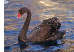 Mulgoa - The region to the south of Penrith is of Aboriginal origin meaning 'black swan'. The Mulgoa Valley was important to the Aborigines: it marked the boundary between two major linguistic groups (the Dharug and the Gundungurra); it was the route along which different tribes travelled when attending ceremonies, and it was close to the Nepean River which provided a permanent water supply and food reserves which could be relied upon during periods of drought.
 Mulgrave - the site of present day Windsor had been named Green Hills by Governor Phillip in 1789 but by 1794 the surrounding district was known as Mulgrave Place, a name that continued to be in use for many years. The name was probably given to honour Henry Phipps, first Earl of Musgrave (1755-1831). After a military career he entered Parliament in 1784 and in 1792 he succeeded to the Irish barony of Mulgrave of New Ross. A close advisor to Pitt on military affairs he became Secretary for Foreign Affairs in 1805. He was described as a 'fine character, manly, perfectly bred, a high Tory and complete John Bull'.