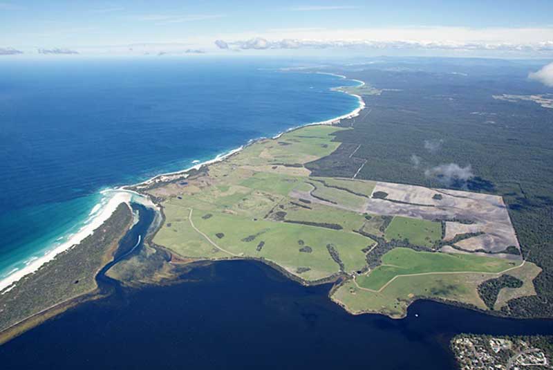
From its long, lonely beaches to its teeming wildlife; from its unique history to its abundant plant life, Mt William National Park is a place of constant fascination. Nestled in the far north-east corner of the State, the park is an important area for the conservation of Tasmania���s coastal heathlands and dry sclerophyll plants.
Whether you fish or swim; watch birds or wander by the sea, there���s always something more to see in this beautiful national park.
Fauna
Mt. William National Park has an amazing diversity of animals. It is an important sanctuary for the Forester (or eastern grey) kangaroo (now restricted to several properties in the Midlands and north-east of the State), wombats, Bennetts wallabies and Tasmanian pademelons are also common. They are usually best seen in the early morning or around sunset.
Another common animal is the echidna. It can often be found during the day, particularly in the summer months, foraging for ants. Brush-tailed possums and Tasmanian devils are common in the Park, but being nocturnal are not readily seen during the day.
Being a coastal park, Mt. William is an excellent area for observing sea birds. Gulls, terns, gannets, and albatrosses can be seen, as well as both the pied and sooty oystercatcher. Although not common, both the white-bellied sea eagle and the wedge-tailed eagle can sometimes be spotted soaring overhead. Mt William is also the first and last stop off point for some migratory birds such as mutton birds, silver-eyes and swamp harriers.
Day Visitor FacilitiesDay visitor facilities
A day-shelter with gas barbecues is found near campground No. 4 at Stumpys Bay in the north of the park. Camp site 2 at Stumpys Bay is a fuel stove only site. Picnic tables, fire and pit toilets are provided near most of the other campgrounds.
There are no garbage bins in the park, so please take all rubbish out with you.
Camping
Campgrounds and narrow access tracks are not suitable for large caravans and motorhomes. They may be seriously damaged due to limited manouvering space and large overhanging tree branches. Small to medium sized caravans and motorhomes can be accommodated in all campgrounds except Stumpys number 2.
Water Activities
The waters around the park provide plenty of scope for the boating enthusiast. However care is needed as there are many reefs just below the surface.
Launching sites for small craft are restricted to the Great Musselroe Bay township, and at No. 3 campsite, Stumpys Bay. At Deep Creek (Picnic Rocks) in the south, launching for boats is restricted to the ramp at Eddystone Point. For all launching sites, a four-wheel drive vehicle is required.
The coastal waters adjacent to the park offer good fishing. To the south, Ansons Bay has long been recognised as a good spot for bream fishing. It is also one of the few in Tasmania where the Australian bass may be caught.
Swimming is a popular summer activity, with a number of bays, beaches and lagoons to choose from. Care is needed at some of the open beaches as deep water and undertows make swimming potentially dangerous. Snorkelling and scuba diving opportunities off the coast of the park are among the best in the state. Georges Rocks, Eddystone Point and a number of other spots are popular with divers.
Where Is it?
Mt William National Park is reached by back roads from Gladstone. From Launceston, travel to Gladstone via Scottsdale (A3 and B82), or via the East Tamar and Bridport (A8 and B82). From Gladstone it is 17 km (on gravel roads C843 and C845) to the Park entrance at the northern end of the park.
The southern end of the park, near Eddystone Point, can be reached by gravel roads from St Helens via Ansons Bay (C843 and C846) or from Gladstone on C843. The nearest petrol is available at Gladstone.
Walks
Important! Before planning any walks, be sure to check the weather. Walks within this park range from easy strolls on the beach to coast and heath walks of half a day or longer. You will need to take your own water for all walks as no reliable drinking water is available on the tracks. Mt William walk is an easy 1 ��� 1/2 hour (return) walk. Follow signs from the Forester Kangaroo Drive to the walk carpark. Climb easily along a clearly defined track to the top of the highest point in the park ��� Mt William (216m). From the top in clear weather there are extensive views over the coast and inland, while to the north you���ll see some of the Bass Strait islands.
Cobler Rocks walk is an easy 1 1/2 ��� 2 hour return trip. Leave from the sign-posted road barrier near campground No. 4 and follow a fire trail that undulates gently through coastal heath before coming out at the coast near Cobler Rocks. A short beach walk past the mouth of the lagoon leads to the start of Cod Bay and uninterrupted coastal views stretching to the park���s southern end near Eddystone Point. Return via the same fire trail.
Other Coastal Walks
The park���s extensive coastline provides ample scope for long and varied beach and coast walking. You will need a detailed map for navigation. You should also take your own drinking water as there is no reliable water along the coast.

Surrounding Area
 The Gardens
The Gardens is a picturesque area was named by Lady Jane Franklin, the wife of Governor John Franklin, who spent some time in the region. If your visit to the area is a brief one, the drive along the coast to The Gardens from Binalong Bay is recommended. Along the way are Jenneret Beach, Swimcart Beach, Cosy Corner and Sloop Point, all of which give access to the beach; some have camping facilities. Cosy Corner and Sloop Point have some great photo opportunities.
 Ansons Bay
The small fishing village of Ansons Bay has been famous since its beginning as a premier bream fishing resort. There are approximately 200 houses scattered along the shores of the Bay, built amongst the natural forest. Some people reside permanently in Ansons Bay but many more visit the community for holidays and weekends. There is only one shop in the area. Ansons Bay is the closest settlement to the historic Eddystone Point Lighthouse – circa 1889. Nearby is the beautiful Mt. William National Park. Extreme care should be taken to avoid wildlife on the roads through the area, which are unsealed.
Surrounding Area

Eddystone Point
Called Larapuna in the local Aboriginal language, Eddystone is part
of the traditional territory of Tasmanian Aborigines. Aborigines have
re-occupied Eddystone Point since 1999 when the Tasmanian Government
agreed in principle to the return of Eddystone Point and Mt. William
National Park. The point is essentially one huge midden – and
there are over ninety middens, – nearly sixty artefact sites and
some burial in Mt. William National Park, which surrounds the point.
The striking pink granite tower of the Eddystone Point lighthouse was
built on a point that juts out into the sea in 1889 in response to many
north bound ships being wrecked by coming in too close to the northeast
coast of Tasmania. The light was serviced by sea and over the years the
landing areas took a battering with jetties having to be rebuilt
several times. The lighthouse is in the Mount William National Park. It
can be reached by unsealed roads of a fair condition from St Helens or
Gladstone (32 km).