
One of Australia's largest National Parks, an UNESCO recognized Biosphere Reserve with an extremely diverse Flora and Fauna. The park features mallee-heathland, beautiful bays and beaches, rugged mountain ranges and rivers. A highlight is Point Ann, where during July to October the Southern Right Whales come to calve in large numbers and can easily be observed from viewing platforms. Most attractions can be reached on 2wd gravel roads.
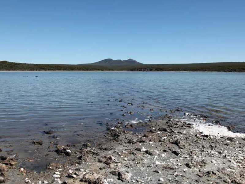
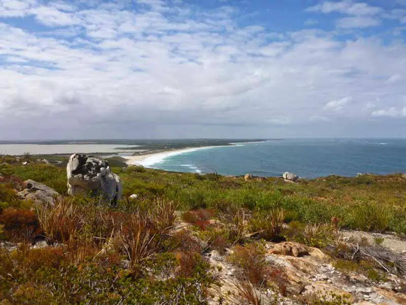
The park sits astride the incised valleys of four major river systems, which flow south-east to the coast. Dominating the southern section is a low range of rugged quartzite hills known collectively as The Barrens, while the core of the park is an extensive undulating plain.
The flora of the park is exceptionally rich and diverse. Although the Park is only 0.2 per cent of Western Australia's land surface, over 20 per cent of Western Australia's plant species occur there. Many of the plant species are endemic to the region, reflecting the tight and varied plant/soil mosaics. Vegetation varies, from woodland on the richer soils through to mallee and mallee heath.
There are more recorded species of birds, mammals and frogs than in any other reserve in south-west Australia. This is partly a reflection of the park size, but also because of the blending of wet country and dry country species which occur in the park.

Scenic drives
This large park is divided in two recreational areas by a central ‘wilderness core’ that is closed to all traffic to ensure its protection. Unsealed roads from the north (Quiss Road and Hamersley Drive) are suitable for two-wheel-drive vehicles and offer scenic views across the heart of the park.
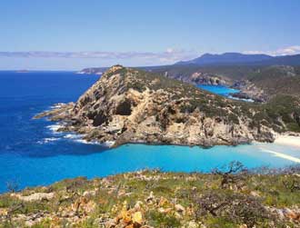
The southern portion of Hamersley Drive is a sealed road that winds along a beautiful part of the coast between the park’s eastern boundary and Hamersley Inlet. This drive will take you to all the main recreation sites in the south-eastern corner of the park: Four Mile Beach, Barrens Beach, Barrens Lookout, East Mount Barren, East Mylies, Mylies Beach, Cave Point and West Beach. Pabelup Drive provides access to sweeping coastal scenery on the west side of the park and Point Ann, which is a prime whale watching spot between July and October.
Walking Trails
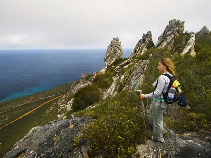
Enjoy the beauty of the park’s diverse plant life and stunning vistas on one of the many walks available. On the eastern side of the park, climb to the summit of East Mount Barren or stroll along inland trails at Sepulcralis Hill and No Tree Hill.
On the western side of the park delve into the region’s heritage with a short walk around the Point Ann Heritage Trail or on the path to St Mary Inlet. Enjoy colourful wildflowers and coastal scenery along the walks at Mt Maxwell and West Mt Barren.
Camping
Campgrounds are located on the western side at St Mary Inlet near Point Ann and on the eastern side of the park at Hamersley Inlet and Four Mile Campground. Camp fees apply. Accommodation is also available at Quaalup, where the renovated and heritage listed Quaalup Homestead is located.
Highlights
Hamersley Inlet
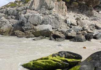
Hamersley Inlet is different from other estuaries in the park because it lies in a deep winding valley carved through the hard schist and quartzite rock of the coastal headlands and ranges. As a consequence it is deeper (around 2 metres) and holds water a lot longer, creating a favourable environment for wildlife, which flourish in and on the water.
Hamersley Inlet camping area on the east side of Fitzgerald River National Park is on Hamersley Inlet Rd off Hamersley Dr, 23 km west of Hopetoun. With basic facilities in a coastal environment, it is popular with anglers. Access in dry weather only. Bring drinking water and a gas/fuel stove. Check with rangers about seasonal closures.
Quoin Head camping area is on Telegraph Track off Hamersley Dr, 45 km west of Hopetoun, on the east side of Fitzgerald River National Park. It has basic facilities close to the foreshore. The steep access track is open in dry weather only. Bring drinking water and a gas/fuel stove.
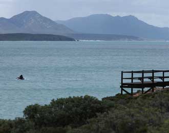
Point Ann
Point Ann is easily the best and most picturesque whale-watching site on the Fitzgerald coast. Purpose-built whale-watching platforms at Point Ann are popular from June to the end of October when southern right whales can be seen cavorting in the bay on most days during the whale season. The dramatic peaks of the Barrens Range form a spectacular backdrop to the view over the bay.
During summer, southern right whales prefer the open ocean, away from the coast, but during early winter and spring the cows come in close to shore. There, near the surf line in sheltered bays, they give birth to their young, before returning to deeper waters as summer approaches. On average, they calve once every three years. Newborn animals are between four and a half to six metres long and weigh approximately one and a half tonnes. Other activities include walking the Point Ann Heritage Trail, beachcombing, swimming and fishing.
Shire Reserve
Shire Reserve camping area is within Fitzgerald River National Park on Hamersley Inlet Rd, off Hamersley Dr, 26 km west of Hopetoun. This secluded area has basic facilities and shady campsites on the water’s edge, making it a nice spot for swimming and fishing. Bring drinking water and a gas/fuel stove. No access in wet weather.
Where is it?
255 km south of Perth
Highlights
St Mary Inlet
St Mary Inlet is a peaceful, scenic waterbody nestled behind the fore-dunes near Point Ann. There are no formal paths around the inlet, but when the water level is low you can explore its southern shore on foot. Fringing shrublands and thickets are often busy with songbirds. The inlet and surrounds is also a great spot to encounter a variety of waterbirds, parrots and birds of prey.
St Marys Inlet camping area has basic facilities in a coastal setting on Point Ann Rd, off Pabelup Dr, 67 km north of Bremer Bay on the west side of Fitzgerald River National Park. Fishing and swimming are the main activities here, and lucky campers may even be treated to the haunting sounds of whales singing at night. Bring drinking water and a gas/fuel stove.
Four Mile Beach/Culham Inlet
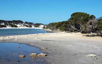
Four Mile Beach is a great little spot to enjoy a picnic, take a stroll or try your hand at beach fishing. At Four Mile Beach, which stretches from Culham Inlet to Barrens Beach, there is a lovely picnic site overlooking soft white sand and the deep blue of the vast Southern Ocean. The picnic site is just a short walk (200m) along a formed path from Four Mile Campground. This is a convenient place to camp when visiting East Mount Barren, Barrens Beach, Mylies Beach and West Beach. The roads from Hopetoun and the park’s eastern entry to the picnic area and campground are sealed.

Mylies Beach
Limestone cliffs and a winding creek at this sheltered picnic spot offer a different experience for park visitors. Mylies features a picnic site nestled in the dunes. From here it’s a short walk along the edge of a small creek to the beach. The low limestone cliffs at Mylies are an unusual sight for visitors. Most of the coastline in the park consists of broad sandy bays separated by headlands and steep cliffs made of very hard quartzite and schist rock (400 million years old). The much younger limestone at Mylies was created during the last two million years when wind-blown dunes of shelly material were dissolved and cemented together by rainfall.
Barrens Beach
Barrens Beach is a small, sheltered beach nestled between dunes and a rugged quartzite headland. It is a popular swimming and fishing spot. Whales sheltering near shore in spring may be visible from the beach. The site also features an interpretive display and art exhibit that provide intriguing insights into the area’s natural and cultural values and the park’s international significance as a conservation area. The art exhibit, which is part of a giant park map, is hands on and provides a bit of fun for the kids.
Fitzgerald Inlet
On Fitzgerald River Track, 20 km east of Pabelup Rd and 80 km north-east of Bremer Bay, this large, open clearing is around 2 km from the beach on the west side of Fitzgerald River National Park. It has basic facilities with some shade available and offers visitors swimming, fishing and bushwalking activities. Bring drinking water and a gas/fuel stove. There may be seasonal closures; check with rangers.
Cave Point
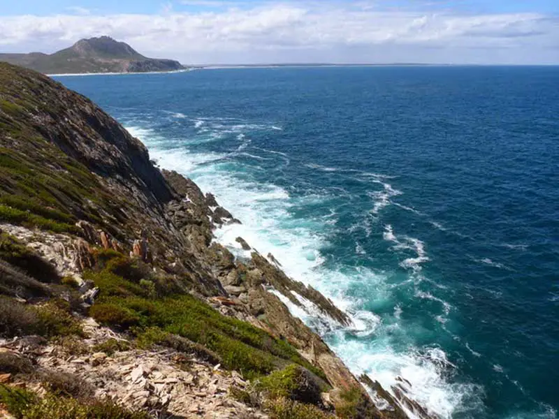
The sheer cliffs at Cave Point and vast Southern Ocean in all it’s moods are a must see on your visit to the eastern side of the park. The point is an ideal place to spot whales and seabirds and discover a diversity of plants in the rock gardens that clothe these exposed headlands. From Cave Point there is a clear view of the magnificent East Mount Barren where the jagged outline of tilted rock ridges resemble the spine of a giant sleeping dragon. Below the peak on its seaward slope is a distinctive broad platform carved by the action of pounding waves when the sea level was higher than it is today. If you absorb this view and then look west you’ll discover that headlands all along the Fitzgerald coast are similar wave-cut platforms created at the same time. In this areas of the park, you can climb to the summit of East Mount Barren or stroll along inland trails at Sepulcralis Hill and No Tree Hill.
Book Vehicle Hire

Book Accommodation

Design by W3Layouts | Content © 2013 Phoenix Group Co. | Sales: phone 1300 753 517, email: [email protected]