
Mitchell River National Park is one of the Kimberley's two newest national parks. The park of 115,300 hectares lies in a remote part of the Kimberley in the far north of Western Australia. The Mitchell River, flowing northwards, drains into Walmsley Bay and Admiralty Gulf, carving gorges and waterfalls into the underlying sandstone, particularly along the margins of the Mitchell Plateau. The fan palm is a conspicuous feature of the vegetation of some parts of the plateau, an elevated laterite-capped plain. This is one of the few places in WA where palms are such a dominant feature.
Mitchell Falls and Surveyors Pool are the park's two main attractions. The track to Mitchell Falls ends at Mertens Creek. From here a walk of about one hour (round trip) takes you to Little Merten Falls and allows time to explore and swim. Allow four to six hours round trip to Mitchell Falls so that time can be spent at the Falls. The walk to the falls is over rough country.

The Mitchell River National Park abuts the northern boundary of the Prince Regent Nature Reserve, effectively creating a continuous conservation reserve of three quarters of a million hectares.
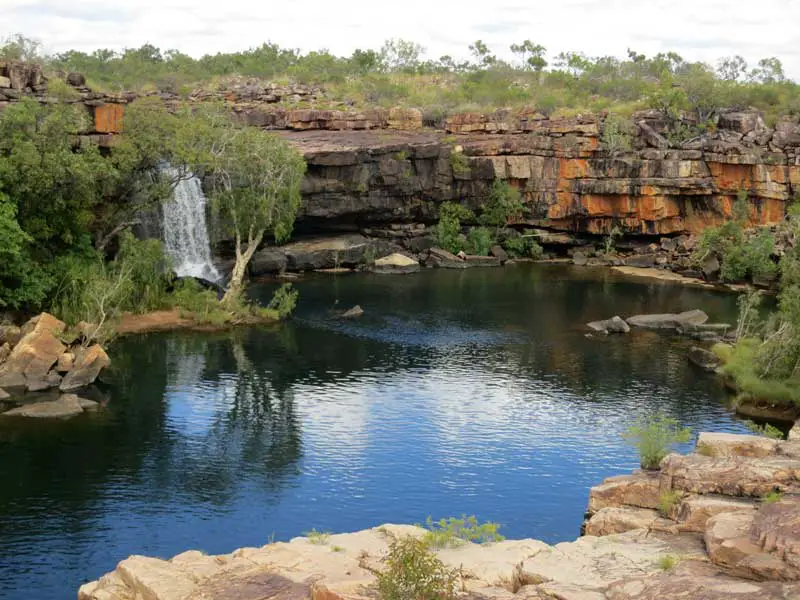
Surveyors Pool
Surveyors Pool is surrounded by bluffs of King Leopold sandstone. Access is not marked accurately on any current map. The present access to Surveyors Pool is 24 kilometres north of the mining camp on the Port Warrender Road. To reach it you must drive six kilometres, then walk four kilometres. Water bottles may be refilled at the pool. Allow six hours from the car park for the return trip. Currburl Creek flows in Surveyors Pool at Aunauyu.
Book Vehicle Hire

Book Accommodation

Design by W3Layouts | Content © 2013 Phoenix Group Co. | Sales: phone 1300 753 517, email: [email protected]