


Lookouts
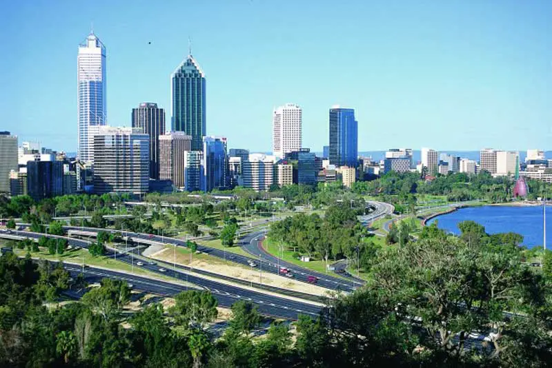
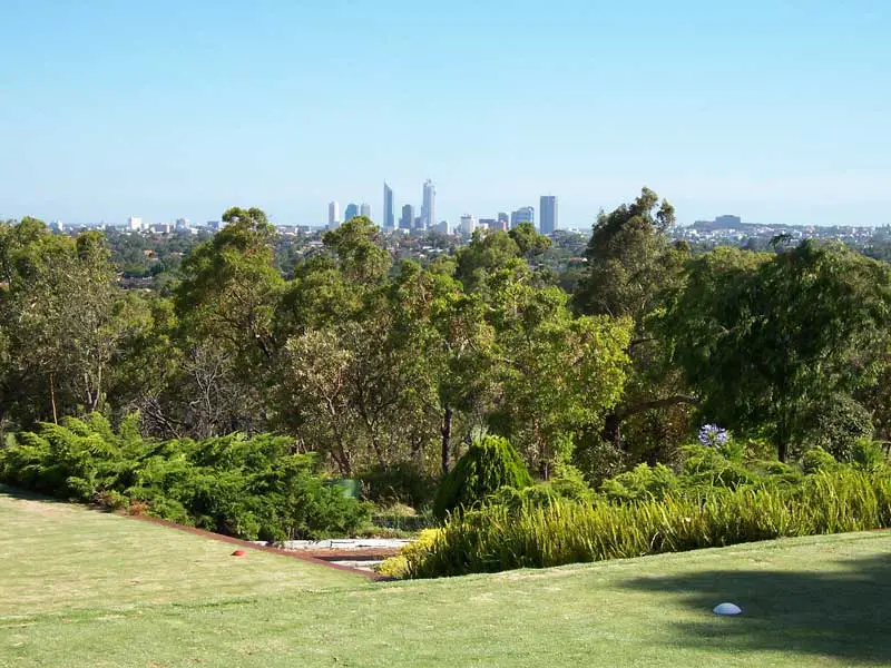
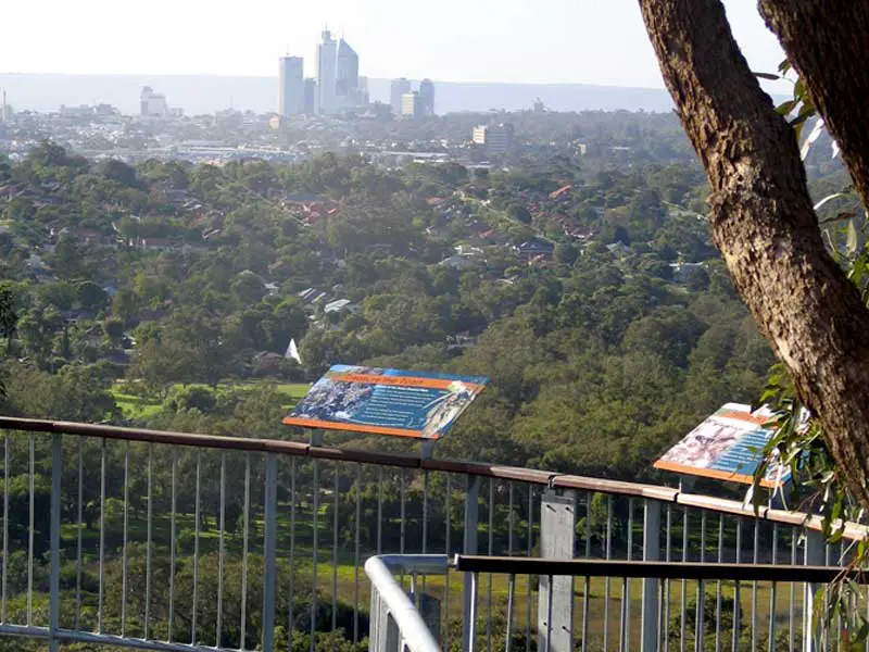
The most photographed view is of Perth’s city skyline is from either Forest Drive (the main entranceway into Kings Park) or from the State War Memorial. Other vantage points throughout the park offer different views of the city and river. Kings Park is the largest inner city park in the world and the most popular visitor destination in Western Australia.
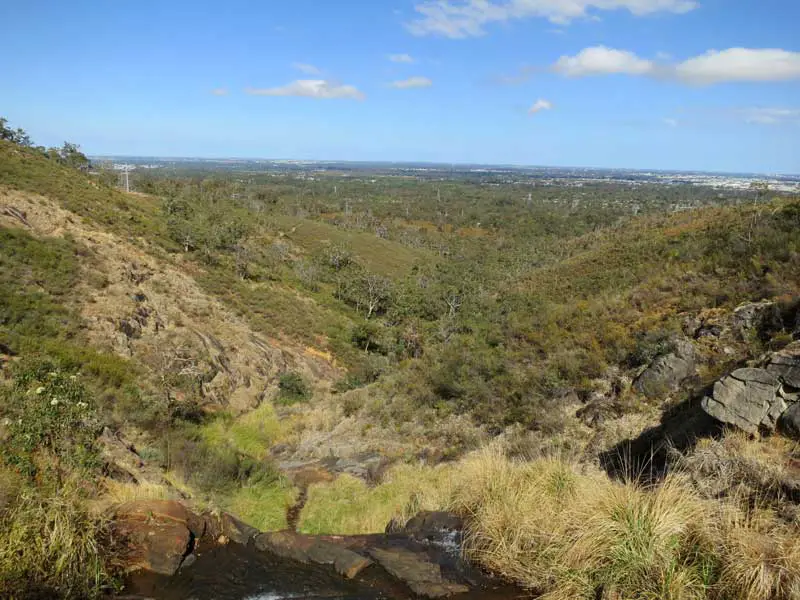
Located on the western edge of the Perth city centre, the park is a mixture of grassed parkland, botanical gardens and natural bushland on Mount Eliza with two thirds of the grounds conserved as native bushland. one of its greatest assets are the panoramic views of the Swan River and Darling Range from its numerous lookouts.
Built on the highest point of the park in 1966, the DNA Tower is a white 15m high double helix staircase that has 101 steps and was inspired by a double staircase in a Chateau at Blois in France. Its design resembles the deoxyribonucleic acid (DNA) molecule. The paving below the DNA Tower is made with stones sent from 11 towns and 80 shires in Western Australia. the lookout has uninterrupted views in all directions.
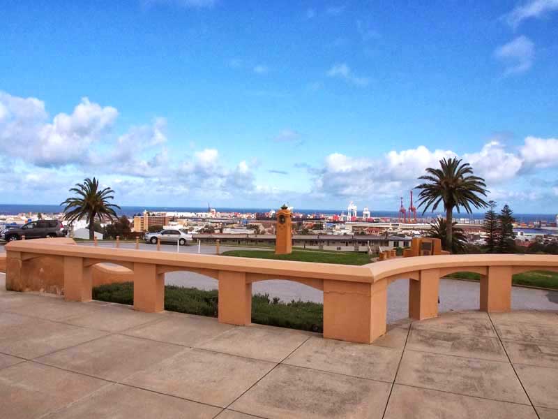
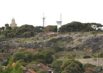
Monument Hill, the highest point in Fremantle, has been a popular lookout over the port and surrounding areas since the early days of British Colonisation. In the second half on the 19th century, an obelisk at the hill’s summit provided a trig point to navigators and surveyors. Early in the 20th century the hill was made a park and continued as a lookout and beauty spot.
To commemorate the losses of the 1914-1918 war, the City of Fremantle erected the Fallen Sailors & Soldiers Memorial at Monument Hill in 1928. The layout of plantings and parkland was established in the 1930s. More memorials were erected after the 1939-1945 war.
Buckland Hill, named by Capt James Stirling after James Buckland who became Dean of Westminster, is the last remaining intact peak of seven prominant hills in the Mosman Park region between the Swan River and the Indian Ocean. It is one of the highest points in the Perth metropolitan area.
It is thought that Willem de Vlamingh, the early Dutch navigator landed nearby this feature in 1697 and climbed the hill to ascertain what lay beyond it and in doing so noted the Swan River which he named.
In the early days of colonisation, the area around Buckland Hill was extensively quarried for limestone. During the Great War, a Battery Observation Post on the western slopes of Buckland Hill served as the Port War Signal Station, a naval facility used to signal vessels leaving and entering Gage Roads. It became the site of the World War II Leighton 6-inch Battery, a gun station commissioned about two weeks after the Japanese attack on Pearl Harbour in August 1941.
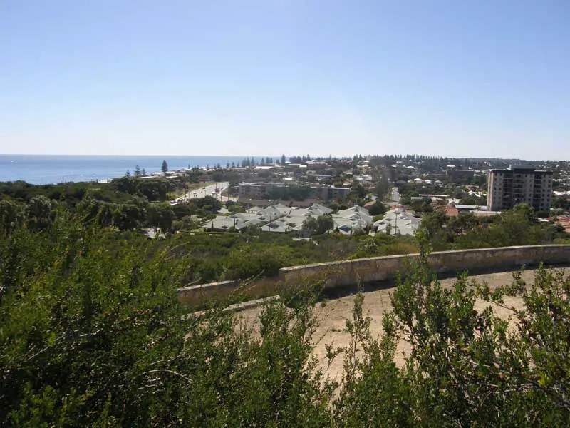
Barracks for the personnel, two coast defence searchlights and other associated facilities linked by a series of tunnels were built to serve the battery. Prior to the 6-inch battery moving to Buckland Hill, a 3.7-inch anti aircraft battery had been deployed near what is today the main entrance to the residential estate. The battery is stil intact with parts of it open for public inspection. Its observation platform offers panoramic views across the area including Cottesloe Beach.
The highest part of Buckland Hill, where there is a reservoir, is often referred to as Monument Hill to differentiate it from the part of Buckland Hill occupied by the Leighton Battery on its western slopes. The water reservoir, built in 1934-35, supplies most of the western suburbs of Perth. Its been there for much of the last century, but is now roofed. Adjacent to the reservoir is a limestone obelisk, hich gives the hill its name. It was built by convicts in the nineteenth century as a Trig point or survey marker. It originally stood in the centre of the reservoir but was moved when the reservoir roof was installed.
The reservoir is the most westerly in the Perth metropolitan area and provides sweeping views from the takes on Rottnest and Garden Islands and Fremantle Port and Swan River mouth to the west and Lucky Bay and Bicton and East Fremantle to the east.
The suburb of Yokine, which originally was known as Yokine Hill, then Mt Yokine when it was subdivided, has a name of Aboriginal origin meaning dingo, or native dog. It is probably taken from Dog Swamp, previously known as Native Dog Swamp or Yokine Swamp to the local Aborigines, a watering hole used as an Aboriginal campsite which is at the foot of the hill. Elevation: 83 metres above sea level.
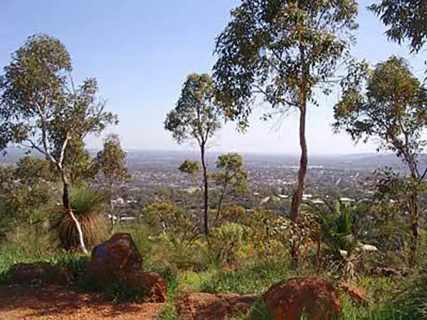
City skyline from Gooseberry Hill
Also referred to as the Darling Range or Darling Ranges, Darling Scarp is a low escarpment running north-south to the east of the Swan Coastal Plain and Perth. It extends generally north of Bindoon, to the south of Pemberton, and easterly to include Mount Bakewell near York and Mount Saddleback near Boddington.
For great views of the city, head to Kalamenda, then follow the Zig Zag Drive down into the valley along the route of a former narrow gauge railway that climbed the Darling Ranges here by means of a zig zag railway. The railway’s story is told at the Kalamunda Museum in the old railway station complex back in the town centre. At the foot of the scenic drive, turn right into Ridge Hill Road, following it into Midland.
Greenmount is a locality on the edge of the Darling Scarp at what is known as Greenmount Hill. Great Eastern Highway at Greenmount Hill is a vital point in the transport routes from the Swan Coastal Plain into the hinterland of Western Australia.
In the era of the Swan River Colony the name ‘Greenmount’ was used for two points on the Darling Scarp. In the 1840s the York Road was known as York Greenmount, and the road further north along the Scarp was known as Toodyay Greenmount. It is possible that these two locations might have had slightly different coloured foliage compared to the grey blue green colour of the Scarp.
The original Eastern Railway linking Perth to Kalgoorlie and the eastern states climbed the Darling Scarp on its western slopes. The current railway route still passes within a few kilometres to the west and north of the hill. Greenmount was a railway stopping place on the Eastern Railway until 1954 when the Mundaring Loop was closed for passenger traffic, however trains continued to work on the line to the Mountain Quarry in Boya until 1962.
Lesmurdie Hill is the route taken by Lesmurdie Road, the main access road to the Darling Scarp village of Lesmurdie from the Swan Coastal Plain is via Welshpool Road. Lesmurdie Road snakes its way up the side of the Darling Scarp from the suburb of Wattle Grove. Lesmurdie Falls National Park is located at the top of Lesmurdie Hill on the escarpment 20 kilometres east/south-east of Perth.
The Boulevard, City Beach. With over fifteen kilometres of bushland walking and bridle trails and ten different lookouts with expansive city and coastal views, Bold Park offers a memorable experience any time of year. Bold Park occupies Reabold Hill, which at 93 metres above sea level, it is the highest peak in the Perth inner metropolitan area.
Originally it was known as One Tree Hill In 1839, Henry Trigg was granted the land around One Tree Hill. He established a lime quarry and kilns, to supply limestone for many of Perth’s original buildings. As a result of Mr Trigg’s business, the area became known as the Limekilns Estate. In 1844 the estate was purchased by Mr Walter Padbury, who was a butcher, built an abattoir and slaughtered animals in the area for many years. In 1869 the Birch Brothers purchased the estate off Walter, and established a vineyard.
Camel Lake was once used as a quarantine area for camels, imported during the Gold Rush. The explorer Ernest Giles, rested his camels at the Lake, after his epic journey from Port Augusta to Perth, in May 1875. The camels are now long gone, however evidence of tethering is still visible on some of the trees. Look for the distinctive circular marks on the trunks.
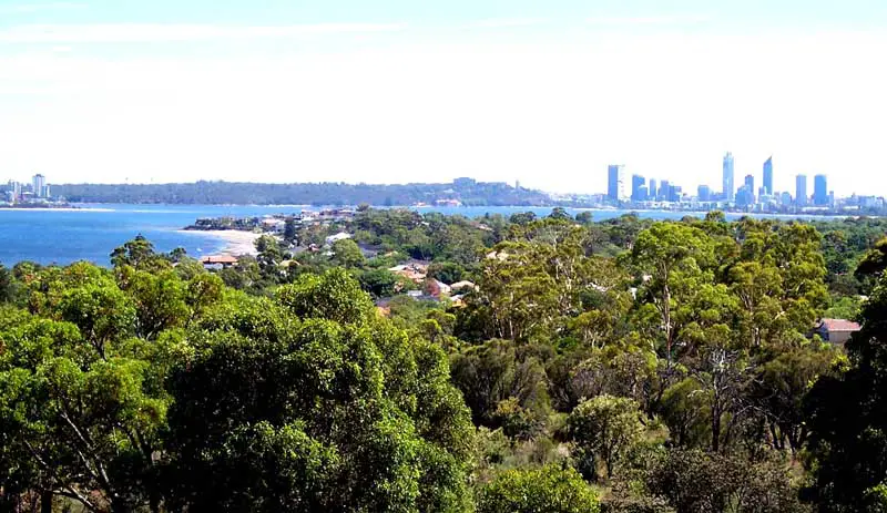
Off Canning Highway, Ardross. Wireless Hill Park is the location of one of Australia’s first Telecommunications Stations built in 1912. Wireless Hill Park, on the southern side of the Swan River between Perth and Fremantle, features two lookouts with views across Melville Water, a Heritage Trail winding through magnificent Western Australian wildflowers in natural bushland and a Telecommunications Museum housed in the original Telecommunications building.
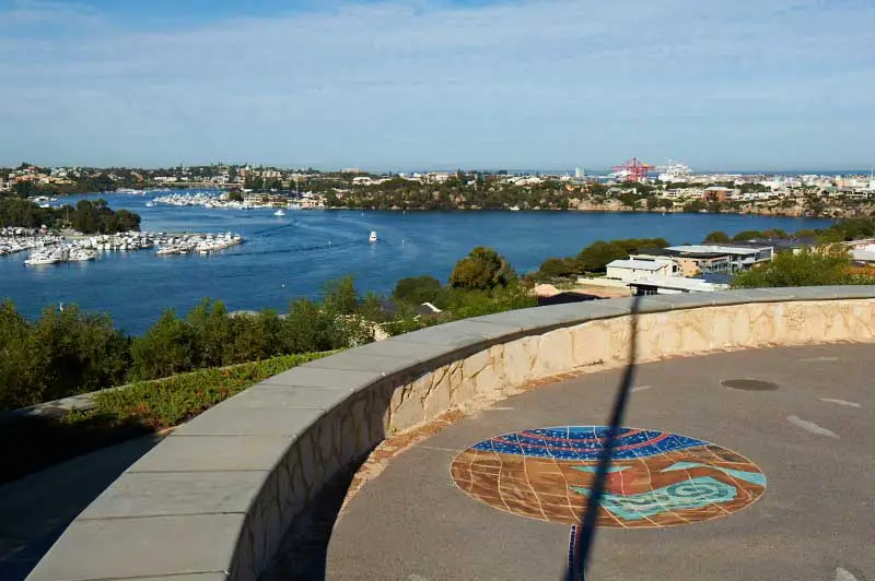
Minim Cove is one of Western Australia’s most sought-after residential estates, created on the site of the former State Engineerring Works in the Perth suburb of Mosman Park.
Minim Cove has extensive landscaped parkland and a lookout tower at Mount Lyell Park near the head of Blackwall Reach. It offers 360 degree views across the Swan River to Perth in the east, and to Fremantle and the Indian Ocean in the west. There is a large gazebo at the lookout, and mosaics and plaques which detail the connection of the Bibbulmun Nation to this area beside the Swan River. The mosaics and plaques were placed in Mount Lyell Park in 1999 as part of the Minim Cove Aboriginal Heritage Artwork. Location: Mount Lyell Park, McCabe Street, Mosman Park.