


Truly the last frontier in Australia, a trek to the northernmost tip of Australia is the ultimate journey for 4-wheel drive enthusiasts and it isn’t difficult to see why. It is a wild and sparsely populated wilderness area that is best visited by visitors during the dry months from April to December, and then preferably with a 4WD vehicle.
If attempting the drive here outside of the months of August and September, don’t even think about driving up the Cape unless you intend coming in a 4-wheel drive vehicle, and have some experience in fording flooded rivers and beating your own path through the bush. After rain the roads are generally impassible, so check road conditions before starting your journey. You will also need to get permits to camp in certain areas around the Cape York Peninsula, which can be purchased at both the EPA and RACQ in Cairns.
If you are driving up from Cairns, and not detouring to Cooktown, Lakeland will be your last major chance to top up your food and grocery supplies. Lakeland to the tip is about 750 km on unsealed roads. Reaching the Gulf of Carpentaria by road is a different kettle of fish. It’s bitumen all the way to Karumba from Bourke, NSW (1,948km via Mitchell and Landsborough Hwys.), Cairns (752km via Gulf Development Rd) or Brisbane (2,156km via Warrego and Landsborough Hwys. and Burke Development Rd.

The best time to visit the region is between May and November in the dry season. Even then, August and September are the only months to tackle the Cape on your own if you are not an experienced 4-wheel driver. No matter what time of the year, after rain the roads are generally impassible, so check road conditions before starting your journey. You will also need to get permits to camp in certain areas around the Cape York Peninsula, which can be purchased at both the EPA and RACQ in Cairns.
Extending from the Great Dividing Range in the east, to the Northern Territory border in the west, the Gulf Savannah region borders the Gulf of Carpentaria. The region covers an area of 186,000 square kilometres – true safari country featuring golden savannah grasslands abounding with wildlife. The Gulf Savannah, renowned for its distinctive coastline and wild and sparsely populated wilderness, is rich with history of gold rushes, bushrangers and wandering Aboriginal tribes.
Visitors can explore deserted ghost towns and small isolated communities that serve the mining, pastoral and fishing industries. As one travels further west, lush tropical rainforests give way to an ever-changing landscape of open woodlands and savannah grasslands, dramatic volcanic landforms, rugged escarpments and cool, fresh-water gorges.
If heading for the Gulf of Carpentaria by road, it is bitumen all the way to Karumba from Bourke, NSW (1,948km via Mitchell and Landsborough Hwys.), Cairns (752km via Gulf Development Rd) or Brisbane (2,156km via Warrego and Landsborough Hwys. and Burke Development Rd. If attempting the drive off the bitumen outside of the months of August and September, don’t even think about driving it unless you have a 4-wheel drive vehicle, and have some experience in fording flooded rivers and beating your own path through the bush. After rain, the roads are generally impassible, so check road conditions before starting your journey.
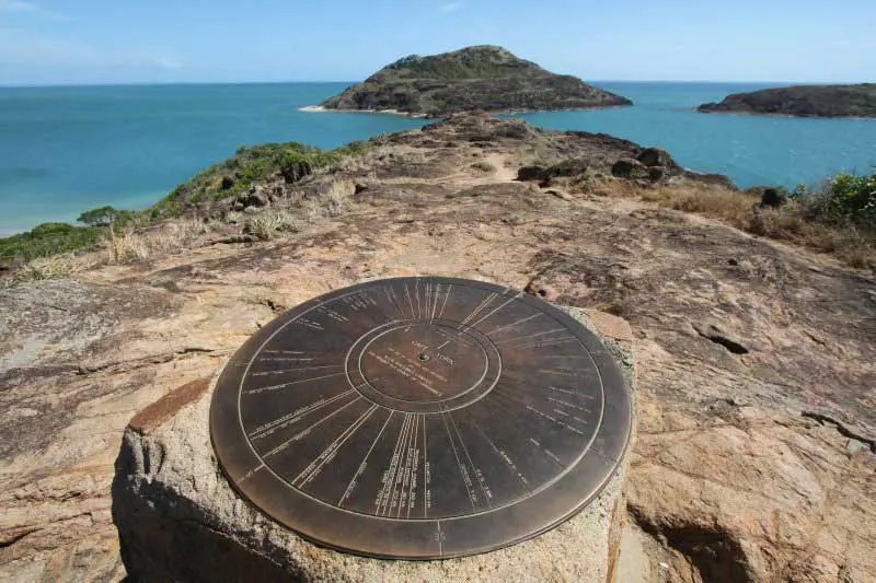
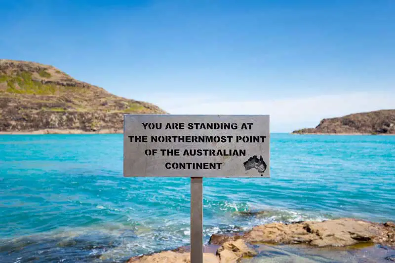
Cape York Peninsula is the north tip of Australia and the state of Queensland. The tip of Cape York is the northernmost point on the Australian continent. It was named by Lt. James Cook in 1770 after His Royal Highness the Duke of York. From the tip, it is about 140 km to New Guinea across the island-studded Torres Strait. The west coast borders the Gulf of Carpentaria and the east coast borders the Coral Sea. Cape York Peninsula is approximately 137,000 km2 in area and it has a population of about 18,000.
Geographically, it is an extremely eroded, almost level plain, with some very low hills on the eastern side. The highest of these form the Iron Range, noted for its unusual tropical rainforests. These support species, including the Eclectus Parrot and Southern Common Cuscus, also found in New Guinea. The soils are remarkably infertile even compared to other areas of Australia, being almost entirely laterised and in most cases so old and weathered that very little development is apparent today (classified in USA soil taxonomy as Orthents). It is because of this extraordinary soil poverty that the region is so thinly settled: the soils are so unworkable and unresponsive to fertilisation that attempts to grow commercial crops have usually failed. The lowlands of the western side of the peninsula are dominated by winding, slow-flowing rivers, which empty into the Gulf of Carpentaria.
The climate on Cape York Peninsula is tropical and monsoonal, with a wet season extending from November to April and a dry season from May to October. The temperature across it is warm to hot, with a cooler climate in higher areas. The mean annual temperatures range from 18 °C at higher elevations to 27 °C on the lowlands in the far south-west. Temperature over 40 °C and below 5 °C are rare. Annual rainfall is high, ranging from over 2000 mm. in the Iron Range and north of Weipa to about 700 mm. at the southern border. Almost all this rain falls between November and April, and only on the eastern slopes of the Iron Range is the median rainfall between June and September above 5mm (0.2 inches). Between January and March, however, the median monthly rainfall ranges from about 170mm (6.5 inches) in the south to over 500m (20 inches) in the north.
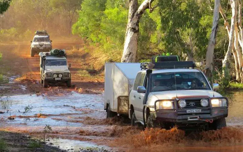
There are many rivers, amongst them the Endeavour, Annan, Bloomfield, Pascoe, Jardine, Wenlock, Archer, Holdroyd, Mitchell, and Staaten. In fact, Cape York Peninsula contributes as much as a quarter of Australia’s surface runoff – indeed it produces more runoff than all of Australia south of the Tropic of Capricorn. A completely sealed inland road links Cairns and the Atherton Tableland to Lakeland Downs and Cooktown on the Cape. The road north of Lakeland Downs to the tip of the Peninsula is unsealed, and sometimes cut after heavy rains during the wet season (roughly December to May). Cape York is a popular destination from May to October for 4WD enthusiasts who come to test their driving skills and their vehicles on the remaining sections of the Overland Telegraph Track.
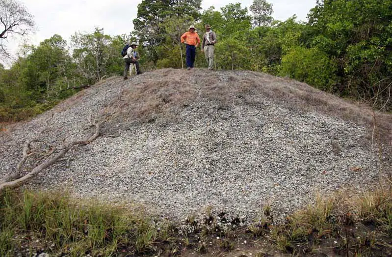
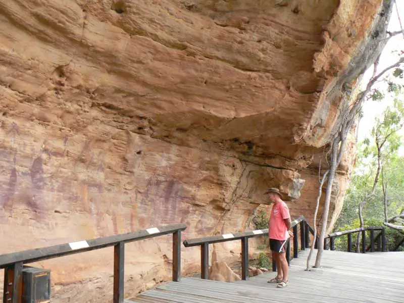
Some of the world’s most extensive and ancient rock painting galleries surround the tiny town of Laura, some of which are available for public viewing. There is also an impressive new Interpretive Centre from which information on the rock art and local Aboriginal culture is available and tours can be arranged.
The main industries are tourism, mining, fishing and cattle. There are extensive deposits of bauxite along the west or Gulf of Carpentaria coast. Weipa is the centre for this mining activity. Although much of the Cape is sparsely populated, there are settlements at Cooktown, Lakeland, Laura, Coen, and Weipa, and Aboriginal communities at Wujal Wujal, Hopevale, Lockhart River, Injinoo, New Mapoon, Umagico, Old Mapoon, Napranum, Aurukun, Pormparaaw, and Kowanyama. Torres Strait Islander communities on the mainland are Bamaga and Seisia.