North Queensland


A to Z of Darwin
The Northern Territory was initially settled and administered by South Australia, until its transfer to the Commonwealth in 1911. On 5th February 1869, George W. Goyder, the Surveyor-General of South Australia, established a small settlement of 135 men and women at Port Darwin. Goyder named the settlement Palmerston, after the current British Prime Minister Lord Palmerston. The streets of Palmerston (now known as Darwin) had been named by Goyder on the journey north from Adelaide to the location long before the site of the township had been selected. Goyder named all the streets after surveyors and members of his party except for Cavenagh Street, which was named after Wentworth Cavenagh-Mainwaring (1822-1895), a South Australian farmer, land agent and MP who was the Commissioner for Lands. His name was given to the principal street and the town square.
Alawa
As one of Darwin’s northern suburbs, Alawa was constructed in the late 1960s. Alawa is named after an Aboriginal tribe who inhabited an area on the southern tributaries of the Roper River, centred around Hodgson Downs Station. The street names in Alawa commemorate the residents and workers, at the old Post Office, who were killed in the bombing of Darwin by the Japanese in 1942, and the boats and people associated with the early settlement of Palmerston (Port Darwin).
Anula
One of the northern suburbs east of Lee Point Road which was under construction when Cyclone Tracy devastated Darwin in late 1974. The suburb derives its name from the Yanyula tribe (or Anula tribe) of Aboriginal people in the Borroloola – McArthur River – Seven Emus area on the coastline of the Gulf of Carpentaria. When the suburb area was designed in 1966, the linguists spelling was that listed, but variant uses of the name were Yanyula and Janjula. Yanyula Terrace perpetuates one variant name for the tribe group, but the whole suburb enshrines Anula as the adopted name in the 1960s, gazetted finally as a suburb in 1984. The streets in Anula are named after early NT Mines and Mineral Fields.
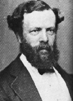
Archer
This original Palmerston suburb is named after James Clarence Archer
who was a former post-War Administrator of the Northern Territory
between 19th July 1956 and 31 March 1961. The suburb is on the southern
fringe of Palmerston. James Clarence Archer, born 28 July 1900 was
first appointed to the Public Service in November, 1916 and served the
Victorian Auditor General’s Office between 1926 and 1938. He served in
New Guinea in the Second World War. In post-War years he was in
External Affairs and dealt with expropriated property in Papua New
Guinea.
As a senior officer in the Department of Territories he was appointed
as Administrator of the Northern Territory in 1956 and was responsible
for the first Administrator’s Council in moves towards self-government.
In his term, the establishment of Local Government and further social
and economic development in the Territory took place. Other events
included the establishment of the Housing Commission and the
institution of Darwin as a City by statute. He died in Canberra on 23
December, 1980.
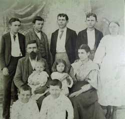
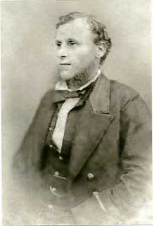
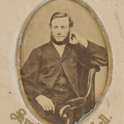
Edward Howard Bakewell
Bakewell
This original Palmerston suburb is named after Edward Howard Bakewell who was born in North Adelaide in 1859 and was educated at Prince Alfred College in Adelaide. After four years banking experience and three years with a large firm of shippers and millers, in 1884 he entered the firm of Elder Smith and Company and held the position of manager of their stock department for some years. He later became the Chairman of Directors of Bagot, Shakes and Lewis. He severed his connection with the firm in 1893 in order to assist Mr John Howard Angas in the management of his estates. Upon the death of that gentleman he received the appointment of general manager of the estates and Managing Director of the Willowie Pastoral Company. Bakewell held titles within the Hundred of Bagot in the area now occupied by Palmerston. Bakewell had also been on the Council of the Royal Geographical Society in Adelaide.Bayview
Bayview is a shortened version of the estate name “Bayview Haven”, which is believed to have been named because the area looks over Frances Bay.
Bellamack
This original Palmerston suburb is named after a local Larakia Aboriginal mentioned in Goyder’s 1870 papers on the early survey expedition and the settlement of Palmerston (Port Darwin). One of the first Aboriginal people to welcome Goyder, Bellamack (also known as ‘Billiamook’ or by his nickname ‘Billy Muck’) gave WW Hoare, the Doctor’s assistant, a necklace of red beads when the party first arrived on the Moonta in 1869. He gave help to the surveyors, standing between Schultze, the botanist, and a group of the tribe with spears who were demanding food (the remains of an emu). Saving the life of Schultze, he was described as:- a handsome, well built Aboriginal whose intelligence was outstanding among his tribe and was well liked by all the members of the expedition who encountered him. The NT Times recorded his movements over the years around Darwin and in 1882 he was sworn in before the Court as an interpreter for the Larakia Aboriginal people. He and ‘Umballa’, another Larakia, travelled widely including to Adelaide. Bellamack disembarked on return from Adelaide in the uniform of the Adelaide Volunteers.
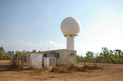
Berrimah Radar installation
Berrimah
The Military authorities in 1941, before World War II, had decided on a number of locations in the north to identify strategic “camps” on ‘the road to the North’ – “Berrimah”, “Noonamah” and “Larrimah”. The Military Board chose some local Aboriginal names but their advice as to the meaning was not entirely accurate. The War Diary relates the events leading up to thebombing of Darwin and in late 1941, action was being taken to erect quickly the 119th Army General Hospital at the camp site to be known as “Berrimah”, the Army quoting the origin of the Aboriginal word “to the south”. The Hospital was erected on the present day Kormilda College site and was then called “Berrimah”. Much of the site works were carried out by the late Mr Stan Secrett.
The original road reserve between Sections 41 and 42, Hundred of Bagot, became to be known as Berrimah Road and by September 1952, this name was officially gazetted as the access road south of the main Highway crossing to the Quarantine Station. The original camp Hospital name was therefore preserved in post-War nomenclature. The strafing of this Hospital by the Japanese in 1942 led to its eventual removal to Adelaide River. Not far away on the eastern side of Berrimah Road, a small cemetery reserve marked the graves of Japanese airmen who ironically died in the earlier attempts to bomb Darwin into submission. These graves were later removed in the 1960s to Cowra in New South Wales.
Berry Springs
This south western Litchfield Shire locality derives its name from ‘Berry Creek’, named by Goyder in 1870, after his Chief Draftsman, Edwin S Berry, a member of Goyder’s 1869 Survey Expedition to Port Darwin. Berry went ashore on the first boat from the Moonta with George Goyder. The area known today as ‘Berry Springs’ was originally shown by Surveyor Gilbert R McMinn on his plan of 1869 as ‘Kangaroo Falls’ with the wording ‘Recommended for Reserve’. Edwin Creek at Humpty Doo also bears Berry’s name.
Brinkin
As one of Darwin’s northern suburbs adjacent to the coast and the Northern Territory University, Brinkin was constructed in the 1980s. Brinkin is named after an Aboriginal tribe who inhabited an area to the south of the Daly River mouth. The streets in Brinkin are named after boats which serviced the coast of northern Australia.
Casuarina tree
Casuarina
Casuarina derives its suburban name from the Casuarina trees that grow along the nearby Casuarina Beach. Casuarina was the name used in the early 1960s for the proposed main business area in the northern suburbs. Casuarina is a small suburb taking in the large shopping and business area and the adjoining emergency service facilities/ buildings.
Coconut Grove
Coconut Grove derives its name from the grove of coconuts on the coastal fringe of this area, south of Nightcliff, occupied by holders of Agricultural Leases in pre-war years. Most streets in Coconut Grove are named after local Darwin residents and interstate visitors who lost their lives during the shipwreck of the Gothenburg off the Queensland coast in 1875.
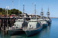
Attack Wharf, HMAS Coonawarra
Coonawarra
The suburb derives its name and takes in the Naval base HMAS Coonawarra. The wartime origin of the name is derived from the aboriginal word for “Swan”.
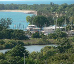
Cullen Bay
Although the name Cullen Beach first appears on plans in 1913; the origin of the name is unclear as both Cullen Beach and Kahlin Beach names have appeared on maps. One interpretation is that Cullen is possibly a mispronouncation and/or a misspelling of ‘Kahlin’ as the name appears on plans when the Kahlin (aboriginal) compound was built. Another possiblity is that the beach was named after the senior partner in the firm of solicitors, Cullen and Wigley, who were based in Pine Creek during the Mining period of the 1870s. Cullen River and Mt Wigley in the Pine Creek area were named during the early 1870s.
With the construction of the Cullen Bay housing estate and marina, in 1993, the term Cullen Bay came into use for the enclosed bay between Myilly and Emery Points. The Cullen Bay Marina Act (1994) and Regulations govern the management of the bay/marina. Cullen Bay is within the suburb of Larrakeyah, Town of Darwin.
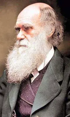
Charles Darwin
Darwin City
Darwin derives its name from the harbour which was named by Captain Stokes and Wickham in 1839 after their former shipmate Charles Darwin who had travelled on the HMS Beagle on a previous voyage. The settlement was named Palmerston by Goyder in 1869 and reverted to Port Darwin by the turn of the century and in 1911 was officially renamed Darwin. Streets within the Darwin CBD were mostly named by Goyder after leading members of his Survey Expedition.
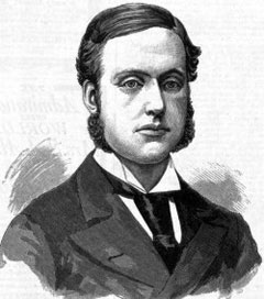
Driver
This original Palmerston suburb is named after Arthur Robert Driver, an engineer, who came from Western Australia and was appointed by the Federal Labour Government as Administrator in 1946. The highlights of his five year term include the rescue in 1947 of Bas Wie upon his stowaway arrival in Darwin from Indonesia and his term as the first President of the Legislative Council which begun in 1948. By this time Driver had embarked on the decentralisation process of establishing Elliott as the focal point between Darwin and Alice Springs in the centre of the Territory. Driver was succeeded in 1951 by another Western Australian, Mr F J S Wise. Driver died in May of 1981.
Durack
This suburban area was left unnamed when Palmerston was divided into suburbs as the area was set aside for a University. With urban development of this area in 1996, it became necessary to give the area a name. The suburb is named after the Durack family, pastoral pioneers of the Northern Territory and the Kimberleys. The Durack brothers in 1883/84 drove four mobs of cattle (7500 head) from Queensland to their Kimberly properties. By 1886, the Duracks had settled on their individual selections in the Kimberleys and had applied to secure Auvergne Station in NT from McCartney. This began the 6000 sq mile (15,500 sq kms) pastoral empire on the Western Australian/Territory Border. Michael Durack sold most of his properties in 1950 at age 85 years and a monument was erected at Argyle to his pioneering kinsman, dying at Perth on 3 September, 1950. Dame Mary Durack Miller, born in 1913, was the eldest of “MP” Durack’s family travelled and gained distinction as an author of “Kings in Grass Castles” and “Sons in the Saddle”. She died in Perth in early 1995.
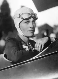
Amelia Earhardt
Earhardt
This undeveloped area on the western side of the upper reaches of the Middle Arm of the Darwin Harbour takes its name from Amelia Earhardt and is a recommended area for a second airport in Darwin’s long term strategy plan. Amelia Earhardt was born in Aitchison, Kansas, in 1898, the daughter of a lawyer. In 1932 she flew a Lockheed Vega from Newfoundland to Ireland, landing at Donegal, bringing her into the forefront of aviation notoriety. Her visit to Darwin in the pre-war days of early aviation exploits ended when she became mysteriously lost north of Lae in New Guinea on 3 July 1937. She was attempting to fly to Howland Island and Hawaii when she disappeared.
East Point
East Point, Lee Point and Point Charles all appear on Goyder’s original plan of Port Darwin in 1869. This point, the easterly extremity of the entrance to Darwin Harbour has been used for a variety of purposes, including gun turrets and anchor for the submarine net during the War (1942-46), a post war golf course and currently a recreation reserve.
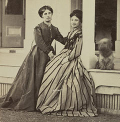
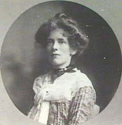
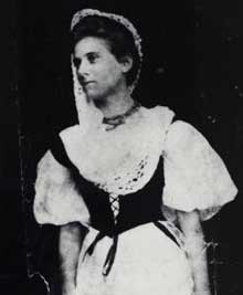
Fanny Carandini (right), with her daughter, Rosina Palmer
Fannie Bay
Fannie Bay is believed to have been named by the surveyors of Goyder’s expedition to found the present day Darwin in 1868, after Fanny Carandini, a popular opera singer of the time. Fanny Carandini was the daughter of an exiled Italian Count, Count Gerome Carandini, tenth Marquise of Saranzo, who came to Hobart, Tasmania, in the 1840s and married Mary Burgess who became a noted opera signer. Madame Carandini and her daughters Fanny, Rosina and Lizzie formed a famed singing group, travelling widely in Australia and overseas.
In 1868 the Carandinis held concerts in Adelaide a monthbefore the South Australian Surveyor-General, George Goyder, and his party set out in the ‘Moonta’ to found Palmerston (the present day Darwin). One of the concerts was a benefit night for ‘Fannie’ Carandini and some of Goyder’s surveyors would almost certainly have been there.
The reason for the difference in the name ‘Fannie’ or Fanny’ is unclear. In his book Australasia and the Oceanic Region published in 1876, William Brackley Wildey wrote of the Palmerston of 1874 – “Palmerston is laid out in 1019 half-acre allotments, and extends nearly three miles across to Fanny Bay, so named by the surveyors after Miss Fanny Carandini – this is prettily and healthily situated, facing the ocean, about four miles from town, a little beyond the town boundary…..” However, Hoare, one of Goyder’s party on the expedition to Palmerston, wrote in his diary “March 1 (1869): Public Holiday. I went with Capt. Barneson & Dr Peel to Talc Point. Got some specimens of shells, talc and coral. I made a sketch of Fannie Bay, Point Emery…..” Also, in the early maps of Darwin the spelling ‘Fannie’ was used.”
One explanation for the confusion could be that the Carandinis changed the spelling of their names for promotional purposes. Although Fanny Carandini’s death certificate reads ‘Fanny’, in newspaper reports and advertisements in her singing days the spelling ‘Fannie’ is used. Her mother appears to have done the same, changing her name from ‘Mary’ to ‘Marie’. Goyder’s surveyors would possibly have taken the version ‘Fannie’ name from a program or a poster advertising the Carandinis’ concerts in Adelaide.
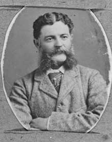
John Samuel Farrar with his family
Farrar
This suburban area was originally part of Gunn when Palmerston was divided into suburbs in 1984. However the development of Palmerston’s eastern suburbs did not proceed in the 1990s as designed in 1984 and therefore the suburb of Gunn of 1998/9 was larger than that originally proposed and it was decided in 1999 to allocate a new name to the area of Gunn between the old and new Stuart Highway alignments. The suburb is named after John Farrar, a pastoral pioneer of the Northern Territory.
John Samuel Farrar was born in Yorkshire (perhaps Bradford), England in 1838 and came to Victoria, Australia, with his father (an ex-cavalry officer) circa 1856. Little is known of the earlier years, but they both gravitated to New South Wales. John Farrar eventually moved to Queensland where he worked as a stockman and drover on stations, such as “Kyabra”, owned by John Costello who was one of the first settlers on the Bullo River. Farrar was associated with the Burke and Wills Expedition, not as an explorer but guided the party through the Diamentina country to Cooper’s Creek.
After his father’s death in 1874, Farrar is believed to have returned to Yorkshire to deal with his father’s estate there. He returned to “Farrar’s Creek” on the Diamentina River (named after him by Costello) and by 1880 had moved into the Northern Territory, managing Lake Nash for Costello for a number of years. When Costello wound up his affairs in the NT in the bleak 1890s, Farrar moved to Hodgson Downs. Farrar with his sons Robert and William Ernest held pastoral leases at Nutwood Downs and Mainoru. John Farrar spent some 14 years at Nutwood Downs (of some 1800 sq miles) after the turn of the century and at one time held Elsey Station. Although speared twice, he was well liked by Aboriginal people. In 1916/17, the Farrars left the Territory to retire at Ferney, nine miles from Maryborough, Queensland, where he was later joined by his sons Robert and John. Mrs Farrar, aged 70, died on 23 December 1917 while John Samuel Farrar died on 13 December 1918, aged 80.
Girraween Lagoon
Girraween
This locality derives its name from Girraween Lagoon, a name given to a lagoon in Section 254, Hundred of Bagot, when in 1967 it was found to have been incorrectly shown as McMinn’s Lagoon. The name “Girraween” is of Aboriginal origin and is derived from Australian Legendary Tales as meaning “the place of flowers”. The locality is generally based on the Girraween Subdivision being developed by the Churcher Estate.
Gray
This suburb is named after William Henry Gray who was born in London in 1808 and who after becoming interested in the Wakefield Scheme of colonizing South Australia in 1834, arrived in Adelaide aboard the John Renwick in 1836. Gray was among the first colonists to purchase land in the new Colony. He bought large tracts of land in Port Adelaide, Palmerston (now Darwin), Southport and surrounding hinterland. He established his farm near Adelaide at the Reedbeds. He set up a Voluntary Military Force known as the Reedbeds Mounted Rifle Company in 1859.
He came to Palmerston in 1870 not long after its founding, the SS Bengal with John McKinlay and others who were seeking some investments in the north when Captain Bloomfield Douglas was the Government Resident. Gray’s lawyer, B A Moulden, was a member of the SA Legislative Council and was at one time Attorney General in the Cockburn Government of 1887. Gray was connected with E H Bakewell of the pastoral firm and the three men held titles in the area now occupied by the new Town of Palmerston. Gray died in 1896 and left a large estate to his family, with interests which have been held by them until recent post-war years.
Jeannie Gunn
Gunn
This suburb is named after Mrs Jeannie Gunn (1870-1961) who was born in Carlton, Melbourne as Jeannie Taylor in June, 1870. She studied literature and history with her sisters and later the three Taylor sisters opened their school ‘Rolyat’ (Taylor spelt backwards) at Hawthorn in 1889. Miss Jeannie Taylor met Aeneas Gunn, a librarian at Prahran, in the 1890s and they were married in December 1901, arriving at the Elsey in 1902. The Gunns came to Port Darwin on the “SS Guthrie”. Aeneas Gunn had previously spent time in the Territory with his cousin Captain Joseph Bradshaw in 1890. Aeneas died in March 1903 and Jeannie Gunn returned to Hawthorn. Her book “We of the Never Never“, about life and the Territory people at Elsey Station became known Australia wide and in 1939 George VI awarded her the Order of the British Empire. She died in Melbourne during June 1961.
Maurice William Holtze
Holtze
This locality to the north of Palmerston, including the Army’s Robertson Barracks, commemorates Maurice William Holtze who arrived in the Territory in 1878 as Government Gardener and set up the Experimental Gardens which later became Darwin’s Botanic Gardens (1878-1891). Holtze held land around from 1883 to 1917 and was engaged in an early agricultural enterprise at Jungle and Palm Creeks. This ‘Jungle’ was known as ‘Holtze Jungle’, but in post war years the area was secured as a Forestry Reserve known as ‘Holmes Jungle’ after Felix Holmes, a butcher, who in 1917 owned and raised cattle in the ‘Jungle’. The name of MW Holtze’s son Valdemar (known as ‘Wallaby Holtze’) is perpetuated in a road on the south boundary of the locality.
Howard Peninsula
This proposed locality west of the actual Howard Springs and the Howard River is a peninsula of upland country dividing the King Creek and the Howard River catchments which drain into Shoal Bay.
Frederick Howard
Howard Springs
Howard Springs is so named after the stream which contains the Springs at its headwater. W P Auld of Finniss’ Party named the Howard River after Frederick Howard in 1865. Captain Howard was the master of the small topsail schooner HMS Beatrice which carried out exploration work from the Escape Cliffs settlement in 1864. He charted, as a hydrographer, the mouth of the Liverpool River and the coastline between Cape Stewart and Port Essington. In 1939, Howard Springs (at one time called Worgan Springs) became the first major water supply area to service Darwin. With the war approaching, Manton Dam was constructed and took over the role of supplying water to Darwin.
Jingili
As one of Darwin’s northern suburbs, Jingili was constructed in the early 1970s. Jingili is named after an Aboriginal tribe who inhabited the area around Elliott in the middle of the Territory. The streets within Jingili are mostly named after Flying Officers killed in the Darwin area during WWII and local people killed in action in France or Belgium during World War I.
Karama
One of the new Northern Suburbs built in the 1979/80 period. In 1964, Douglas Lockwood recommended that a number of tribal names be used for neighbourhood units or suburbs of Darwin. Karama and Garawa were listed, but Karama was preferred although Welfare authorities felt that Garawa was more correct. Karama is pronounced with the emphasis on the first syllable.
King Creek
This proposed locality takes its name from the feature of that name which was applied by W P Auld in 1865 after Stephen King Snr to the upper reaches of the creek whilst Auld was traversing from Escape Cliffs to Port Darwin.
Richard Randall Knuckey
Knuckey Lagoon
This prominent lagoon or lagoons was named by Surveyor General GW Goyder during the Survey of the Port Darwin and Environs in 1869 after Richard Randall Knuckey, his Senior Surveyor, who took a leading part in the survey. Knuckey also surveyed part of the Overland Telegraph Line in later years. Born in Cornwall (England), Knuckey was educated in Kadina (SA), trained as a surveyor in Adelaide and served in the Northern Territory. This locality was removed from the Berrimah suburban area in the “City of Darwin”.
Larrakeyah
The suburb gets its name from the original Aboriginal tribe when Darwin was founded by G W Goyder in 1869 after early abortive attempts by South Australia at Escape Cliffs. The Larrakeyah and Woolner tribes were known to and assisted the survey parties. Aboriginal camps were apparent in the area covered by the suburb to the west of the city. Larrakia (current orthography) are a group of Gulumirrigin speaking Aboriginal people. The name Larrakeyah / Larrakia would appear to have no meaning.
Leanyer
The name Leanyer was in general use for the area at the time of development and first appeared on 1869 survey plans. The origin is not known, but is presumed to be Aboriginal. The roads within this suburb are generally named after coastal features and rivers in the northern part of the NT or pastoral properties owned by the developer of the subdivision – Hooker Rex.
Lee Point
Lee Point
The name of this new suburb is derived from the geographical feature, ‘Lee Point’, which appears on Goyder’s 1869 Plan of Port Darwin and probably dates back to Stokes’ examination of the Harbour in 1839. The suburb is taken up with Defence installations.
Ludmilla Holtze
Ludmilla
Ludmilla, as a suburb, derives its name from Ludmilla Creek, believed to have been named after Ludmilla Holtze by Gustav Sabine, a Government Surveyor who carried out a survey of that particular area in 1893. As the name did not appear on any maps prior to this survey it is pretty certain to have been Gustav Sabine (Sabine Road, Millner). Not very much is known about Ludmilla Holtze herself other than she was the only daughter of Maurice and Evlampia Holtze who migratedto Australia from Hanover in 1872, together with Ludmilla and her three brothers. Both Maurice Holtze as Government Gardener (1878-1891) responsible for the development of horticulture in Palmerston (Darwin), and Nicholas (Ludmilla’s brother) through his untiring work from 1891 when he took over from his father until his untimely death in 1913 aged 45, are credited with the variety of species and beauty of the Botanical Gardens as they are today.
Malak
Named after the Aboriginal tribe who came from the Daly River area who have totemic groupings, (eg turtles, crocodiles, lizards etc). Alternative spellings have been Mallak, Mulluck Mulluck. It seems also to be an alternative name for the Gubabiungui who now live at Milingimbi. Although the naming intended in 1965 to have the tribe pronounced Mulluck, its name has been pronounced in a variety of anglicised forms.
Manton
This locality derives its name from Manton Dam, Darwin’s first wartime water supply. Boyle Travers Finniss, commander of the Escape Cliffs settlement named the River after his second-in-charge of the expedition, James Thomas Manton, who later took over the abortive survey task, and was recalled in 1866. Manton was a surveyor, an engineer and architect, who had built lighthouses in SA and also the Tapley Hills Road before taking on the NT task in 1864. He died in Adelaide in 1899.
Marlow Lagoon
Named after Joseph Marlow who came to the Territory at the age of 21 year in about 1917 from the Malay States. He was a fettler on the Railways at stages, but had an interest in Agricultural Lease No. 213 between 1927 and 1938. This lease covered the peninsula area jutting into East Arm of Darwin Harbour between Berrimah and Palmerston. It is believed that his occupation of this lease led to the use of the name Marlow’s Lagoon (for the waterhole) on pre-war plans. In 1935, Joseph Marlow married Ellen Mary Flynn, daughter of Nellie & Tom Flynn of Rum Jungle on 26th February and they had two children. On 27th September 1940 Marlow (recorded as Joseph Marler) died at Parap, aged 46 years).
Marrara
The swamp between the suburb and the Darwin International Airport is shown on Goyder’s original surveys of Darwin in 1869, but it, like Leanyer, is believed to be derived from an Aboriginal name for the area. The suburb derives its name from the swamp and includes the residential area and the sporting complex between the airport and McMillans Road. The streets in the residential area of the suburb are named after golf courses at he request of the Darwin Golf Club who developed the residential subdivision in order to develop the greens.
Micket Creek
Although the name Micket Creek in various spelling forms has appeared on maps and plans since 1869 when Port Darwin and environs was surveyed by members of the Goyder expedition, the origin of the name is unknown. As the name appears on the same plan as Leanyer and Marrara Swamps, the posibility of the name being of Aboriginal Origin can not be discounted. More recently the Micket Creek Shooting Complex has been built in the locality, bringing various shooting clubs into the one complex.
Millner
This suburban area was named after Dr James Stokes Millner, who came to Darwin after Goyder’s party and was its Medical Officer and Protector of Aborigines after Dr Robert Peel left in September 1869. He remained on as Government Resident until Captain Bloomfield Douglas arrived in 1870. He stayed on during Darwin’s first 6 years and resigned and with his family perished on the ill-fated Gothenburg in February 1875.
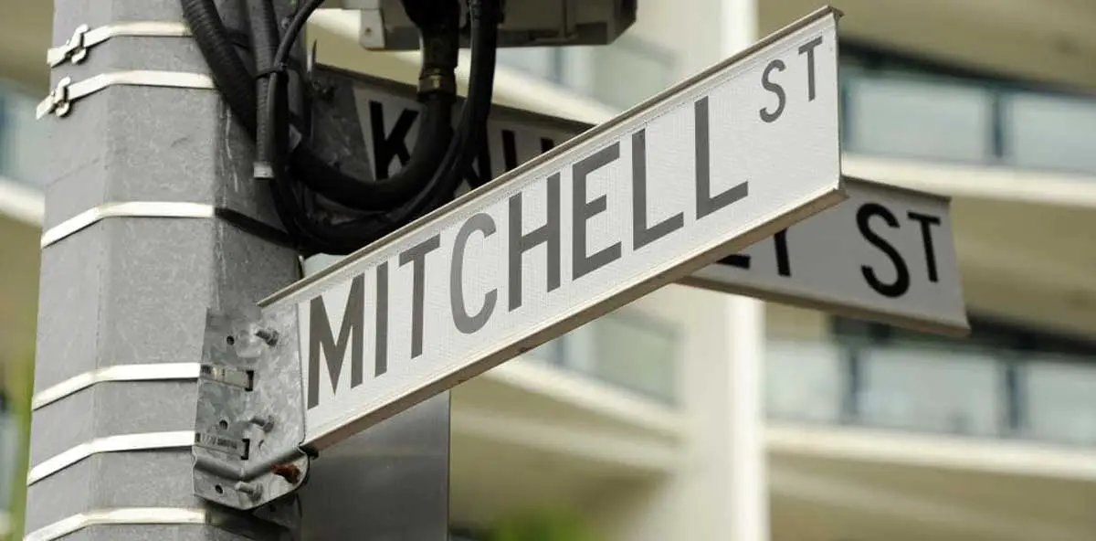
Surveyor AJ Mitchell
Mitchell
The suburb of Mitchell and nearby Mitchell Creek are named after Surveyor Alexander James Mitchell who was a Senior Surveyor with Surveyor General GW Goyder during the surveying of Palmerston and surrounding hinterland in 1869-70. He was involved in the actual surveying of the land where the current Palmerston stands. Following the surveying around Port Darwin, he is known to have been employed by the Lands Department in NSW prior to emigrating to California, USA, in 1874.
Moil
One of Darwin’s northern suburbs, built before Cyclone Tracy in 1974. It derives its name from the Aboriginal people on the Moyle River who inhabit an area on the lower reaches of the Daly River and around Port Keats.
Moulden
The suburb of Moulden is named after Beaumont Arnold Moulden who was one of the representatives for the Central District in the Legislative Council of SA. Moulden was born at Southwark, London, on 19 October 1849 arriving in South Australia with his father (Joseph Eldin Moulden) in 1850 and was educated at Mr J L Young’s school. Subsequently, Moulden was articled to the late Honourable J Tuthill Bagot, MLC, and was admitted to the Bar in November 1870.
At the general elections in 1887 he was returned at the head of the poll for the Assembly District of Albert, and held the portfolio of Attorney-General in the Cockburn Government during 1889-1890, but being unable to agree with his colleagues on the progressive land tax Moulden voluntarily resigned his office. In December 1903 following a by-election, he was returned as a member of the Legislative Council for the Central District, and was re-elected for that District at the 1905 general elections. Beaumont Moulden was for seven years President of the Australasian National League. He was a Liveryman of the Worshipful Company of Furriers, London, and a Freeman of the City of London. In 1900, in recognition of his political services, he received at the hands of Lady Cecil, the Grand Star of the Primrose League of England. It was in the earlier years that Moulden became involved with W H Gray as his solicitor in acquiring land near Darwin and, in 1871 together with Gray’s son, F J Gray, and E H Bakewell, Moulden held an interest in Section 83 Hundred of Bagot near to the present suburb of Moulden.
Nakara
One of Darwin’s northern suburbs just established before Cyclone Tracy in 1974. It derives its name from the Aboriginal tribe who occupy the coastal area of Boucaut Bay, west of the Blyth River in northern Arnhem Land. Most of the Nakara people now live at Maningrida. The streets in Nakara are mostly named after early residents of the Territory.
Nightcliff
‘Night Cliff’ appears on Goyder’s original plan of Port Darwin (1869), but could have originated between Stokes’ examination of the harbour in 1839 and that time. Many people believed, incorrectly, it came from a misspelling of J G Knight’s name, but he arrived in 1873. When Nightcliff became a Town for land title purposes in 1948, the Nomenclature Committee of the day agreed to the conjoint name ‘Nightcliff’. The new Progress Association of the 1950’s before Local Government arrived in Darwin applied the floral and shrub names to the suburbs streets.
Parap
Parap
Parap derived its name from that applied by Dr J A Gilruth, first Commonwealth Administrator in 1912. He applied the name Paraparap (believed to have been a pastoral property of Dewing near Moriac, Geelong), but had to abbreviate it to Parap later during his term.
Rapid Creek
Rapid Creek derives its name from the fast flowing stream in the Wet season which flows from the Marrara Swamp to the sea at Casuarina Beach. It was first settled by the Jesuit Mission under Father Strele, but was abandoned before the turn of the century. After Nightcliff expanded as a seaside suburb in the 1950’s, the residential area expanded to Rapid Creek. Rapid Creek prior to the war was a favourite day trip / picnic area for Darwin people, along the bush track which was to become Bagot Road and McMillans Road. The streets in Rapid Creek are mostly named after Police Officers.
Fifth Earl of Rosebery
Rosebery
This suburb is named after the Fifth Earl of Rosebery who was born in London as Archibald Philip Primrose and was to become a British statesman including the Prime Minister of Britain. It was during his overseas visit in 1884 that the South Australian Government decided to name additional Counties in the Top End. After the initial group of Palmerston, Gladstone and Disraeli, the County of Rosebery was gazetted in 1885, together with the County of Malmesbury. Rosebery covered the area north of Pine Creek with Malmesbury being to the west over the Daly River area. The Place Names Committee in conjunction with the Palmerston Development Authority decided to perpetuate the Rosebery name as the County of Rosebery fell into disuse and was cancelled on 7 January 1977.
Shoal Bay
This locality takes its name from the feature named by Captains Wickham and Stokes on the HMS Beagle in 1839, who anchored in Shoal Bay and named it before going on to discover Emery Point and Port Darwin. The bay was named because of its shallowness.
John McDouall Stuart
Stuart Park
This area derived its name as part of Parap after the Army had left in 1946 and a number of Sidney William hutments remained. The Parap Parish Hall between Westralia Street and Charles Street existed in 1949, but was not named until 1954. When Administrator Driver was making the first moves towards local government, local Progress Associations were set up, including Stuart Park in 1950. It is believed that the park or camp area, formerly part of Parap, got its name as a separate unit from the park/camp area near the Stuart Highway which in turn is named after explorer John McDouall Stuart.
The Gardens
This suburban name is derived from the Botanic Gardens which began with the appointment of Maurice Holtze as the Curator in 1878 and has grown to have one of the largest known collections of palms. Holtze used the Gardens area to investigate the possibility of growing sugar cane and cotton in the Territory. A small residential area adjacent to the Botanical Gardens was called Palmerston Gardens in 1968, but to avoid confusion with the ‘new’ Palmerston, the Palmerston appellation was discarded in 1984 when the suburb was officially named.
The Narrows
The Narrows, as a suburb, derives its name from the name given to the narrow strip of land between Ludmilla and Sadgrove Creeks. The name appears on early plans of Darwin and was retained as a suburb name when the area of land south of the RAAF Base was subdivided in 1960.
Rocky Point, Bathurst Island
Tiwi
One of Darwin’s northern suburbs, partly built before Cyclone Tracy struck in December 1974. It is the aboriginal word used for the people of Melville and Bathurst Islands which lie some 50Km to the north of Darwin. Bathurst and Melville Islands are known collectively as the Tiwi Islands. Tiwi simply means “people” being the plural form of the islander’s word for an island man (Tini) and women (Tinga). The streets in Tiwi are mostly named after pastoral stations.
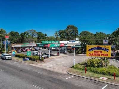
Virginia
This locality is named after the small satellite town surveyed by George McLachlan in 1869 as part of the Goyder Survey of Palmerston of that year. The townsite was located on the Elizabeth River. These two names appear on Goyder’s plan the Survey of Port Darwin and Environs, but their origin is obscure. It is believed that only one title was issued on the waterfront in this area. Many of the original street names have been applied to roads in the area and Virginia Road now gives access to the main freehold blocks surveyed by McLachlan in 1869. Virginia has been used as a name for the area since the 1870s, following the subdivision of the original sections.
Wagaman
One of Darwin’s northern suburbs built before Cyclone Tracy struck in 1974. It derives its name from the Aboriginal people who inhabit the upper reaches of the Daly River, around Dorisvale and Oolloo Stations and most of those surviving are now found there and at Adelaide River. The usual spelling is Wagaman, although the form Waggaman has been widely used. The streets in Wagaman are mostly named after Dutch explorers of the north Australian coast and their boats.
Wanguri
One of Darwin’s northern suburbs built before Cyclone Tracy struck in 1974. It derives its name from the Aboriginal Tribe, one of the relatively small clans of North East Arnhem Land. The Wangwu people spoke a slightly different dialect from those of their neighbours and their country lay in the area between SE Arnhem Bay and Caledon Bay. Most now live at Yirrkala. (The ‘N’ and the ‘G’ should be pronounced separately WAN-GURI; possibly the correct spelling is WANG-GURI, but Wanguri is in general use). The streets in Wanguri are mostly named after early Greek residents of Darwin.
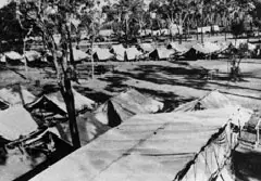
Winnellie Army Camp
Winnellie
This industrial suburb to the south of the airport derived its name from the ‘Winnellie Camp’ formed there by the Army in 1941. It is believed that the name came from the conjoint name of ‘Winifred’ and ‘Nellie’, wives of two officers who were involved in building the camp.
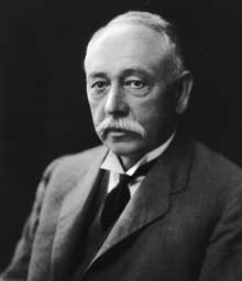
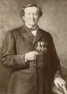
George Woodroffe Goyder
Woodroffe
This suburb is named after George Woodroffe Goyder, Surveyor-General of South Australia from 1861 to 1893. Goyder was born in Liverpool in 1826 to a Dr David George Goyder and his wife Sarah (nee Etherington). The family later moved to Glasgow and after obtaining his education at the Glasgow High School, Goyder was articled to a firm of Engineers studying surveying. Goyder migrated to Australia in 1848 and joined the Colonial Engineer’s Office in Adelaide in 1851. He became Deputy Surveyor-General then Surveyor-General in 1861, remaining in this position until 1893. In 1868/69 Goyder was appointed by the South Australian Government to carry out a survey of land in the Northern Territory.
Woolner
Named after the Woolner (Wulna) Aboriginal tribal group which occupied the area east of Darwin when the town was founded in 1869.
Wulagi
One of Darwin’s northern suburbs east of Lee Point Road built after Cyclone Tracy struck Darwin in late 1974. It derives its name from an Aboriginal tribe on the Blyth and Cadell Rivers in Central Arnhem Land. It has four male subsections WAMUD, KARAMANG, BURALANG and BALANG and BILINJIL (female). The streets in Wulagi are named after birds found in the Northern Territory.
Yarrawonga
This suburb is named after the Yarrawonga Park Zoo, a wildlife park, established on freehold land in the area in 1965. The late Dr Alex McKenzie and Mrs Jean McKenzie came to Darwin in the post-war years and settled at Pee Wee Camp at East Point. It is believed that the name came from Victoria, the Aboriginal word origin being ‘the place where the wonga pigeon nested’.