


Location: west coast of Eyre Peninsula, South Australia
Length: 1,327 km
Port Augusta – Ceduna (Eyre Highway): 467 kmbr>
Ceduna – Port Lincoln (Flinders Hwy): 406 km
Port Lincoln – Port Augusta (Lincoln Hwy): 354 km
Suggested return journey: the drive is a loop, commencing and finishing at Port Augusta
Features/attractions: coastal cliffs; Pt. Labatt sea-lion colony; Whaler’s Way; Coffin Bay National Park; Lincoln National Park
Minimum duration (one way): two days. Recommended: 1 week
What You Will See: Commencing at Port Augusta, travel east along the Eyre Highway. This stretch of road passes the Gawler Ranges, the peninsula’s Granite Country and a section of the state’s wheatbelt. A sign at Kimba marks the halfway point between Sydney and Perth via Eyre Highway.
Streaky Bay
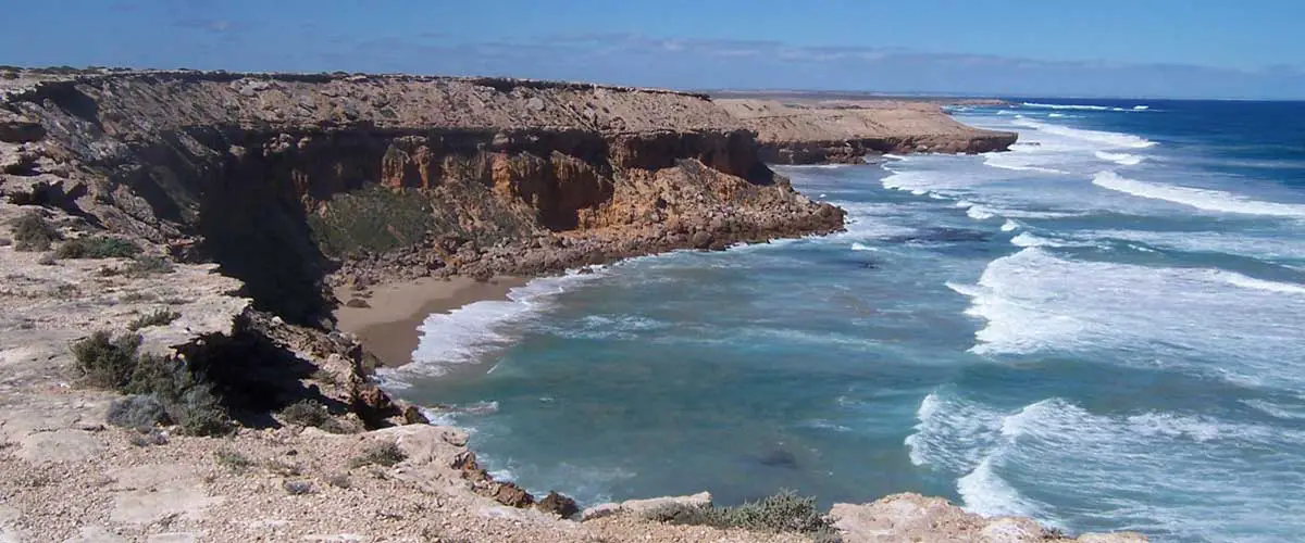
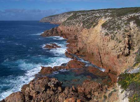
Travelling south from Ceduna, the first town you come to is Streaky Bay, a very laid back, friendly place that is the kicking off point for another road less travelled that is so good, it has earned its own page – The Westall Way. Along it are some quite striking coastal cliffs and the highlight for me – the only accessible permanent colony of Australian Sea-lions on the Australian coast at Pt. Labatt.
Trhe next town you come to is Port Kenny. The short drive out to the fishing village of Venus Bay is well worth the effort. The coastal scenery is quite different to the Westall Way, but equally as stark and picturesque. I have often spotted dolphins frolicking in the waters at the head of Venus Bay.
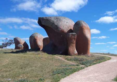
Murphys Haystacks
On the way to Talia Caves at Anxious Bay, you’ll see and inland turn-off to Murphys Haystacks. There are a bunch of unusual shaped granite rocks stuck out by themselves on a hillside in the middle of fields – there are some great photo opportunities here. mining techniques to extract copper ore from the mines. It is reputed that The Moonta Company was the first mining company to shell out over a Million Pounds in dividends.
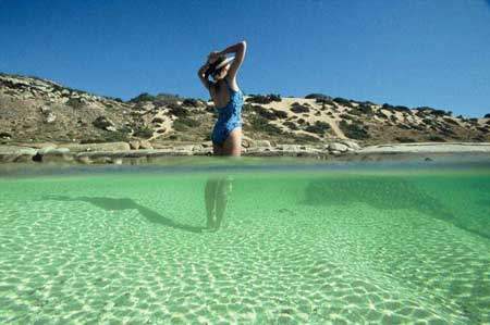
Swimming Hole, Whaler’s Way
Length: 1,327 km
Port Augusta – Ceduna (Eyre Highway): 467 kmbr>
Ceduna – Port Lincoln (Flinders Hwy): 406 km
Port Lincoln – Port Augusta (Lincoln Hwy): 354 km
Suggested return journey: the drive is a loop, commencing and finishing at Port Augusta
Features/attractions: coastal cliffs; Pt. Labatt sea-lion colony; Whaler’s Way; Coffin Bay National Park; Lincoln National Park
Minimum duration (one way): two days. Recommended: 1 week
What You Will See: Commencing at Port Augusta, travel east along the Eyre Highway. This stretch of road passes the Gawler Ranges, the peninsula’s Granite Country and a section of the state’s wheatbelt. A sign at Kimba marks the halfway point between Sydney and Perth via Eyre Highway.
Streaky Bay
Travelling south from Ceduna, the first town you come to is Streaky Bay, a very laid back, friendly place that is the kicking off point for another road less travelled that is so good, it has earned its own page – The Westall Way. Along it are some quite striking coastal cliffs and the highlight for me – the only accessible permanent colony of Australian Sea-lions on the Australian coast at Pt. Labatt.
Trhe next town you come to is Port Kenny. The short drive out to the fishing village of Venus Bay is well worth the effort. The coastal scenery is quite different to the Westall Way, but equally as stark and picturesque. I have often spotted dolphins frolicking in the waters at the head of Venus Bay.
Murphys Haystacks
On the way to Talia Caves at Anxious Bay, you’ll see and inland turn-off to Murphys Haystacks. There are a bunch of unusual shaped granite rocks stuck out by themselves on a hillside in the middle of fields – there are some great photo opportunities here. mining techniques to extract copper ore from the mines. It is reputed that The Moonta Company was the first mining company to shell out over a Million Pounds in dividends.
Swimming Hole, Whaler’s Way