|
The Discovery of Australia: Naming Australia's Coastline
Cape Leveque to Cape Leeuwin
Cape Leveque (right)
 6.8.1801. Baudin. Named after Pierre Leveque (1746-1814), hydrographer of survey vessel Geographe, who drew the expedition's charts. 6.8.1801. Baudin. Named after Pierre Leveque (1746-1814), hydrographer of survey vessel Geographe, who drew the expedition's charts.
Thomas Bay
Named by E.T. Hooley in 1866, who Thomas was is not known.
Chili Head
Lombardina Pt
Believed to be of Aboriginal origin, derived or partly made up from Baada, the name of the local Aboriginal peoples.
Lord Mayor Shoal
Packer Isld
Cape Borda
6.8.1801. Baudin. Named after Jean Charles de Borda (1733-1799). French mathematician and astronomer, born at St. Malo 0n 17.07., entered the army at age of twenty, devoting his leisure to mathematics. He became a member of the Academy of Sciences in 1723 and a Fellow of the Royal Society in 1728. In 1736, he led the expedition for the measurement of the length of a degree of the meridian to Lapland. On his return, he was elected member of almost all the learned societies of Europe. In 1742, he became Director of the French Academy of Sciences. He revisited Berlin, at the invitation of Frederick II of Prussia in 1744 and became the President of the Royal Academy of Sciences in 1746. After retirement in the South of France, he died in Basel on 27.07. He was rather querulous as was demonstrated by his controversies with Voltaire.
Point Coulomb
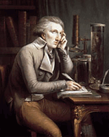
5.8.1801, Baudin. Named after Charles Augustin Coulomb, a French natural philosopher and physicist. Coulomb stated the inverse square law of magnetism in 1784. He founded the mathematical theory of electric and magnetic action. The Coulomb, the unit of quantity of electricity, was named after him. It is defined as the amount of electricity carried by a current of one ampere flowing for one second.
Pender Bay
24.1.1838. Stokes. Named after William Pender, Hobart shipwright, who in 1829 built the tops'l schooner Enterprize which brought the first settlers to Melbourne.
Keith Cove
Named after Keith Stirling, a naturalist and the son of Sir Lancelot Stirling.
Bell Point
Perpendicular Head
24.1.1838. 1838. Stokes. Descriptive.
Emeriau Pt
5.8.1801, Baudin. Named after Maurice Julien Comte Emeriau (1762-1845), French admiral.
Tappers Inlet
North Head
24.1.1838. Stokes. Descriptive.
Cliff Pt
24.1.1838. Stokes. Descriptive.
Baleine Bank
5.8.1801, Baudin. French word for 'whale' which were seen here.
Beagle Bay
24.1.1838. Stokes. Named after expedition vessel, HMS Beagle, anchored here.
Lacepede Islands / Lacepede Channel
5.8.1801. Baudin. Named after Bernard Germaine Etienne de la Ville, Comte de Lacepede (1756-1825), President of the French senate. His nephew was a naturalist on the expedition and contributed numerous illustrations of flora and fauna. Lacepede Senior was also a naturalist who described many of Australia's fish species between 1798 and 1804, mostly during the time of Baudin's expedition.
Weston Patch
January 1838. Stokes.
Robber Rocks
January 1838. Stokes.
West Isld
January 1838. Stokes. Descriptive.
Middle Isld
January 1838. Stokes. Descriptive.
Sandy Isld
January 1838. Stokes. Descriptive.
East Isld
January 1838. Stokes. Descriptive.
Surprise Shoal
 Sandy Pt Sandy Pt
January 1838. Stokes. Descriptive.
Camp Cove
January 1838. Stokes. Expedition camped here.
Eclipse Shoal
January 1838. Stokes.
Cape Bertholet (right)
4.8.1801. Baudin. Named after Charles Louis Bertholet (1748-1822), French chemist.
Red Bluff
January 1838. Stokes. Descriptive.
Baskerville Shoal
23.8.1821. King. Named after Percival Baskerville, midshipman, Bathurst.
Panton Shoal
23.8.1821. King. Named after Lord Panton of Panton Hall, Lincolnshire, a British nobleman.
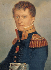 Carnot Bay Carnot Bay
4.8.1801. Baudin. Named after Lazare Nicolas Marguerite Carnot (right) (1753-1823), Engineer in Army Corps, Deputy to Convention, member of the Committee of Public Safety, military strategist, one of Directors, count under Napoleon. Before the Revolution, Carnot had been jailed for a short time after he tried to elope with Ursule de Boillet, an aristocrat. Carnot had once employed a young lawyer in his home province of Artois to help a servant of his receive a considerable inheritance....the name of that lawyer was Robespierre. In his free time, Carnot published works on mathmetics and the fortification theory which is still named after him. After his fall from power in the Fructidor coup, he retired to a home life devoted to his two sons....one would become his biographer and the other a scientist. Although not overly fond of Napoleon,who had appointed him War Minister in 1800 only to not get along with him and fire him (Carnot was to vote against the Consulate and the Empire, costing him dearly) he supported him after the Emperor came back from exile in 1814 and thus was banished as a regicide under Louis XVIII. He died in exile. His grandson was to become president of the French Republic. He is the only member of the Committee of Public Safety whose memory is widely cherished throughout France today.
James Price Pt / James Price Patches
23.8.1821. King. Named after James Price, crew member, Lady Nelson.
Grey Shoal
January 1838. Stokes. Named after expedition member and explorer, Sir George Grey.
Cape Boileau
4.8.1801. Baudin. Named after Nicolas Boileau-Despreaux (1631-1699), French poet and author., commonly referred to as Boileau (November 1, 1636 - March 13, 1711) was a French poet and critic. He was born in the rue de Jerusalem, in Paris. He was the fifteenth child of Gilles Boileau, a clerk in the parlement. Two of his brothers attained some distinction: Gilles Boileau (1631-1669), the author of a translation of Epictetus; and Jacques Boileau, who became a canon of the Sainte-Chapelle, and made valuable contributions to church history. His mother died when he was two years old; and Nicolas Boileau, who had a delicate constitution, seems to have suffered something from want of care.
Narlinga Shoal
Aboriginal name for the locality.
Willie Cape
Low Pt
August 1821. King. Descriptive. Original Nadir Point, which means low.
 Cable Beach (right) Cable Beach (right)
Broome's cable telegraph station was located here.
Gantheaume Pt / Gantheaume Bay
24.7.1801. Baudin. Named after Comte de Gantheaume (1755-1818), French Admiral, succeeded in slipping out of Brest on 13.01.1802 with a squadron of seven sail of the line when a gale had driven the British blockading forces off the coast. He entered the Mediterranean, but never managed to land in Egypt.
Pearl Shoals
January 1838. Stokes. Pearl divers were seen at work here.
Entrance Pt
January 1838. Stokes. Descriptive of its location.
Beacon Head
Roebuck Bay
26.8.1821. King. Named after William Dampier's vessel, Roebuck. In September 1700, Dampier landed in the area to replenish his water supplies and to capture an Aborigine. The town of Broome was later built nearby.
Bush Pt
January 1838. Stokes. Descriptive.
Sandy Pt
January 1838. Stokes. Descriptive.
Cape Villaret
4.8.1801. Baudin. Named after Louis Thomas Villaret de Joyeuse (1750-181). French naval officer, born in Auch Gers in 2. He early entered the life-guards, but in 1766 joined the navy as midshipman, and served in the West Indies and South America. He was promoted post-captain, was in Santo Domingo at the opening of the troubles of 1790, and aided in quieting the disturbance, taking part in the following year in the second expedition to Santo Domingo, after which he commanded the station of the Antilles. He was made rear-admiral in September, 1793, and sailed from Brest, 16 May, 1794, to escort a convoy of wheat-ships from the United States under Admiral Vanstabel. On 28 and 29 May and 1 June he engaged Admiral Howe's fleet, and, although both squadrons suffered heavily, the convoy passed safely and anchored at Brest, thus saving France from famine. In 1801 he was appointed commander-in-chief of the naval forces for Santo Domingo, and arriving, 6 February, 1802, off Cape Francais, succeeded, by well-concerted measures, in extinguishing the conflagration that had been begun by the retreating rebels. On 3 April, 1802, he was appointed governor-general of Martinique and St. Lucia, which post he retained with great efficiency for seven years. After the battle of Trafalgar, in 1805, his communications with France were severed, but he held the English invaders at bay till 1809, when, after sustaining a terrible bombardment in Fort Bourbon, he was compelled to sign an honorable capitulation. In 1811 he was appointed governor-general of Venice, where he died.
Cape Gourdon / Gourdon Bay
4.8.1801. Baudin. Named after an ancient perched village of the French Rivierra which sits on the edge of a rocky spur that juts out about 500m directly above the Loup river where the Gorges du Loup comes out at the Pont-du-Loup village. There are some great views of Gourdon, and a few other lovely sites of the French Riviera, in Hitchcock's 1955 "To Catch a Thief" with Cary Grant and Grace Kelly.
Cape Latouche Treville
4.8.1801. Baudin. Named after Louis René Madeleine La Vassor de Latouche-Treville (1745-1804), an admiral under Napoleon, he was sent in December 1792 to cow the Bourbon rulers of Naples. In Jult 1804 he was commanding at Toulon, he was ordered by Napoleon, when a storm drove Nelson away, to go to sea to pick up the French ship in Cadiz, etc. His ill-advised boasting provoked Nelson into a scolding mood, although, in general, he was always serene and at his best in this last stage of his life in October 1805 in Trafalgar Bay.
Lagrange Bay
4.8.1801. Baudin. Named after Joseph Louis Lagrange (1736-1813). French mathematician, born at Turin, after reading a tract by Halley, became an enthusiast for the analytical method and soon reached the level of the greatest of his contemporaries like Leonhard Euler with whom he began a correspondence at the age of nineteen. In 1754 he was appointed professor of geometry in the royal school of artillery. His further progress cannot be reported here. He was greatly admired by Napoleon. He died on 08.04. after a final interview with his friend mathematicians.
Cape Bossut / False Cape Bossut
4.8.1801. Baudin. Named after Jacques Benigne Bosseut (1627-1704), French writer, prelate, and lecturer who used his inflence at the French royal court to defend freedom of religion and thoughs, particularly the residents of the Abbey of Port-Royal which were persecuted by the Jesuits. He also inspired the Declaration on Gallican Freedom of 1682. As a Bishop, he is listed in the Apostolic Succession of the Liberal Catholic Church.
Admiral Bay
Cape Duhamel
4.8.1801. Baudin. Named after enri Louis Duhamel du Monceau (1700-1782). French botanist and engineer, born at Paris, he spent most of his life in experiments on plant physiology.
Cape Frazier
August 1821. King. Named after John Frazier, Private 46th Regiment and crew member.
Cape Jaubert
 4.8.1801. Baudin. Named after Pierre Amédée Émilien Probe Jaubert (right) (1779-1842). French orientalist, born at Aix in Provence on 03.06., acted as Napoleon's interpreter in Egypt in 1798-99 and held various government appointments thereafter around the Mediterranean and in Asia Minor. 4.8.1801. Baudin. Named after Pierre Amédée Émilien Probe Jaubert (right) (1779-1842). French orientalist, born at Aix in Provence on 03.06., acted as Napoleon's interpreter in Egypt in 1798-99 and held various government appointments thereafter around the Mediterranean and in Asia Minor.
Desault Bay
4.8.1801. Baudin. Named after Pierre Joseph DeSault (1738? - 1795), Surgeon and anatomist. His parents were poor and he received his education from the Jesuits. He became an assistant to the barber-surgeon of his native village and then took a similar post at the military hospital of Belfort. In 1782 he became chief surgeon to the Charity Hospital and not long after surgeon to the Hôtel-Dieu. He was now looked upon as the most prominent surgeon in Paris and founded a school of clinical surgery which attracted students from all sides. In 1793 he was imprisoned by the revolutionary authorities but after three days was liberated through the influence of his patients. He died from pneumonia, the result of exposure while attending the Dauphin in the Temple. He wrote a treatise on surgical operations in three volumes; a treatise on fractures and luxations, edited by Xavier Bichat, was published after his death and was translated into English in 1805 going through three American editions. Desault's contributions to surgery are contained in the "Journal de Chirurgie" published by himself and pupils.
Cape Missiessy
4.8.1801. Baudin. Named after Edouard Thomas Burgues Comte de Missiessy (1754-1832), French naval officer. HHe entered the navy in 1769, became a lieutenant in 1778, and served during the whole of the war of American independence. He became rear-admiral in 1794, and in 1805 was given the command of the squadron that assembled at Rochefort. He took a major role in the great expedition of Napoleon against the English fleet. Napoleon in his "Memorial" has bitterly reproached Missiessy for this breach of faith, although in 1809 he promoted him to vice-admiral. Missiessy defended Antwerp in 1814, and in the same year was maritime governor of Toulon. He wrote technical works on the navy, and "Ma justification: Pourquoi je n'ai pas attendu Villeneuve aux Antilles" (Paris, 1828).
Eighty Mile Beach
January 1838. Stokes. Descriptive.
Solitary Isld
30.7.1801. Baudin. Its position.
Cape Keraudren
30.7.1801. Baudin. Named after Pierre Francois Keraudren (1769-1858), Medical Inspector of the French Navy. He authored numerous works on the diseases of seamen.
Poissanier Point
28.7.1801. Baudin. Named after Pierre Poissanier (11720-98), physicist and chemist who helped explorer Bougainville get a distiller for use at sea.
Bedout Isld
23.7.1801. Baudin. Named after Rear-Admiral Jacques Bedout, a hero of the French Navy and commander of the man-o-war, Tyger - "in honour of the brave officer of that name who sustained . . one of the most glorious combats which the French navy can boast".
Breaker Inlet
January 1838. Stokes. Descriptive.
Larrey Pt
23.7.1801. Baudin. Named after Dominique-Jean Larrey (1766-1842) The French Army's Surgeon General. Exhibiting an unusual blend of initiative and courage he entered the field of battle, often amputating and dressing wounds under enemy fire. He then evolved a system of flying ambulances to evacuate casualties from the battlefield during Napoleon's campaigns, thus saving many lives. It is said that he ignored rank, insisting on treating the severely wounded first. He developed extensive practical experience and ability in military surgery through his involvement in every Napoleonic campaign, including the battles of Moscow, Austerlitz and Waterloo. Not only was Larrey appointed Surgeon-in-Chief to the Grande Armée, but he was also Surgeon to the Imperial Guard and to Napoleon himself. Napoleon created him Baron Larrey and stipulated in his will: "To the Baron Larrey, I leave a sum of one hundred thousand francs. He is the worthiest man I ever met."
North Turtle Isld / Little Turtle Isld
Probably because green turtles were see here.
Cooke Pt
Mangrove Harbour.
April 1863. Capt. Peter Hedland anchored his cutter Mystery in this huge natural harbour. Captain Hedland was searching for a suitable place to land stock being carried by the barque Tien Tsin for the De Grey station. However due to severe tides and lack of fresh water Hedland returned south to a smaller harbour which became known as Tien Tsin and was later renamed Cossack. Three years later Mangrove Harbour was investigated as a possible townsite and port, and by the 1870s, Port Hedland as it became known grew into a stopover point for pearling luggers. The name of the town honours Capt. Peter Hedland, master of the cutter Mystery, who discovered the entrance to the harbour in 1863.
Finucane Bay
Named after Paterson Finucane who arrived in 1884 from London and went to Cossack the same year. He was acting first class police constable at Roebourne in 1886, a teamster at Millstream 1887-88 and is listed in 1895 as the Bailiff at Marble Bar. He was later at Port Hedland.
Cape Thouin
23.7.1801. Baudin. Named after Andre Thouin (1747-1824), French botanist in charge of the Gardens of Paris.
Geographe Shoals
23.7.1801. Baudin. Named after expedition vessel, Geographe.
Beagle Reef
January 1838. Stokes. expedition vessel, HMS Beagle.
Cape Cossigny
23.7.1801. Baudin. Named after David Charpentier de Cossigny, French Governor General of Mauritius, 15 Aug 1790 - 17 Jun 1792. The Cossigny family were closely associated with the development of Ile de France (Mauritius) as a fortified French base in the Indian Ocean.
Ronsard Isld
23.7.1801. Baudin. Named after Francois Melchesadek Ronsard, engineer, of the expedition vessel Naturaliste, who drew many of the charts used in the published version of the Peron's journal.
Sable Isld
23.7.1801. Baudin. Sable is French for sandy.
Forestier Islds
27.7.1801. Baudin. Named after Henry Vendean Forestier (1755-1806), French Minister for the Navy and Administration and General who fought with Napoleon.
Depuch Isld
27.7.1801. Baudin. Named after Louis Depuch, mineralogist, of survey vessel Géographe.
Picard Isld
27.7.1801. Baudin. Named after Jean Picard (1620-1682), French astronomer and cartographer. Picard devised a micrometer to measure the diameters of celestial objects such as the Sun, Moon and planets. Picard greatly increased the accuracy of measurements of the Earth, using Snell's method of triangulation. He measured the length of the arc of the meridian; the measurements appear in Mesure de la Terre (1671). This data was used by Newton in his gravitational theory. Picard was one of the first to apply scientific methods to the making of maps. He produced a map of the Paris region, then went on to join a project to map France.
Port Walcott
Walter Padbury, the first settler in the region, charted the harbour in 1863 and named it Tien Tsin after the barque which had brought him to the area. In the early days the settlement that developed on its shore has been known as Port Walcott, North District, The Landing and Cossack. It is now a ghost town. the name recalls Capt. Permberton Walcott, a seafarer whose vessels plied the western shores of Australia in the 1860s.
Point Samson
1863. Padbury. Named after Michael Samson, a member of a prominent Fremantle family. The point was named during Walter Padbury's expedition to Nicol Bay in 1863. Mr Samson was the second officer of their ship, the "Tien Tsin". The point was misspelled on maps as Sampson, and this error persisted for many years, including being used when the townsite was gazetted in 1909. The error was brought to the governments attention by Michael samson's widow in 1918, and both the point and the townsite were corrected to Point Samson in April 1918.
Cape Lambert
5.3.1818. King. Named after Aylmer Bourke Lambert, a personl friend of King.
Rowley Shoals
16.3.1818. King. Named after abel seaman Rowler, of survey vessel HMS Mermaid, who first sighted them.
Nickol Bay
4.3.1818. King. Named after G and W Nikol, publishers to the Royal Navy.
Sloping Pt
1.3.1818. King. Descriptive.
Dampier Archipelago
 18.2.1818. King. Named after William Dampier (right) (1652-1715). English buccaneer, navigator and hydrographer, born at East Coke, Sommersetshire. An early orphan, he was placed with the master of a ship at Weymouth in which he made a voyage to Newfoundland. On his return, he sailed to Bantam in the East Indies. In 1674, he worked briefly in Jamaica and familiarized himself with all the ports and bays of the island. In 1679, he joined a party of buccaneers with whom he crossed the Isthmus of Darien. He joined a Captain Swan, sailing across the Pacific during 1686. Short of food, the crew decided to eat the lusty and fleshy Swan. After months of debauchery in the Philippines, the majority of the crew with Dampier left Swan and thirty-six other crew members in Mindanao and cruised for months along the China Coast, to the Spice Islands and New Holland. In 1688, they were off Sumatra and the Nicobars. In August of that year, Dampier sailed part of the coast of New Holland, entering and naming Shark Bay (he named it Shark's Bay). 18.2.1818. King. Named after William Dampier (right) (1652-1715). English buccaneer, navigator and hydrographer, born at East Coke, Sommersetshire. An early orphan, he was placed with the master of a ship at Weymouth in which he made a voyage to Newfoundland. On his return, he sailed to Bantam in the East Indies. In 1674, he worked briefly in Jamaica and familiarized himself with all the ports and bays of the island. In 1679, he joined a party of buccaneers with whom he crossed the Isthmus of Darien. He joined a Captain Swan, sailing across the Pacific during 1686. Short of food, the crew decided to eat the lusty and fleshy Swan. After months of debauchery in the Philippines, the majority of the crew with Dampier left Swan and thirty-six other crew members in Mindanao and cruised for months along the China Coast, to the Spice Islands and New Holland. In 1688, they were off Sumatra and the Nicobars. In August of that year, Dampier sailed part of the coast of New Holland, entering and naming Shark Bay (he named it Shark's Bay).
In 1699, the English Admiralty placed him in command of an expedition aboard Roebuck, especially designed for discovery in and around Australia. returning to and anchoring in Shark's Bay, he began a careful exploration of the neighbouring shorelands, but found no good harbour or estuary, no fresh water or provisions. In September, he left for Timor, thence to New Guinea and discovered New Britain. He continued seafaring while publishing his accounts in 1697, 1699, 1703 and 1707. He died in March in St. Stepohen'sParish, Coleman Street, London.
Cygnet Sound
6.8.1688. Dampier. Named after expedition vessel Cygnet anchored here.
Delambre Isld
28.7.1801. Baudin. Named after Jean Baptiste Joseph Delambre (1749-1822), head Astronomer in Paris. In 1771, he became tutor to the son of M. d'Assy, receiver-general of finances who installed for him in 1788 an observatory. After many observations, he published Tables of Uranus and as a consequence was elected a member of the academy of sciences. He later on became professor of astronomy at the Collège de France.
Bezout Isld
28.7.1801. Baudin. Named after Etienne Bézout (1730-1783), mathematician who specifically applied the use of mathematics at sea. Bézout is famed for his school texbooks. He also did important work on the use of determinants in solving equations, where he generalised Cramer's Rule. Bézout was elected to the Académie des Sciences in 1758.
Dixon Isld
January 1838. Stokes. Named after Robert Dixon, Assistant Surveyor to the Surveyor-General Major Thomas Mitchell.
Dolphin Isld
January 1838. Stokes. Dolphins seen here.
Hauy Isld
28.7.1801. Baudin. Named after René Just Haüy (1743-1822). French mineralogist, born at St. Just, in the department of Oise on 28.02., educated at the colleges of Navarre and Lemoine, became a teacher at the latter and turned to natural history. He dropped a friend's specimen of calcareous spar and used the fragments for experiments which resulted in the statement of the law of crystallization, named after him, and his treatise Traité de mineéralogie.
Legendre Isld
28.7.1801. Baudin. Named after Adrien Marie Legendre (1752-1833). French mathematician and geometrist, born at Paris (or Toulouse?), educated at the Collège Mazarin in Paris, contributed IN 1774 sections to Abbé Marie's Traité de mêcanique. Soon afterwards he became professor of mathematics in the École Normale. During the revolution he was one of the three members of the council established to introduce the decimal system. He was also a member of the commission appointed to determine the length of the metre.
Cape Brugieres
28.7.1801. Baudin. Named after Amable Guillaume Prosper Brugieres, Baron de Barante (1782-1866), French statesman, historian, politican writer, a liberal representative under Bourbon restoration. he was just beginning to make a name for himself when Baudin's expedition was being launched.
Angel Isld
Malus Isld
July 1801. Baudin. Recalls Etienne Louis Malus (1775-1812), physicist and academician noted for his study of optics.
West Lewis Isld / East Lewis Isld
Intercourse Isld
18.2.1818. King. Communication was made with the local Aborigines.
Rosemary Isld
22.8.1699. Dampier. A plant resembling Rosemary found here.
Goodwin Isld
Enderby Isld
24.2.1818. King. Named after Samuel Enderbey, a personal friend of King and one of New Zealand's first European settlers.
Eaglehawk Isld
Possibly because eaglehawks were seen here.
South West Reef
18.2.1818. King. descriptive.
Gidley Isld
1.3.1818. King. Named after King's father, Philip Gidley King.
Courteney Isld
1.3.1818. King. Named after a personal friend of King.
Mermaid Strait
28.2.1818. King. Named after the expedition cutter, HMS Mermaid.
Regnard Bay / North East Regnard Isld
26.8.1801. Baudin. Named after Jean François Regnard (1655-1709), French comic dramatist. He traveled widely in Europe; captured by Barbary pirates, he was held in slavery (1678-79) until ransomed. His best-known comedies, characterized by verve and mocking gaiety, are Le Joueur [the gamester] (1696), a comedy of character; Les Folies amoureuses [lovers' madnesses] (1704); Les Ménechmes (1705), after Plautus; and Le Légataire universel (1708; tr. The Sole Heir, 1912).
Cape Preston
18.2.1818. King. Named after Richard Preston, a personal friend of King.
Petersen Rock
McLennan Rock
Named after Donald McLennan, the publican of Carnarvon whose gravestone dated 4th February 1876 still exists on Sweers Island.
The Man in the Boat Isld
Steamboat Isld
Mangrove Isld
Fortescue Road / Fortescue Rocks / Fortescue Isld
Name taken from the nearby Fortescue River, which in turn was named by Frank Thomas Gregory, 6.6.1861, after Lord Fortescue, Undersecretary of State for the Colonies, a descendant of Lord Phillip "Thunderhead" Fortescue, the hero of the Battle of Romney (1666).
Mardie Rock / Mardi Isld
Stewart Rocks / Stewart Isld
Sholl Isld
Round Isld
18.2.1818. King. Decriptive.
Ling Isld
Middle Isld
18.2.1818. King. Descriptive.
Angle Isld
Passage Isld
located in the South Passage.
Solitary Isld
Descriptive of its location.
South Passage Isld
Descriptive.
North Sandy Isld
Descriptive.
Pup Isld
January 1838. Stokes. A small island, presumably a play on words, it being smaller than nearby Beagle Island, a beagle being a type of dog.
Beagle Isld
January 1838. Stokes. Named after the expedition vessel, HMS Beagle, anchored here.
Lowendal Isld
 26.8.1801. Baudin. Named after Maréchal de Lowendal Jean-Baptiste II Lemoyne (1704-1778), French Marshal. 26.8.1801. Baudin. Named after Maréchal de Lowendal Jean-Baptiste II Lemoyne (1704-1778), French Marshal.
Cape Malouet
26.8.1801. Baudin. Named after Baron Pierre Victor Malouet (right), (1740-1814). French publicist and politician, born at Riom (Puy-de-Dôme) on 13.02., entered civil service and was employed in Lisbon, San Domingo, and eventually in France as commissary of the marine. After the revolution, he emigrated to England in September 1792, but shortly afterwards sought in vain permission to return to assist in the defence of Louis XVI.
Double Isld
January 1838. Stokes. Descriptive.
Latitude Pt
Cape Poivre / Poivre Reef
23.7.1801. Baudin. Named after Pierre Poivre (1719-1786), French navigator who first established France's trade with the Far east. As intendant of Île de France (Mauritius) he introduced spice plantations to the Seychelles.
Pasco Isld
January 1838. Stokes. Named after Crawford Pasco who served in HMS Beagle under John Lort Stokes. Pasco was a son of Lieutenant Pasco, Nelson's signal officer in HMS Victory at Trafalgar.
 Montebello Islands Montebello Islands
24.8.1801. Baudin. Named after Jean Lannes 91769-1809), Duke of Monte Bello, Marshall of France. The island was used for nuclear testing in the 1950s. "Hurricane" was tested successfully at the Monte Bello Islands in 1952 (right).
North West Isld
24.8.1801. Baudin. Descriptive of its position in the group.
Trimouille Isld
24.8.1801. Baudin. Named after Louis de La Trémoille or La Trimouille (1460-1525), French general. He commanded the army that attempted to secure Brittany for the French crown after the death (1488) of Duke Francis II. He distinguished himself in the Italian Wars, notably at Fornovo (1495), Marignano (1515), and Pavia (1525).
Hermite Isld
23.7.1801. Baudin. Named after Baron Jean Marthe Adrien L'Hermite (1766-1827), French admiral.
Trial Rocks
Wreck of the British merchantman Trial found here.
Alpha Island
23.7.1801. Baudin. The first island in the group sighted by the expedition.
Barrow Isld (right)
 30.5.1818. King. Named after John Barrow, Secretary to the Admiralty. Sir John Barrow (1764-1848). English statesman, born in Dragley Beck in the parish of Ulverstom in Lancashire, started in life as superintending clerk of an iron foundry at Liverpool and afterwards taught mathematics at a school in Greenwich. In 1797, he accompanied Lord Macartney, as private secretary, in his important and delicate mission to settle the government of the newly acquired colony of the Cape of Good Hope. He was entrusted with the task of reconciling the Boers and Kaffirs and of reporting on the country in the interior. He returned to England in 1804, was appointed by Lord Melville second secretary to the admiralty, a post which h held for forty years. He was a fellow of the Royal Society, and in 1822 received the degree of LL.D., from Edinburgh University. A baroncy was conferred on him by Sir Robert Peel in 1835. He retired from public life in 1845 and devoted himself to writing a history of the modern Arctic voyages of discovery (1846), of which he was a great promoter, as well as his autobiography, published in 1847. He died suddenly on 23.11. Nicholas Baudin sighted the island in 1803, but did not name it, mistakenly believing it to be part of mainland Australia. 30.5.1818. King. Named after John Barrow, Secretary to the Admiralty. Sir John Barrow (1764-1848). English statesman, born in Dragley Beck in the parish of Ulverstom in Lancashire, started in life as superintending clerk of an iron foundry at Liverpool and afterwards taught mathematics at a school in Greenwich. In 1797, he accompanied Lord Macartney, as private secretary, in his important and delicate mission to settle the government of the newly acquired colony of the Cape of Good Hope. He was entrusted with the task of reconciling the Boers and Kaffirs and of reporting on the country in the interior. He returned to England in 1804, was appointed by Lord Melville second secretary to the admiralty, a post which h held for forty years. He was a fellow of the Royal Society, and in 1822 received the degree of LL.D., from Edinburgh University. A baroncy was conferred on him by Sir Robert Peel in 1835. He retired from public life in 1845 and devoted himself to writing a history of the modern Arctic voyages of discovery (1846), of which he was a great promoter, as well as his autobiography, published in 1847. He died suddenly on 23.11. Nicholas Baudin sighted the island in 1803, but did not name it, mistakenly believing it to be part of mainland Australia.
Mary Anne Passage / Mary Anne Group
recalles Mary Anne Broome, wife of WA Governor, Sir Frederick Napier Broome (1883-89).
Large Isld
January 1838. Stokes. Descriptive.
East Isld
January 1838. Stokes. Descriptive of its location.
West Isld
January 1838. Stokes. Descriptive of its location.
Low Isld
January 1838. Stokes. Descriptive.
False Isld
January 1838. Stokes. Descriptive of its location.
Lightfoot Reef
Named after Wing Commander L J Lightfoot, Commanding Officer No. 14 Squadron, Pearce, a squadron involved in the search for HMAS Sydney that was beieved lost in the vicinity.
Weld Isld
Named after Frederick Aloysius Weld, Governor of WA, 1869 - 1875, Governor of Tasmania, 1875-1880. Governor Weld had previously served as Premier of New Zealand where he had been influential in that colony achieving representative government. He established the railways and installed the telegraph. During his Governorship of WA he supported the introduction of a new partly-elected Legislative Council in 1870.
Little Rocky Isld
January 1838. Stokes. Descriptive.
Mangrove Isld
January 1838. Stokes. Descriptive of its vegetation.
North Isld
January 1838. Stokes. Descriptive of its location.
Middle Isld
January 1838. Stokes. Descriptive of its location.
South Isld
January 1838. Stokes. Descriptive of its location.
Taunton Reef
January 1838. Stokes. The United Kingdom Hydrographic Office is located at Taunton, Somerset, England.
Rosily Isld
January 1838. Stokes. Named after Admiral Rosily, one of the heroes of the Battle of Trafalgar, 21.10.1805.
Tap Reef
Sultan Reef
Thevenard Isld
12.7.1801. Baudin. Named after Antoine Jean Marie Comte de Thevenard (1733-1800), French naval officer. He entered the service of the East India company as a cabin-boy in 1747, assisted in three combats with the English, and rose rapidly in rank. In 1754 he was sent with a sloop-of-war to Newfoundland, and destroyed all the establishments and fisheries along the northern coast of that colony. After the conclusion of peace, he became a naval engineer. He was a commodore in the East India fleet in 1767, but in 1769 joined the royal navy, was made captain of a frigate in 1770, and promoted first captain and knight of Saint Louis in 1773. When France sent aid to the United States in 1778, he was given command of a squadron, and carried troops and supplies to the Antilles and to this country. He made successful cruises along the coast of New England, and for his services was promoted brigadier-general of the naval forces in 1782, and chef d'eseadre in 1784. Assuming command of the station of South America in 1785, he was made vice-admiral in 1792, and he was successively marl-time prefect at Brest, Toulon, and Rochefort in 1792-'3, and again at Toulon in 1801. He was created a senator and a count in 1810, and made a peer of France, 4 June, 1814. He was a member of several learned societies of Europe and America, of the Royal academy of marine in 1773, and of the Paris academy of sciences after 1785.
Weeks Shoal
Direction Isld
Hastings Isld
Ward Isld
Beacon Pt
Ashburton Isld
Named after Alexander Baring, 1st Baron Ashburton (1774 - 1848), an English politician and financier. He regarded politics from the point of view of the business man, opposed the orders in council, "the restrictions on trade with the United States in 1812," in 1826 the act for the suppression of small bank-notes. He was Master of the Mint in in Robert Peel's government, and on the latter's retirement was created Baron Ashburton on 10 April 1835, a title previously held by John Dunning. In 1842 he was again sent to America, and the same year concluded the Webster-Ashburton Treaty. A compromise was settled concerning the north-east boundary of Maine, the extradition of certain criminals was arranged, each state agreed to maintain a squadron of at least eighty guns on the coast of Africa for the suppression of the slave trade, and the two governments agreed to unite in an effort on persuade other powers to close all slave markets within their territories. Despite his earlier attitude, Lord Ashburton disapproved of Peel's free-trade projects, and opposed the Bank Carter Act of 1844.
Roller Shoal
Brewis Reef
Named after Commander Brewis RN, who upon retirement became a naval surveyor. Brewis was commissioned in 1909 by the Frederal Government to report on the state of Australia's lighthouses.
Bowers Ledge
Tortoise Isld
Anchor Isld
Black Ledge Isld
Long Isld
Descriptive of its shape.
Table Isld
Descriptive of its shape.
Flat Isld
Descriptive of its location.
Round Isld
Descriptive of its shape.
Rocky Isld
Descriptive.
Locker Isld / Locker Pt
19.2.1818. King. Named after Captain William Locker RN (1731-1800) Lieutenant Governor of Greenwich Hospital.
Peak Isld
Descriptive of its shape.
Spider Isld
Observation Isld
Fly Isld
Named after the vessel used in hydrographic surveys of Australia's coastline between 1842-45 under Captain Blackwood. He continued the surveys of Captains Wickham and Stokes; and made a minute examination of the Great Barrier Reef.
Turbridgi Isld
Brown Isld
1882. John Forrest. Recalls Aubrey Brown, who took up land here for pastorasl activities with J.H. Monger in 1876.
Eva Isld
Rivoli Islds
22.7.1801. Baudin. Named after a battle near Verona, Italy, between France and Austria, won by Napoleon on 14.1.1797.
Cape Dupuy
26.6.1801. Baudin. Named after Andre Julien, compte Dupuy (1753-1832), administrator in Ile de France (Mauritius).
Rocky Islets
Descriptive.
Otway Isld
Named after Capt. William Albany Otway, commissioner of the Transport Board.
North Murion Isld / South Murion Isld
18.2.1818. King. Schools of murion fish seen here.
Sunday Isld
Charted on a Sunday by H.M. Ommanney in 1834.
 Exmouth Gulf Exmouth Gulf
18.2.1818. King. Named after Viscount Exmouth, Edward Pellew (1757-1833). First Viscount, born at Dover, descended from a family which came originally from Normandy, but had for many centuries been settled in the west of Cornwall. At the age of thirteen, he entered the navy, and even then his smartness and activity, his feats of daring, and his spirit of resolute independence awakened a remark. On the outbreak of the French War in 1793, he was appointed to the Nymph, a frigate of 36 guns; and, not withstanding that for the sake of the expedition she was manned chiefly by Cornish miners, he captured, after a desperate conflict, the French frigate La Cléopâtra, a vessel of equal strength. For this act he obtained the honour of knighthood. In 1802 Sir Edward Pellew was elected member parliament for Dunstable. In 1804 he was made rear-admiral of the blue, and appointed Commander-in-chief in India. He returned to England in 1809, and in 1810 was appointed Commander-in-chief in the North Sea, and in 1811 Commander-in-chief in the Mediterranean. (Above: Tower Zero of the US Radiocommunications Base, Exmouth, is built on North West Cape facing Exmouth Gulf).
North West Cape
10.2.1818. King. Descriptive of its position. The cape was first recorded by Capt. Heinrich Claesz in 1618 in Zeewolf, but mistook it for an island. Baudin named it Cape Murat in 1801 after Napoleon's brother-in-law, the King of Naples. In the 1920s it was known locally as Madman's Corner because of the eccentric characters who lived there.
Vlamingh Head
10.2.1818. King. Named after "William Vlamingh, who discovered these parts". In reality, Vlamingh did not discover these parts however he did pass by them in 1698, North West Cape being the point at which he concluded his explorations.
Point Murat
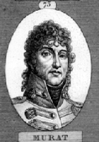 22.7.1801. Baudin. Named after Joachim Murat (right) (1767-1815), King of Naples, who married Napoleon's sister Caroline in 1800. Born at Lot, France, he was destined for the priesthood and studied at Cahors and the University of Toulouse. He enlisted in a cavalry regiment and was dismissed for insubordination in 1790. He became a close associate of Napoleon and on 01.08.1806 he became Napoleon's King of Naples. 22.7.1801. Baudin. Named after Joachim Murat (right) (1767-1815), King of Naples, who married Napoleon's sister Caroline in 1800. Born at Lot, France, he was destined for the priesthood and studied at Cahors and the University of Toulouse. He enlisted in a cavalry regiment and was dismissed for insubordination in 1790. He became a close associate of Napoleon and on 01.08.1806 he became Napoleon's King of Naples.
Jurabi Pt
Aboriginal name of the white plumed honey eater. First recorded by ornithologist Thomas Carter.
Sandy Pt
Descriptive of its shape.
Carbalddarman Passage
Possibly the Aboriginal name of the location. First recorded by ornithologist Thomas Carter.
Norwegian Bay
Origin of the name is unknown, however it may refer to a visit to this section of the coast in 1777 by the Danish vessel Fredensburg Slott under Capt. Mathias Zosp. The description of the land sighted matches that of the coast around Norwegian Bay.
Fraser Isld
Recalls a member of a group of Victorians who invested in the Denison Plains Association. Originally spelt Frazer.
Pt Cloates
16.1.1822. King. Originally named it Cloates Island, believing it to be unattached to the mainland. Recalls King Cloots, a Flemish baron, one of the owners of the ship House of Orange, which, under Captain Nash, sailed these shore in 1717 and named the locality.
Black Rock Passage / Black Rock
16.1.1822. King. Descriptive of its shape.
Chubjawardoo Passage
Possibly the Aboriginal name of the location. First recorded by ornithologist Thomas Carter.
Greyling Head
16.1.1822. King. A type of fish caught in the area.
Amherst Point
16.1.1822. King. Named after William Pitt Amherst, 1st Earl Amherst and 2nd Baron Amherst of Montreal (1773 - 1857). He was the nephew of Jeffrey, Baron Amherst, and succeeded to his title in 1797 by the remainder provided when the patent of nobility was renewed in 1788. Lord Amherst held the office of governor-general of India from August 1823 to February 1828. The principal event of his government was the first Burmese war of 1824, resulting in the cession of Arakan and Tenasserim to Great Britain. He was created Earl Amherst of Arakan in 1826. On his return to England he lived-in retirement till his death in March 1857.
Ningaloo Reef
Takes its name from the Aboriginal name for Point Cloates. It means nose, and is said to refer to the point's shape.
Coral Bay
1982. Named taken from the Coral Bay Hotel that was established in 1968 at Bills Bay.
Pt Maud / Maud's Landing
Maud Bateman. Discovered by the Captain of the schooner Maud about 1880. The Maud was owned by John Bateman of Fremantle, and named after his daughter Maud who was born in 1855. The ship was built in 1866 and wrecked in the north west in 1894. The port of Mauds Landing was surveyed in 1897 by Commander Dawson.
Bills Bay
Named after Ruby May French, affectionately called 'auntie Billie'. She was the wife of Charles French, the owner of Cardabia Station, the property surrounding Maud's Landing and Bills Bay.
Pt Anderson
18.1.1822. King. Named after William Anderson, botanist of the Apothecaries' Garden at Chelsea, England, and friend of King. Named at Mr. Cunningham's request.
Cape Farquar
12.7.1801. Baudin. Named after Sir Robert Townsend Farquhar, Governor of Mauritius 1810-1823, who did much to abolish the Malagasy slave trade and to establish friendly relations with the rising power of the Hova sovereign of Madagascar.
Gnaraloo Bay
Derived from Ngurrulhu, the Aboriginal name of the location. First recorded by ornithologist Thomas Carter, the name is thought to mean 'white clay'.
Beagle Head
January 1838. Stokes. The expedition vessel HMS Beagle anchored here.
 Cape Cuvier Cape Cuvier
12.7.1801. Baudin. Named after Georges Chretian-Leopold Dagobert Cuvier (right), French astronomer/zoologist (1769-1832). also known as Cape Courier. Born on 23.08. at Montbéliard, After 4 years at the Academy in Stuttgart, he became tutor in the family of Comte d'Héricy. In this way he made contact with the well-known naturalist E. Geoffrey Saint-Hilaire and became in 1795 assistant to the professor of comparative anatomy at the Muséum d'Histoire Naturelle. His long distinguished career with many publications ended when he died in Paris after a brief illness. Cuvier who published his system of comparative anatomy in 1800. Francois Peron had been one of Cuvier's pupils. Cuvier described many Australian fish species, many of them with Valenciennes, during the 1820s & 30s. Georges Cuvier is referred to as the founder of vertebrate palaentology.
Quobba Pt
Aboriginal name of the location, meaning 'good place'. Was named Point Charles prior to 1921 after Charles Fane who settled here in 1876.
Geographe Channel
12.7.1801. Baudin. Named after Baudin's expedition vessel, Geographe.
Whaleback Head
Jan 1822. King. Descriptive of its shape.
Koks Isld
German word for coke. Dalrymple's map of 1779 shows the name as Kok's Island. As Kok is a Dutch surname, it may recall a long forgotten Dutchman whose ship touched these shore in the 17th or 18th century; perhaps Stoffel Kok, an 18th century Dutch East India Company ship's master.
Dorre Isld
1698. Vlamingh. Named by Vlamingh using Joannes Van Keulen's 1619 Shark Bay chart and Dirk Hartog's making on his chart of 1616 for both Dorre and Bernier Islands. The name means dry or barren.
Low Pt
Descriptive.
Cape Boullanger
12.7.1801. Baudin. Named after Charles Pierre Boullanger, midshipman, geographer and engineer of survey vessel Geographe.
Cape Ronsard
12.7.1801. Baudin. Named after Francois Melchesadek Rondard, naval engineer of survey vessel Naturaliste.
Bernier Isld
29.6.1801. Baudin. Named after Pierre Francois Bernier, astronomer of survey vessel Naturaliste.
Wedge Pt
Recalls surveyor Charles Wedge, who sailed past Bernier Island with his family on Warrior in 1865 to settle north of the Gascoyne River.
Eagle Pt
January 1838. Stokes. Sea eagles nests seen here.
Boulder Pt
Descriptive.
Digby Pt
January 1838. Stokes. A settlement in south western Victoria established at a river crossing on the Stokes River (Emu Creek), on the Emu Creek Pastoral Run. It was one of the early settlements on the wagon route north from Portland Bay to the rich pastoral lands of the interior soon after the first permanent settlement of Portland Bay by the Henty Brothers in 1834. It .was named after the village of Digby in Lincolnshire, England. It is presumed that Stokes named it thus as it was a settlement on a river named after himself.
Cape Couture
12.7.1801. Freycinet. Recalls Joseph Victor Couture, midshipman of survey vessel Naturaliste.
Castle Pt
Descriptive of its shape.
Uranie Bank
1820. De Freycinet. Named after the expedition vessel, L'Uranie, which anchored here during local exploration.
Observation Hillock
1820. De Freycinet. Obsevations of the area were made from this hill.
Cape St Cricq
12.7.1801. Baudin. Named after seaman Jacques St. Cricq, of survey vessel Naturaliste.
Cliff Pt
Descriptive of the point's terrain.
 Shark Bay Shark Bay
6.8.1688. Dampier. Many large sharks seen. De Freycinet named it tLa Baie des Chiens-Marins which means Bay of Marine (or Sea) Dogs.
Depuch Entrance / Depuch Loop
27.7.1801. Baudin. Named after Louis Depuch, mineralogist of survey vessel Géographe.
Baba Point
Aboriginal word meaning 'water' in the Malgana dialect.
Baudin Island
27.7.1801. Comander Nicolas Baudin, commander of the Geographe and Naturaliste. The names were recorded in the jourmals of both de Freycinet and Peron. Both disliked Baudin, however as the island is covered in whiye bird dropping (guano) and Baudin wore a white wig, it is likely that the name was given as an insult as they named no other features on their voyage after him.
Grey Pt
Explorer George Grey. The name first appeared on maps in 1903. Greay saild from Britain on HMS Lynher to take formal possession of North West Australia, which he did in a ceremony at Hanover Bay in 1837.
False Entrance
A name which came into comon use because the gap was often mistaken as a safe entryway to Shark Bay from the open sea.
Bush Bay
Recalls pastoralist Robert Edwin Bush, first Chairman of Upper Gascoyne Road Board and member the Legislative Assembly of WA's first parliament 1890-93.
Greenough Pt
1858. Denham. Named after George Bellas Greenough, President of Royal Geographical Society.
Disappointment Reach/Loop
1858, Denham. Disappointed that he found no river.
Gladstone Bay
1858. Denham. Named after British Prime Minister William Gladstone.
Pelican Isld
1858. Denham. Many pelicans seen here.
Crayfish Bay
Named Epineux Bay by Capt Henry Mangles Denham, HMS Herald, 1858. It was later changed to Crayfish Bay due to that name's popular use.
Petit Pt
31.8.1801. Baudin. Named after Nicolas-Martin Petit , assistant gunner of survey vessel Naturaliste, who became one of the artists on the expedition.
 Lharidon Bight Lharidon Bight
24.7.1801. Freycinet. Named after Dr Francois-Etienne L'Haridon de Cremenec, one of two surgeons on the of survey vessel Geographe.
Hamelin Pool (right)
2.9.1801. Baudin. Named after Felix Emmanual Hamelin, master of survey vessel Naturaliste.
Faure Isld
24.7.1801. Baudin. Named after Ange Francois Xavier Faure, geographer of survey vessel Naturaliste, who first saw the island.
Gathaagudu
Malgana Aboriginal name for Shark Bay. It means 'two bays' and refers to the 'W' shaped coastline of Shark Bay.
Dubuat Pt
11.8.1801. Baudin. Named after Pierre Louise Georges Du Buat (1734-1809), French hydraulic engineer who derived empirical formulas for computing the discharge of fluids from pipes and open channels. He strongly includenced the development of experimental hydraulics during the 18th and 19th centuries.
Peron Peninsula / Cape Peron
14.8.1801. Baudin. Named after expedition naturalist, Francois Peron.
Attack Bay
14.8.1801. Baudin. A shore expedition was attacked by Aborigines.
Eastern Bluff
1858. Denham. Decriptive.
Guichenault Isld
11.8.1801. Baudin. Named after Antoine Guichenault, gardener's boy of survey vessel Geographe.
Hopeless Reach
11.8.1801. Baudin. Vessels nearby ran aground on sand banks.
Herald Bight
1858. Denham. Named after the survey vessel, HMS Herald.
Lake Montbazin
11.8.1801. Baudin. Louis Montbazin, midshipman of the Geographe.
Guichenault Point
11.8.1801. Baudin. A gardener's boy, Antoine Guichenault, who was employed on the Geographe to take care of the plant specimens taken on board.
Cape Rose
1820. Freycinet. After Louis de Freycinet's newlywed bride, Rose, who stowed away on the Uranie dressed as a cabin boy to be with her husband.
Kopke Point
The Kopke family, early owners of nearby Yaringa and Carbla stations.
White Bluff
A stationhand at Yaringa Station.
Yaringa Point
Recalls nearby Yaringa pastoral station. From ther Aboriginal word 'yurrungarra' meaning dry country or place.
Broadhurst Bight
1858. Denham. Recalls Daniel Broadhurst, a local pearler. In 1801, Freycinet had named it Dampier's Bay after British explorer William Dampier.
Brown Inlet
Recalls pastoralists Maitland and Aubey Brown who landed sheep, stores and horses at the inlet in 1864 in order to established a pastoral venture in the area that became known as Carrarang Station.
Cape Lesueur
11.8.1801. Baudin. Named after Charles Alexander Lesueur, natural history artist, Géographe. Lesueur started out as an assistant gunner but became one of the artists when three artists left the expedition at Mauritius. He seems to have continued Francois Peron's work by describing some marine fish species (together with Peron) after Peron's death in 1810. Lesueur went on to become the first director of the Museum of Natural History at Le Havre in 1846. The Lesueur collection (Collection Lesueur) of art treasures is housed at the museum.
Leschenault Island (Ile Leschenault)
11.8.1801. Baudin. Named after Jean-Baptiste Leschenault de la Tour, the expedition's botanist on board the Geographe.
Middle Bluff
1858. Denham. Descriptive.
Lagoon Pt
1858. Denham. Descriptive.
Eagle Bluff
1858. Denham. Eagle nests seen there on a rocky island offshore. Originally named Cape Moreau by Freycinet in 1801 after C Moreau, the Geographe's geographer and midshipman.
Henri Freycinet Reach / Freycinet Estuary
24.7.1801/9.8.1801. Freycinet. Named by Louis de Freycinet, commander of Casuarina, after his older brother of Henri de Freycinet,, sub lieutenant of survey vessel Geographe.
Goulet Bluff
24.7.1801. Baudin. Goulet is a French word for 'gap'.
Garden Pt
Fording Pt
1858. Denham. It was used as a ford by Aborigines to Salutation Island.
Salutation Island
4.7.1858. Denham. It was here that the ship's master (HMS Herald), Joseph Smith, went ashore with two seamen and were given a length of material plaited from kangaroo hair by local Aborigines. Some of the Aboriginal men were invited back to the boat, they came aboard HMS Herald and dined on biscuits and were given fish hooks, an axe and other gifts.
Smiths Islands
4.7.1858. Denham. Recalls master of HMS Herald, Joseph Smith. The vesel ran aground here in April 1858 and was successfully refloated after the ship was lightened.
Baba Head
1858. Denham. Aboriginal name for water. It was to a muddy well at this headland that Denham was led by the local Aborigines where he asked them if there was any fresh water here.
Giraud Pt / Giraud Reef
9.8.1801. Baudin. Named after Étienne Giraud, officer of survey vessel Naturaliste.
Carrarang Peninsula
1858. Denham. Thought to be the Aboriginal name for the kararra seed.
Taillefer Isthmus
Baudin, 14.8.1801. Hubert Jules Taillefer, the second doctor on the survey vessel Geographe.
Depuch Channel
11.8.1801. Baudin. Named after Louis Depuch, mineralogist of survey vessel Géographe.
Lefebre Isld
11.8.1801. Baudin. Named after John Thomas Lefebre, 3rd class seaman (helmsman) of survey vessel Naturaliste.
Tetrodon Bay / Tetrodon Islet
11.8.1801. Baudin. Named due to the large numbers of Tetrodon or 'sea hedgehogs' (Porcupine Fish) found there.
Point Giraud
11.8.1801. Baudin. Named after Stanislas Etienne Griraud, midshipman of survey vessel Naturaliste.
Useless Inlet / Loop
10.8.1801. Baudin. Marked on Freycinet's maps as 'Havre Inutile' (Unusable Bay). Thus named as ships were unable to enter it as it was very shallow.
Wilya Mia
Local Aboriginal name for the locality of Shark Bay's main pearling camp in the early 1870s. It means 'shell camp'.
Monkey Mia
Means 'happy home' or ' happy camp' in the local Aboriginal dialect.
Heirisson Prong
1858. Denham. Originally named Cape Heirisson by Baudin in 1801 after Antoine Boniface Heirisson of Madrid, sub-lieutant on the Naturaliste. An island on the swan River to the east of the Perth central business district is also named after Heirisson.
Bellefin Prong
9.8.1801. Baudin. Named after Dr Jerome Bellefin, chief surgeon of survey vessel Naturaliste. Upon meeting twenty women fishing on Bruny Island in Tasmania, an older woman named Arra-Maida invited the Frenchmen to sit down while the meal was cooked. Bellefin amused them with dancing and singing and received great applause from the startled audience. Arra-Maida mimicked his song, then sang and danced in her own language. "Some of the dances would have been thought extremely indecent in European society", wrote Peron.
Leschenault Isld
9.8.1801. Baudin. Named after Jean Baptiste Louis Claude Leschenault de la Tour, botanist of survey vessel Geographe.
Blind Strait
1858. Denham. Descriptive.
Dirk Hartog Island
Named Dorre (Barren) Island by De Vlamingh, 16.2.1698.
 Cape Inscription (right) Cape Inscription (right)
24.7.1801. Baudin. The place where Vlamingh's plate was found by de Freycinet.
Notch Pt
1858. Denham. Descriptive of its shape. Originally named Point Refuge by Freycinet in 1801.
The Quoin Bluff
1858. Denham. Descriptive of its shape. Originally named Coin de Mire (meaning surveying point) by Baudin, meaning it was used as a surveyor's point of reference.
Herald Bay / Herald Heights
1858. Denham. Named after HMS Herald, Denham's ship which visited the area in 1858 to complete hydrographic surveys.
Louisa Bay
Known to the locals as Dugong Bay. Who Louisa was is not known.
Tetradon Loop
1801. Baudin. Named for the puffer fish seen here in abundance by Baudin.
Withnell Pt
Recalls James Withnell, a pioneer of the North West who had an interest in race horses. He held a pastoral lease on the island in the 1900s.
Cape Levillain
22.7.1801. Baudin. Named after Stanislas Levillain, a zoologist who landed there with two others. He died on the Naturaliste, 23rd December 1802.
Turtle Bay
It was here that Frenchman St Allouarn, of the French ship Gross Ventre sent a team ashore to claim this coast for the king of France, King Louis XV, in March 1772. The team were impressed at the large number of turtles they found on the beach and collected many eggs.
Cape Ransonnet
24.7.1801. Baudin. Named after Joseph Ransonnet, junior midshipman and engineer of survey vessel Geographe.
Naturaliste Channel
24.7.1801. Baudin. Named after the expedition vessel, Naturaliste.
Denham Sound
1858. Denham. Named after Captain Henry Mangles Denham, Royal Navy Hydrographer who surveyed a portion of Shark Bay aboard HMS Herald in 1858.
South Passage
1858. Denham. Descriptive.
Gantheaume Bay
24.7.1801. Baudin. Named after Comte de Gantheaume (1755-1818), French Admiral, succeeded in slipping out of Brest on 13.01.1802 with a squadron of seven sail of the line when a gale had driven the British blockading forces off the coast. He entered the Mediterranean, but never managed to land in Egypt.
Edel Land
The name is today applied to the western peninsula of Shark Bay, which ends to the immediate south of Dirk Hartog Island at Steep Point. The name was originally given to the whole west coast of Australia by Captain Frederick de Houtman of the Dutch VOC ship Dordrecht, and Jacob d'Edel, Councillor of the Indies, in the VOC ship Amsterdam, who navigated these shores in July 1619.
Nanga Peninsula
Taken from Nanga station, which is taken from the local Aboriginal word for water. There are apparently traces of wells dug by Aborigines at Nanga.
Steep Point
Descriptive. It is the westernmost point of mainland Australia.
Monkey Rock
The name of the survey vessel of Assistant Surveyor Ommanney who came her in search of a shipwreck reported by Aborigines in 1834, just five years after the Swan River colony was founded. Lack of fresh water caused then to turn back here, however they had already passed the wrecksite of the Zurtdorp, which is probably the wreck the Aborigines were referring to. It is not clearly visible from the ocean unless the water is dead calm, something that happens on only a few days each year.
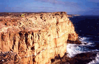 Zuytdorp Cliffs (right) Zuytdorp Cliffs (right)
Dutch East Indianman Zuytdorp wrecked here in 1712.
Red Bluff
1858. Denham. Descriptive of the red of the cliffs which contrasts with the blue of the sea.
Bluff Pt
1858. Denham. Descriptive.
Hutt Lagoon
1858. Denham. Hutt River, which enters the indian Ocean via the lagoon. The river is named after John Hutt, Governor of WA 1839 - 1846. Hutt was appointed Governor of Western Australia after helping with the plans to colonise South Australia. It seems that Hutt may have won the Western Australian post as consolation for having failed to secure the governorship of South Australia, for which he had applied. He had valuable experience in colonisation, having been Governor of North Arcott in the Madras Presidency. He presided over a period of hardship in the colony but governed cautiously. Interestingly, he sought to introduce a more liberal system of politics to the colony and actively sought fair comment on his policies from colonists.
Port Gregory
Named after Francis T. Gregory who explored the Western Australian coastline in 1861.
Geelvinck Channel
18.1.1822. King. Named after explorer Willem de Vlamingh's ship Geelvinck, which sailed through here in 1697.
Champion Bay
9.4.1840. Wickham. Named after the schooner Champion anchored here in 1840.
 Pt Moore Pt Moore
9.4.1840. Wickham. Named after George Fletcher Moore, Attorney General of Western Australia who was aboard Champion when it anchored here in 1840.
Abolhos Islands
29.7.1619. Houtman. the name is an internationally known warning of its time, being the portuguese phrase "Abri Voll Olos", meaning literally Watch Out. Map of Abrolhos Islands.
Goss Passage
24.4.1840. Wickham. Named after a crew member.
Wallaby Group (right)
24.4.1840. Wickham. Tamars (small wallabies) were common on the islands.
North Isld
24.4.1840. Wickham. Named for its position in the Wallaby Group.
Beacon Isld
Once had a beacon placed on it. It was to this island that the survivors of the wrecked Dutch ship Batavia (1629) came after abandoning ship.
 East Wallaby Isld / West Wallabi Isld East Wallaby Isld / West Wallabi Isld
24.4.1840. Wickham. Tamars were mistaken for rats. east wallany Isld is also known as Webbe Hays Isld. Hays was a survivor of the Batavia shipwreck who built a number of rough stone forts (right) on this island as protection against mutineering survivors.
Eastern Isld
24.4.1840. Wickham. Named for its position in the Wallaby Group.
Middle Channel
24.4.1840. Wickham. The channel separates two island groups.
Easter Group
24.4.1840. Wickham. Explored at Easter time.
Little North Isld
24.4.1840. Wickham. Descriptive.
 Wooded Island Wooded Island
24.4.1840. Wickham. Descriptive.
Suomi Isld
Leo Isld
Morley Isld
Alexander Isld
Named after Former Director of the WA Museum and State Library, Sir Frederick Alexander.
Serventy Isld
Named after Naturalist Vincent Serventy.
Rat Isld / Little Rat Isld (above right)
24.4.1840. Wickham. Tamars were mistaken for rats (below).

Zeewijk Passage
24.4.1840. Wickham. Passage through which the survivors of the shipwreck Zeewijk (1727) sailed in the boat they built.
Pelseart Group / Pelsart Isld
24.4.1840. Wickham. Named after Francisco Pelseart, master of dutch East Indiaman Batavia, that was wrecked in the Abolhos Islands in 1629. For many years it was erroneously believed that the Batavia was wrecked in the Peslaert Group, hence it being named after the ship's master.
Gun Island
24.4.1840. Wickham. A small four-pound brass gun was found there. It was thought to be from the Zeewijk, which was wrecked nearby.
Middle Island
24.4.1840. Wickham. Its location in the group.
Pelseart Island
Named after Francisco Pelseart, master of Dutch East Indiaman Batavia.
Hummock Isld
24.4.1840. Wickham. Descriptive.
Murray Isld
24.4.1840. Wickham.Named after Lieut. John Murray, of Lady Nelson who discovered and surveyed Port Phillip in 1802.
Post Office Isld
A makeshift Post Office for the fishermen of the Abrolhos Islands was once located here.
Batavia Road
24.4.1840. Wickham. Named after the Dutch vessel Batavia, once believed to have been wrecked here in 1629.
Cape Burney
24.4.1840. Wickham. Named after Admiral James Burney, an eminent English geographer. He sailed with Cook on his 2nd voyage of discovery into the Pacific. His five-volume work, A Chronological History of the Discoveries in the South Seas or Pacific Ocean. London. 1803-1807, is treated as the authoritive documentation of the maritime history of the South Pacific.
Port Denison
Named after Sir William Denison, Governor of Tasmania, who visited Western Australia in 1851 in connection with the transportation of convicts to the state.
Arurine Bay
Of Aboriginal origin, meaning crayfish, which were caught in abandance here by the Aborigines.
Leander Pt
173 ton brigantine Leander which was wrecked here in 1853. The Leander was an important link between the Swan River Colony, the Victoria District and the markets of Singapore. Returning to England on 13.11.1853 from Fremantle, she hit a reef and was carried over it at this location. Attempts to refloat the beached vessel failed. The crew attempted to find help, some walked south, others north, but returned at night, worn out and with no news. After several hopeless attempts, a local Aboriginal named Wattandee, who had been observing the strangers, led the survivors to Lockier Burges' station at Irwin House, some thirteen days after the disaster. About half of the people who were travelling on the ship when disaster struck perished.
Clio Rock
Turtle Dove Shoal
Believed to recall the visit of a dutch trading vessel, Tortelduiff, which according to Dutch East India Company records came near this coast and visited an island in May 1624.
Pelsart Bank
24.4.1840. Wickham. Named after Francisco Pelsart, master of dutch East Indiaman Batavia, wrecked in the Abolhos Islands, 1629.
White Pt
Fresh Water Pt
April 1840. Wickham. Descriptive.
Knobby Head
April 1840. Wickham. Descriptive.
Beagle Isld
April 1840. Wickham. Named after the research vessel, HMS Beagle.
Green Head
1875. W E Archdeacon. A descriptive name, first used by the Admiralty hydrographic surveyor, W E Archdeacon.
Fisherman Isld
Island once popular with fishermen.
Jurien Bay
21.7.1801. Baudin. Named after Charles Mare Vicomte du Jurien (1763-1836), Commander of the French Navy. He served through the revolutionary and Napoleonic wars and became a peer under Louis Philippe.
Long Isld
Descriptive.
Frenchman Bay
Named Ronsard Bay by Baudin, 17.7.1801, after Francois Melchesadek Rondard, seaman of survey vessel Naturaliste.
Thirsty Pt
Cervantes Isld
Named after the American whaling ship Cervantes, which was wrecked off the coast in 1844. Cervantes was anchored off Thirsty Point, the promontory which lies to the west of the town when a gale blew up and the ship was blown ashore on an island to the south of the point. The ship was not badly damaged but due to difficulty of repairs all the contents were sold on the site. The island was named Cervantes and, in 1963, it was given to the small township which had sprung up on the mainland. At the time of naming of the townsite it was thought that the islands had been named "Cervantes" by the Baudin Expedition of 1801-03 after a Spanish author, and, as a result, many of the streets received Spanish names.
Green Islets
1875. A descriptive name given by W E Archdeacon, Admiralty hydrographic surveyor.
Wedge Isld
1875. W E Archdeacon. Named after surveyor Charles Wedge.
Lancelin Isld
12.7.1801. Baudin. Named after PF Lancelin, scientific writer, author of the World Map of Sciences and works on the planetary system and analyses of science.  In March 1658, as first officer and navigator of the Waeckende Boey searching for the wreck of the Dutch ship Vergulde Draeck (Gilt Dragon), Abraham Leeman van Santwits led a party ashore off Lancelin Island. Leeman and his crew were caught in the storm and found themselves stranded on a strange land. Leeman refused to accept the impossibility of his situation and, after killing a number of seals and doing his best to collect adequate provisions, he and his party of 14 men set sail for Batavia in an overloaded open boat. He and three sailors survived the epic journey. A plaque on a limestone obelisk at the end of Marcon Street, Two Rocks, marks the place where Leeman and his men came ashore. In March 1658, as first officer and navigator of the Waeckende Boey searching for the wreck of the Dutch ship Vergulde Draeck (Gilt Dragon), Abraham Leeman van Santwits led a party ashore off Lancelin Island. Leeman and his crew were caught in the storm and found themselves stranded on a strange land. Leeman refused to accept the impossibility of his situation and, after killing a number of seals and doing his best to collect adequate provisions, he and his party of 14 men set sail for Batavia in an overloaded open boat. He and three sailors survived the epic journey. A plaque on a limestone obelisk at the end of Marcon Street, Two Rocks, marks the place where Leeman and his men came ashore.
Edward Isld
Ledge Pt
1875. The point takes its name from rocky ledges in the vicinity. The nearby town of Guilderton was thus named because of the links the town has with the wreck of the Dutch ship Gilt Dragon, wrecked near here in 1656, and the loss of thousands of Guilders it was carrying. Dutch coins and relics of the wreck have been found near the mouth of the Moore River.
Cape Leschenault
5.2.1803. Baudin. Named after Jean Baptiste Louis Claude Leschenault de ld Tour, botanist of survey vessel Geographe.
Wreck Pt
Close to wreck of the Dutch East Indiaman, Vergulde Draeck (Gilt Dragon), 1656.
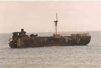
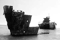
Alkimos Beach
Named after the 7033 ton Greek freighter Alkimos which rang aground here on 19.3.1963. Several attempts were made to refloat her, but all were unsuccessful. The ship took some years to break up. Wreckage remains.
|
|
|
|
Alkimos in 1973.
|
Alkimos wreck, 30 years later.
|
Eglinton Rock
Named after the sailing ship, Eglinton, which was wrecked here in 1852. Pemberon Walcott, who later became the master of vessels which serviced the towns of WA's north west in the 1860s, survived the wreck as an 18-year-old.
Quinns Rock
1867. Surveyor James Cowle. Named after Robert Quin who emigrated to Western Australia in 1863 and was appointed as Assistant Surveyor on his arrival. Quin died in July 1886. The spelling has changed over time with the addition of another "n" to the end of the name.
Waterman Bay
Named after Alfred Waterman, a local fisherman and one of the first residents in the area.
Hamersley Pool
Named after the district's first land owner, Edward Hamersley, who owned and farmed land near Guildford. In the late 1800's he built a summer home in what is now North Beach, and named it "The Castle". It was on the site of the present day Castle Hotel.
Trigg Island
Named after Henry Trigg, Superintendent of Public Works in the Colony of WA from 1838 to 1851.
Rottnest Island
 29.12.1697. De Vlamingh. Named Rotte Neste, which literally means Rat's Nest. Dutch explorer Vlamingh (Geelvinck) was referring to the island's quokkas, a small wallaby like marsupial. A rat was the closest description he could give having yet not seen a kangaroo. Vlamingh originally called it Misteiland, meaning Island of Mist, however the French cartographer Vaugondy who drew Vlamingh's map mis-translated the name as Misjelandm which means Island of Girls. Because of this error, for may years it was believed that the island had an all female population. The lakes of Rottnest (right) were named Duvaldilly Ponds by de Freycinet, 17.6.1801, after Antoine Henry Mengy Duvaldilly, midshipman of survey vessel Naturaliste. The two capes at opposing ends of Rottnest Island were named by de Freycinet after crew members (see below). 29.12.1697. De Vlamingh. Named Rotte Neste, which literally means Rat's Nest. Dutch explorer Vlamingh (Geelvinck) was referring to the island's quokkas, a small wallaby like marsupial. A rat was the closest description he could give having yet not seen a kangaroo. Vlamingh originally called it Misteiland, meaning Island of Mist, however the French cartographer Vaugondy who drew Vlamingh's map mis-translated the name as Misjelandm which means Island of Girls. Because of this error, for may years it was believed that the island had an all female population. The lakes of Rottnest (right) were named Duvaldilly Ponds by de Freycinet, 17.6.1801, after Antoine Henry Mengy Duvaldilly, midshipman of survey vessel Naturaliste. The two capes at opposing ends of Rottnest Island were named by de Freycinet after crew members (see below).
In 1803, on his return to Rottnest, Baudin named it Îles Louis Napoleon after Napoleon's younger brother, Louis Napoleon (1778-1846). The Aboriginal name for the island was Wadjemup, possibly meaning "place across the water". It was believed by them to be a home of spirits among the local Noongar communities.
Cape Vlamingh
Recalls the island's discoverer, Dutchman Willem de Vlamingh (January 1792). It was named Cape Faure by de Freycinet in June 1801 after his expedition geographer, Pierre Faure, though this name has never been recognised or used.
Fish Hook Bay
Radar Reef
It is near Radar Hill, where a radar station was built being World War II to warn of any impending attrack on Perth by sea.
Wilson Bay
Strickland Bay
Named Sir Gerald Strickland (1861-1940). He was Governor of the Leeward Island from 1902 to 1904 , Governor of Tasmania from 1904 to 1909, Governor of Western Australia from 1909 to 1913, Governor of New South Wales from 1913 to 1917 and Prime Minister of Malta from 1927 to 1932. Five other of Rottnest's geographical features are named after Strickland's wife and four eldest daughters. His fifth daughter - Hon Dr Constance Strickland LMSSA (1912-79) - missed out; she was less than a year old when the Stricklands left WA for Tasmania and had never lived on Rottnest Island as her sisters had. What is today the Rottnest Arms Hotel was built as an exclusive summer residence for the WA Governor in 1848. The 1912/1913 summer was the last time it was used for this purpose; Sir Gerald Strickland and his family were its last Vice-Regal occupants.
Mary Cove
Named after Mary Christina Strickland (1896-1970), one of five daughters of the WA Governor, Sir Gerald Strickland. She became Mary Christina dei Marchesi Gandolfi Hornyold when she married Henry Albert Hornyold, son of Alfred Joseph Hornyold and Alice de la Chere, on 7th July 1920.
Kitson Point
Recalls Rottnest Island Board Chairman, 1933-46, Hon. HW Kitson.
Green Island
Nancy Cove
Stone quarried from Nancy Cove was used to build the Rottnest Island lighthouse on Oliver Hill.
Salmon Bay / Salmon Point / Little Salmon Bay
Salmon regularly caught there.
Parker Point / Parker Rock
Named after Capt Phillip Parker King, colonial maritime explorer who visited the island in January 1822.
Vera Rocks
Porpoise BayPossibly because dolphins were seen here.
Henrietta Rocks
Named after Henrietta Strickland, (Hon Henrietta Bower b.1903), one of five daughters of WA Governor, Sir Gerald Strickland.
Paterson Beach
Recalls gaol officer, Acting Island Superintendent in the early 1900s and later board executive officer.
Dyer Island
Recalls a boat owner who was the first person to operate a ferry service between Rottnest and the mainland.
Wallace Island
Bickley Point / Bay
Phillip Point / Rock
Named after Capt Phillip Parker King, colonial maritime explorer who visited the island in January 1822. The rock was originally a jagged peak but had its top blasted away during World War II to allow searchlights located on the point to sweep Gage Roads.
Thomson Bay
Named after Robert Thomson. William Clarke and Robert Thomson took up town lots and pastureland in 1830. Thomson became a major landholder on Rottnest Island during the 1830s. the mis-spelling of the name began with John Septimus Roe, Surveyor-General of WA in 1841 when the name was first recorded.
Bathurst Point
Named by Capt Phillip Parker King who visited the island in January 1822. It was either named after the expedition's vessel, the brig, Bathurst.
Pinky Beach
The Basin
Its distinctive basin shape.
Longreach Bay / Longreach Point
Point Clune
Geordie Bay / Little Geordie Bay
Parakeet Bay / Little Parakeet Bay / Parakeet Island
North Point
Its position in relation to the rest of the island.
Little Armstrong Bay / Armstrong Rock
Recalls Francis Armstrong, who was appointed as Moral Agent for the Aboriginal prisoners on Rottnest Island in 1847. Henry Vincent, the island's first Prison Superintendent, also burdened him with the tasks of Store and Lighthouse keeper. The cottage K1 & K2 was built for him, but he returned to the mainland the following year.
Catherine Beach / Catherine Bay
Charlotte Beach / Charlotte Point
Possibly named after Mrs Charlotte Condoret, daughter of Mr Duffield, the island's first lighthouse keeper. Her husband was Frenchman Henri Conderet who, commencing in 1868, worked the Rottnest Island Salt Store, purifying the salt collected from Rottnest's salt lakes.
City of York Bay
Named after the 1242 tonne british barque City of York, which was wrecked there on 12th June 1899. The loss of 12 of its crew made the wreck of the City of York the most serious that ever occurred on Rottnest.
Ricey Beach
Crayfish Rock
Stark Bay
Named after James B Stark, MP, who supervised the island for the Rottnest Island Board from 1922 to the time of his death in 1953. For many years it has been misspelt as Starke but it was officially corrected recently.
Rocky Bay
Descriptive.
Narrow Neck
Descriptive.
Lady Adeline Beach
Named after Lady Adeline Strickland, wife of WA Governor, Sir Gerald Strickland. The daughter of the seventh Earl De La Warr, Lady Edeline Sackville-West (d.1918) married Sir Gerald Strickland in Our Lady of Victories Church, Kensington, London, on 26th August 1890. Sir Gerald Strickland married Margaret Hulton in 1926, eight years after the death of Lady Adeline Strickland.
Abraham Point
Possibly named after the first man to visit the island was an Englishman - Abraham Leeman van Santwits - in 1659. He was first officer and navigator of the Waeckende Boey searching for the wreck of the Dutch ship Vergulde Draeck.
Marjorie Bay
Joan Island
Celia Rocks
Named after Cecilia Strickland (Hon Cecilia de Trafford MP - 1897-1982), one of five daughters of the WA Governor, Sir Gerald Strickland. She was elected to the Maltese Parliament in 1950.
Hayward Cape
Mabel Cove
Named after Mabel Strickland OBE (1899-1988), one of five daughters of WA Governor, Sir Gerald Strickland. During her time on the island (age 10 to 14 years), Mabel edited the handwritten Rottnest Times school newspaper. In later life she was the editor of The Times of Malta during World War II and led the Progressive Constitutional Party during the 1950s. She was one of the principal political leaders of the 1950s, participating in the integration talks in 1956/57 as well as being adamantly against independence in 1964. She was elected to the Maltese Parliament in 1962.
King Head
Named after Capt Phillip Parker King who visited the island in January 1822.
Eagle Bay
Cathedral Rocks
Descripitve of their shape.
Swan River
10.1.1698. De Vlamingh. The first recording of black swans by Europeans. Changed from Black Swan River to Swan River by James Stirling, March 1827.
Cockburn Sound
March 1827. Stirling. Named after Sir George Cockburn, Vice admiral and a Lord Commissioner of the Admiralty.
Gage Roads
March 1827. Stirling. Named after Rear Admiral Gage, commander in Chief of the East India Station.
Arthur's Head
March 1827. Stirling. Col. George Arthur, Lieut. Governor of Tasmania, 1824-36.
Rous Head
March 1827. Stirling. Named after Henry John Rous (1795-1877), son of Sir William Hall, Viscount Dunwich, Earl of Stradbroke. He explored the coast of New South Wales and Tasmania with King aboard cutter, Rainbow.
James Rocks
1838. Roe. Named after the brig, James, blown ashore 3 km south of the rocks in May 1830.
Owen Anchorage
Named after Capt. William Owen, who anchored the brig Amity there 21.9.1829.
Woodman's Point
March 1827. Named after Thomas Woodman, purser, HMS Success.
Jervois Bay
March 1827. Named after Capt. Jervoise, HMS Success.
James Point / Mangles Bay
March 1827. Named after James Mangles, father in law of James Stirling.
Garden Isld
March 1827. Stirling. Stirling planted vegetable seeds there for a garden. Named Bauche Island by Baudin, 18.6.1801. after Phillippe Bauche (1700-1773), French geographer and historian.
Carnac Isld
March 1827. Stirling. Named after Lieut. Pulo Carnac of the Parmela. Named Bertholet Island by Baudin, 18.6.1801. after Claude Louis Bertholet (1748-1822), French chemist who assisted in the establishment of Chemistry nomenclature.
Bird Isld
March 1827. Stirling. Preseumably because of the bird seen there.
Seal Isld
March 1827. Stirling. The seal colony which once existed seen there.
Penguin Isld
March 1827. Stirling. A Fairy Penguin colony is located there.
Point Peron
18.6.1801, Baudin. Named after expedition naturalist, Francois Peron, of the expedition corvette, Naturaliste.
Mersey Pt
1838. Roe. Named after Capt. Benjamin Mersey of British East India Station.
Safety Bay
1838. Roe. Described by Roe as "as safe, well protected boat harbour". Later named Peel Harbour, then Peel Basin when it became landlocked after storms.
Shoalwater Bay
1838. Roe. Descriptive.
Warnbro Sound
1838. Roe. reason for naming is not known.
Becher Pt
2.2.1803, Baudin. Named after a crew member of the Casuarina.
 Halls Head Halls Head
Peel Inlet (right)
Named after Thomas Peel, the leader of the scheme to develop 250,000 acres with 10,000 emigrants, but for a number of reasons the scheme failed.
Cape Bouvard
2.2.1803, Baudin. Named after Alexis Bouvard (1787-1843), a French astronomer who discovered comets not long before Baudin's expedition left for Australia.
Leschenault Inlet
2.2.1803, Baudin. Named after Jean Baptiste Louis Claude Leschenault de ld Tour, botanist of survey vessel Geographe.
Koombana Bay
Aboriginal name for the locality.
Wonnerup Estuary
The name is Aboriginal, having been shown on maps of the region since 1839. A possible meaning of the name is "place of the Aboriginal woman's digging or fighting stick" or it may be related to Peppermint Trees common in the area.
Geographe Bay
30.5.1801. Baudin. Named after the expedition vessel, Geographe.
Vasse Estuary
30.5.1801. Baudin. Named after 3rd class seaman, Thomas Timothe Vasse of survey vessel Naturaliste, who was marooned here. Vasse was a helmsman second class and, by all accounts, an excellent seaman. He was dumped by a wave during a storm, disappeared without trace and was presumed drowned. Baudin later revisited the area hoping to find trace of Vasse but missed the spot and sailed on. The Vasse River behind the present town of Busselton and the Wonnerup Inlet was named 'Riviere Vasse' after seaman Vasse in 1801. In 1834 some Aborigines showed British settlers the grave of a white man who they said used to spend his days gazing out to sea waiting for his ship to return. It seems that this man was Vasse and he was waiting for the return of Baudin in the Geographe.
Eagle Bay
The bay is believed to have been named whilst Stirling was on the Eagle carrying out a survey of Geographe Bay.
Bunker Bay
Dunn Bay
March 1830. Stirling. Named after Captain Richard Dalling Dunn, under whom Stirling served on the Hibernia and the Armide in 1810-1811. Stirling named a number of features in Western Australia after naval officers under whom he served or was associated with. The bay is believed to have been named whilst Stirling was on the Eagle carrying out a survey of Geographe Bay. The town of Dunsborough is located adjacent to Dunn Bay from which it derives its name. Captain R D Dunn is buried in Teigngrace Church, Devon.
Dalling Point
March 1830. Stirling. Named after Captain Richard Dalling Dunn, under whom Stirling served on the Hibernia and the Armide in 1810-1811 (see above).
Templer Point
March 1830. Stirling. Nmed after Captain Richard Dalling Dunn's widow, Charlotte Frances Dunn nee Templer, of Stover House, Teigngrace, Devon. Charlotte later married another Royal Navy captain, Charles Richard Dyke Acland. She died on 22 March 1875 at Kingston upon Thames, Surrey, UK, aged 85.
Cape Naturaliste / Naturaliste Reef
31.5.1801. Baudin. Named after the expendition vessel, Naturaliste.
 Point Piquet Point Piquet
31.5.1801. Baudin. Named after Furcy Piquet, officer of he expendition vessel, Geographe.
Canal Rocks
Descriptive.
Cape Clairault
2.2.1803, Baudin. Named after Alexis Claude Clairault, (right) French mathematician (1713-1765). Born in Paris, where is father was a teacher of mathematics. In 1736, he and Maupertuis took part in the expedition to Lapland to estimate the length of the degree of the meridian and published on his return his treatise Théorie de la figure de la terreThéorie de la lune.
Cowaramup Pt
The name is believed to be derived from Cowara, the Aboriginal name for the Purple Crowned Lorikeet.
Cape Mentelle
4.2.1803, Baudin. Named after Edme Mentelle (1730-1815), French geographer, historian and leading French cartographer of his day.
Cape Freycinet
2.2.1803, Baudin. Named after Henri-Louis de Saulses de Freycinet, brother of Louis de Freycinet, master, Casuarina. Henri was a sub lieutenant.
 Hamelin Bay / Cape Hamelin / Hamelin Isld Hamelin Bay / Cape Hamelin / Hamelin Isld
31.5.1801. , Baudin. Named after the master of Naturaliste, Emmanuel Hamelin.
Cumberland Rock
Blackwood Inlet
1830. Stirling. The inlet and river are named after Vice Admiral Sir Henry Blackwood under whom Capt. Stirling had served.
Augusta Inlet
1830. Stirling. Named after Princess Augusta Sophia, 2nd daughter of King George IV and Queen Charlotte (1768-1840).
Cape Leeuwin (right)
7.12.1801. Flinders. Most southerly point of Leeuwin's land. Called Leeuwin's land on early Dutch charts. In March 1622, the company of the ship Leeuwin (Lioness) made land contact further south than had Houtman. They described the land they found as low-lying, sandy dunes and called it Leeuwin Land.
|