Australia For Everyone: Canberra


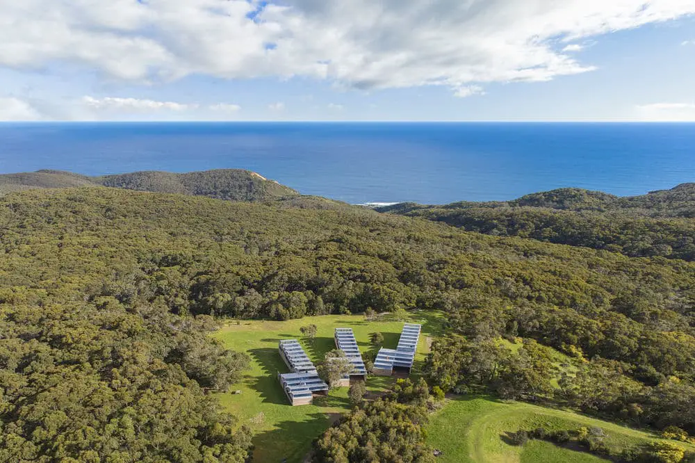
Alkina Lodge, Wattle Hill
Wattle Hill
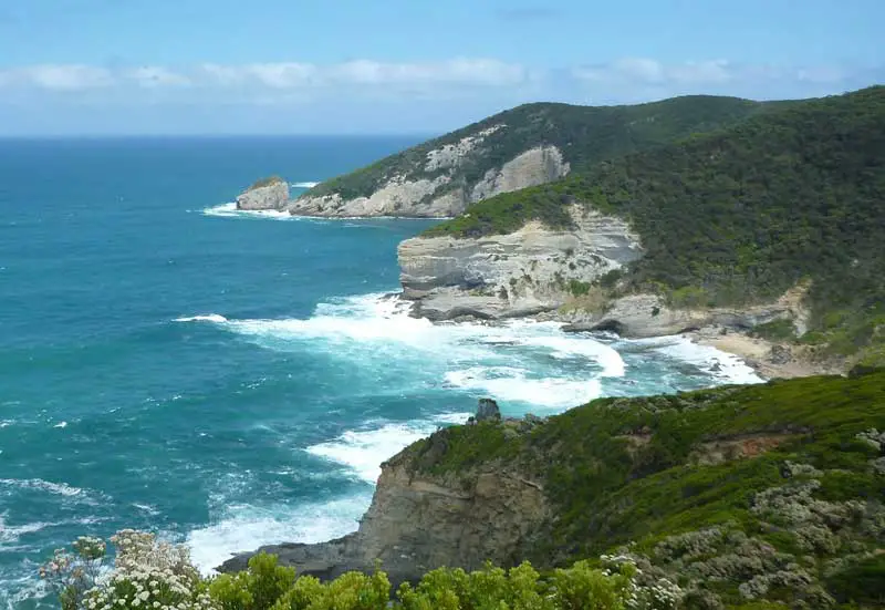
Along the great Ocean Road, south west of Laver’s Hill through Yuulong, is Wattle Hill where the historic former Wattle Hill Hotel still stands, but is today, a private residence. It sits on the corner of Moonlight Head Rd which takes the traveler to one of the most magnificent views of the Great Ocean Road at The Gable which provides an easterly view from one of the highest cliff lookouts along the coast (130 metres). The Gable is a prominent rock feature located 1 km west of Moonlight Head.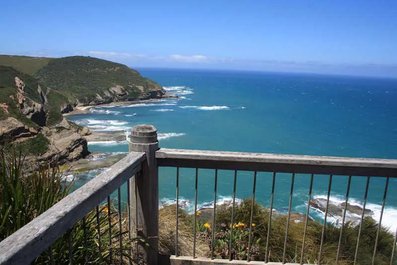
The Gables Lookout
The Gable has a remote but accessible beach which is only frequented by adventurous surfers and fishers. The beach can be seen from the eastern Moonlight Head car park. It can be reached from the spur off the Moonlight Head Road, with a 1 km walk down the steep, grassy slopes to the beach. The beach faces south-west and receives waves averaging 1.5 metres, which break over the reefs and produce a steep, barless beach face. There is surf to be found over the reefs at high tide. You can fish deep water right off the beach in the rips, or from the inner reefs at low tide.
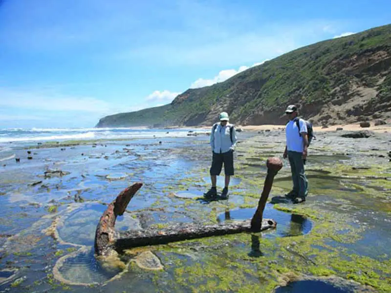
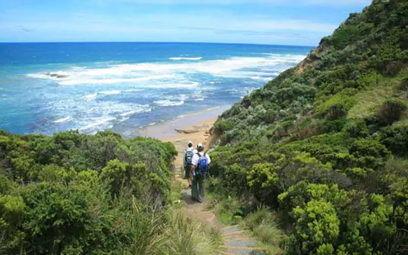
Wreck Beach
Wreck Beach is named after the wreck of the ship Marie Gabrielle in 1869 and sometimes also goes by that name. It is located below the 80 m high Moonlight Head car park and immediately west of Cat Reef. Wreck Beach consists of a 1.2 km long continuous strip of sand arranged in six semi-circular bays, with rock platforms forming the boundary of each bay and reefs offshore. Moonlight Beach continues on past a small headland for another 400 metres. The waves average over 1.5 m and combine with the reefs and sand to produce four large, permanent rips along Wreck Beach, and one off Moonlight Beach. All the rips flow out through gaps in the reefs.These are two hazardous beaches with a rip and reef dominated surf so swim here with great caution. There are some quieter rock pools exposed at low tide, which are the safest places to swim. Be very careful of the deep, calm channels between the reefs, as these contain rip currents. For surfers there are breaks over the reefs at high tide, with the rip channels giving easy access to the outer breaks. There are several good, deep, permanent rip holes along the beach for fishing, plus the reef off the beach.
Oliver Hill is a 130 metre high bluff just west of Moonlight Beach. At the base of the bluffs is a narrow, 100 metre long, south-west facing beach, with sheer bluffs behind and on the sides, and reefs to eit her side. Around its western head is a similar beach below 60 m high bluffs, with Pebble Point forming its western boundary. A walking track from Moonlight Head runs along the back of the bluffs, however there is no access to the beaches.Both beaches are exposed to waves averaging over 1.5 m which are, however, lowered by the reefs and points. The result is two steep, narrow beaches, with reefs to either end and a deep, reef controlled rip channel running out the centre. These beaches are only for the adventurous surfers or fishers. The rip channels provide permanent, deep fishing holes right off the beaches.
View to Cape Volney from Ryans Den campsite. Photo: Steve Hampton
Cape Volney
Cape Volney and adjacent Point Reginald are prominent isolated headlands, backed by steep slopes that rise to 190 metre. One kilometre north of the cape is a small valley, at the base of which is a 50 m long, south-east facing sand and boulder beach, which is fronted by continuous reefs. The beach is essentially inaccessible, except by boat in calm conditions at high tide. It is remote, isolated and hazardous and not suitable for swimming or surfing. There are high rock platforms on the southern head, with reef lying off the beach, are ideal for fishing. Access to Cape Volney is via the Cape Volney track which leaves the Great Ocean Road before reaching Wattle Hill when travelling west.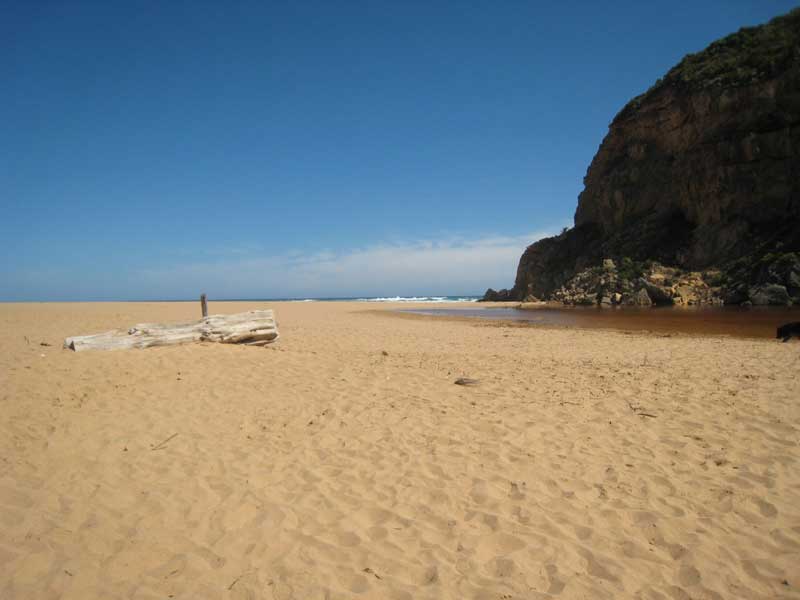
The Gellibrand River flows out beside Point Ronald: a 50 m high, limestone cliff to the north west of Wattle Hill. A continuous surf zone extends for 3 km to the east of Point Ronald, backed by five separate beaches, with calcarenite and limestone bluffs and platforms separating the beaches. Access to the main Gellibrand Beach is by the Princetown Reserve Road, which ends at the National Park camping area located behind the main beach, also known as Princetown Beach. The main beach has the small Gellibrand River mouth in the western corner. One large rip usually runs out through the surf.
A 500 metre long walking track runs along the river bank to the beach. The two easternmost beaches can be reached by a vehicle track along the National Park boundary, which leads to an access track to the second beach, 2 km east of the camping area. To reach the middle two beaches requires a walk along the bluffs or around the headland.The five beaches face south-west and receive waves averaging over 1.5 metres. The easternmost beach is 200 metres long, with protruding reefs at each end and 60 metre high bluffs behind. It usually has one large rip draining out from the middle of the beach. The second beachis 1 km long, has reefs at each end and usually two to three large rips along the beach. The middle beaches are each 100 metre long pockets of sand backed by steep bluffs.
These are three energetic and rip dominated beaches, with deep rip channels against the shore. Use extreme care if swimming here and stay in lee of the bars. For surfers there are excellent beach breaks along these three beaches, with best conditions in low to moderate swell and northerly winds. The deep rip channels provide good deep holes to fish from the beaches.
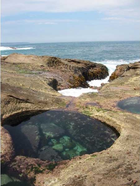
Wreck beach rock pool