


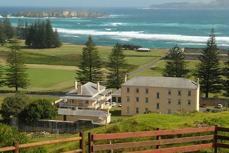
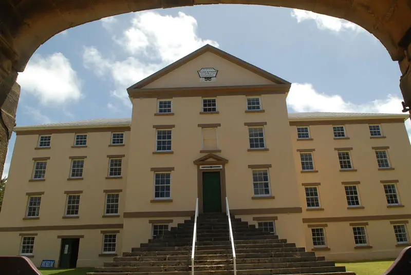
Norfolk Island, located in the Pacific Ocean between Australia, New Zealand and New Caledonia, is a destination like no other. It is an isolated island of unspoiled natural beauty. Elegant convict-built Georgian buildings are still in daily use and the Kingston and Arthur’s Vale Historic Area is now World Heritage Listed as part of the Australian Convict Sites inscription.
Norfolk Island must be Australia’s ultimate get-away-from-it-all destination, to go there is to take a step back in time. The only fast food is pulled fresh from soil or sea. Time moves slowly here. Norfolk Island is as laid back as you want it to be. There are cars but no traffic lights because the traffic is always light. You can still park your car with the keys in the ignition.
Norfolk Island is populated predominantly by a unique people. the descendants of the famous Bounty mutineers, who number less than 2,000. They speak their own special language (as well as English), and welcome visitors in their own unique way.
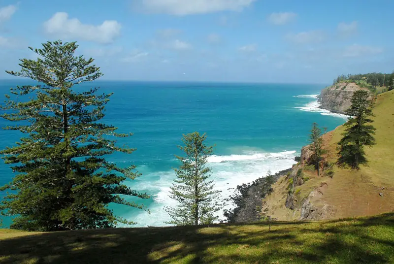
Norfolk Island is just a short flight from Australia and New Zealand. The island is 34 km2 in size with 32 km of coastline. Norfolk has 80 km of lanes and tracks, weaving along cliffs and beaches, around crumbling ruins and scented Norfolk Island pine trees. The Norfolk Island pine, a very striking evergreen tree endemic to the island, is pictured in the island’s flag.
There are no railways, waterways, ports or harbours on the island. Loading jetties are located at Kingston and Cascade, but ships cannot get close to either of them. When a supply ship arrives, it is emptied by whaleboats towed by launches, five tonnes at a time. Which jetty is used depends on the prevailing weather on the day. The jetty on the leeward side of the island is used. If the wind changes significantly during unloading/loading, the ship will move round to the other side. Visitors often gather to watch the activity when a supply ship arrives.
The airstrip was built during World War II, as a southern base to repel the Japanese taking over the pacific. As Norfolk Island did not have enough flat ground, several bulldozers were used to knock the tops off of several hills, and fill in the valleys between them. Steel mesh was then used to make a solid surface. The airport was never used as a major base, however it was a stopover for aircraft travelling to and from New Zealand. Mount Bates also had a secret radar installation.
As of 2004, 2532 telephone main lines were in use. Undersea coaxial cables link the island with Australia, New Zealand and Canada. There is one local TV programming station and two repeaters that bring in Australian programs by satellite.
The finding of stone adzes and other implements suggests that Norfolk Island was once used by seafaring Polynesian people as a brief stop-over point. However, no trace of permanent settlement has been found. Norfolk Island was colonised by the British as part of their settlement in Australia in 1788. It then served as a convict penal settlement until 1794, when it was abandoned until 1856, when permanent residence on the island for civilians began. In 1901, the island became a part of the Commonwealth of Australia which it has remained until this day.
The first European known to have sighted the island was Lieut. James Cook, in 1774, on his second voyage to the South Pacific on HMS Resolution. He named it after the wife of the premier peer of Britain, Edward Howard, 9th Duke of Norfolk (1685-1777). Cook went ashore on Tuesday 11th October 1774, and was impressed with the tall straight trees and flax-like plants. He took samples back to England and reported on their potential uses for the Royal Navy.
In June 1856, the descendants of Tahitians and the HMS Bounty mutineers, were resettled on Norfolk Island from the Pitcairn Islands, which had become too small for their growing population. The British government had permitted the transfer of the Pitcairners to Norfolk, which was then established as a colony separate from New South Wales but under the administration of that colony’s governor.
Norfolk Island is located in the South Pacific Ocean, east of Australia. The island has an area of 34.6 km2 with no large-scale bodies of water. It has no land boundaries with any foreign country and has 32km of coastline. The island’s highest point is Mt. Bates (319m above sea level), located in the northwest quadrant of the island. The majority of the terrain is suitable for farming and other agricultural uses.
The coastline of the island consists, to varying degrees, of cliff faces. A downward slope exists towards Sydney Bay and Emily Bay, the site of the original colonial settlement of Kingston. There are no safe harbour facilities on Norfolk Island, with loading jetties existing at Kingston and Cascade Bay. All goods not domestically produced are brought in by ship, usually to Cascade Bay. Emily Bay, protected from the Pacific Ocean by a small coral reef, is the only safe area for recreational swimming, although surfing is sometimes done at Ball Bay.