North Queensland


Gold Coast Beaches
There are many beaches along the Gold Coast shoreline but, in effect, they are all part of the same strand which, but for the mouths of Tallebudgera Creek and Currumbin Creek, extends southwards, in an unbroken fashion, to the Tweed River inlet at the Queensland border. Apart from the two estuaries mentioned above, the only breaks in the 40-km sand-line are a few small rocky headlands just north of the state boundary at Coolangatta. Of course, the whole coastline isn’t patrolled but many sites are all the way along the coast. Naturally, such activities as swimming, surfing (there are many surfing tuition organisations), boogyboarding, surf fishing, walking and sunbathing are popular and there are plenty of parks adjacent te beaches with picnicking, barbecue and play facilities.
Gold Coast Oceanway
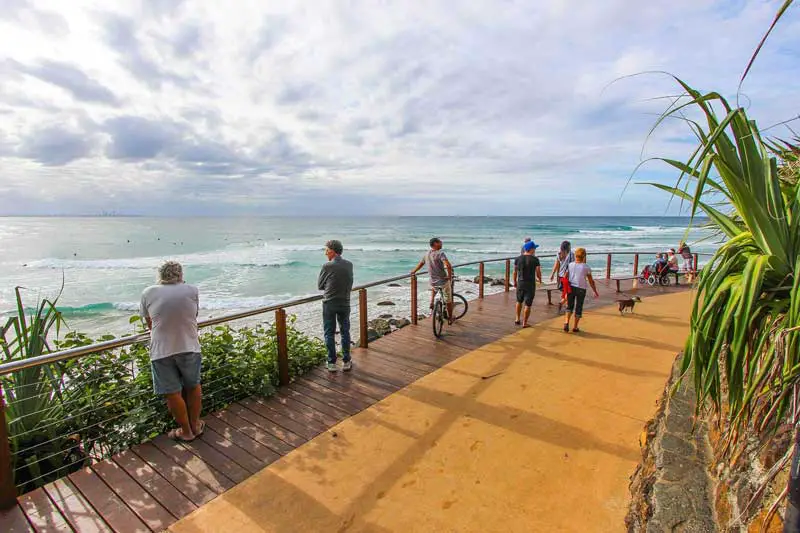
The Gold Coast Oceanway is a 36 kilometre network of pathways along beaches from the Gold Coast Seaway (The Spit) to the Point Danger Lighthouse (Coolangatta). The pathways provide healthy and environmentally-friendly ways for pedestrians and cyclists to explore the renowned beaches of the Gold Coast. The Oceanway provides access to a wide range of coastal environments including spectacular coastal vistas, beaches, headlands, mangroves, dunes and Littoral Rainforest.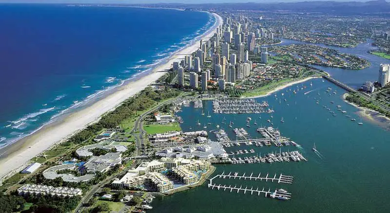
Main Beach and The Spit
North of Surfers Paradise Beach is Main Beach. At the expanse of sand known as ‘Narrow Neck’ an artificial reef has been constructed to protect it from heavy surf. Continuing north are the historic Main Beach bathing pavilion, the Southport Surf Life Saving Club on Macarthur Parade, then the lengthy narrow promontory known as The Spit. Seaworld Drive extends north all the way along The Spit, past the Sheraton Mirage Hotel and Sea World.On the eastern side of Seaworld Drive is an extensive foreshore greenery that extends all the way along The Spit. Most of it is known as Philip Park, which is crisscrossed by walking paths. There are two parking areas just south of Sea World with nearby barbecue facilities. South of the Sheraton is Hollindale Park, which has more walking tracks, public toilets, public telephones and there are picnic facilities at the southern end of Seaworld Drive. In the north-western corner of The Spit is Doug Jennings Park and, opposite, extending 500 metres out into the ocean, is a jetty beloved of anglers.
There are three boat ramps facing The Broadwater, on the western side of The Spit: the southernmost is on Pelican Beach, adjacent the jetty by the corner of the Gold Coast Highway and Waterways Drive; the second is adjacent the marina at the southern end of Seaworld Drive, and the third is on the northern side of Sea World, off Muriel Henchman Drive. There is a yacht club at the southern marina and there is another marina behind the Mirage Hotel with water police adjacent. For information on foreshore facilities along the western side of The Spit, north along The Broadwater and along the inland waterways, see entry on Southport.
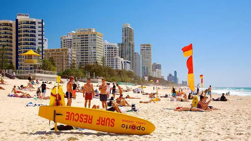
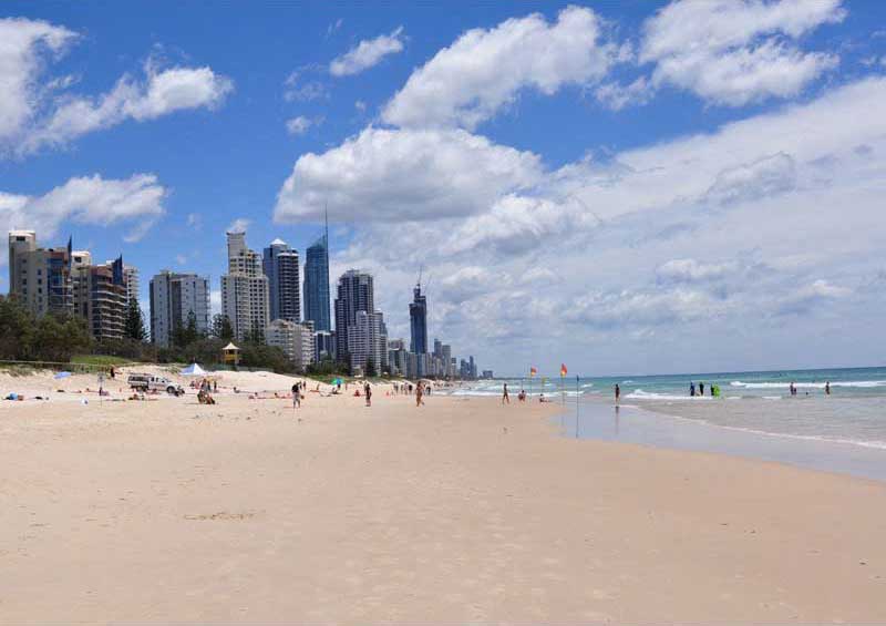
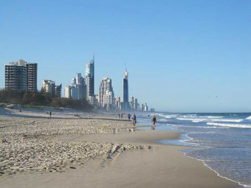
Surfers Paradise
Surfers Paradise Beach itself offers free volleyball and there are craft markets every Friday night on the adjacent Esplanade, as well as two surf lifesaving clubs – in Hanlan St and Thornton St. It is an oft-voiced criticism of Surfers Beach that The Esplanade and its high-rise development encroach almost right to the edge of the beach, leaving very little foreshore greenery to act as a physical, aesthetic and psychological buffer against the ostentatious and imposing commerciality and brouhaha of Surfers.There are also a number of facilities along the foreshores of the Nerang River at Surfers. There is a boat ramp just north of Budds Beach, off Paradise Place, a ferry cruise terminal at the end of Cavill Ave which is essentially a shopping strip (there are small parks to either side of the terminal), and a boat ramp near Capri Bridge, off Naples Ave.
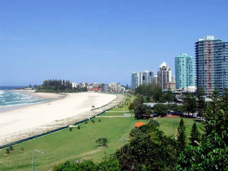
Broadbeach
Immediately south of Surfers is Broadbeach. Pratten Park, on the foreshore adjacent Old Burleigh Road, offers visitors anexpanse of greenery with parking, picnicking, barbecue facilities, the Kurrawa Surf Lifesaving Club (host of the annual Australian Surf Lifesaving Titles) and a footbridge connecting with the mall and the monorail, which circuits back and forth between this point and Jupiters Casino. A second surf club – the Broadbeach SLSC – is located further north in Broadbeach Blvd.There are any number of streetside cafes, along with restaurants and shopping opportunities in the mall and along Surf Parade. A craft market is held on the first and third Sunday of each month and there is a lantern craft market on Friday nights between September and May. There is a boat ramp at Miami Keys (off T.E. Peters Drive) and a huge Pacific Fair shopping complex, complete with cinema, six major stores and more than 250 specialty shops. It is situated between the Nerang-Broadbeach Rd, Sunshine Blvd and the Gold Coast Highway.
Kurrawa Beach
For those who enjoy unwinding at the beach, Broadbeach offers some of the most beautiful coastline in the area. Less crowded than the beaches to the north, Kurrawa Beach is the perfect attraction for anyone wanting to just relax and soak up some sun. Only minutes from the center of town, Kurrawa Beach is easily accessible by foot or car. This is a patrolled beach with lifeguards and designated safe swimming areas between flags, as well public showers, a surf club and even an outdoor workout gym. There are picnic tables, barbecue grills and a great playground for kids, making this a wonderful place for families to spend the day.
Mermaid Beach
Mermaid Beach is both the suburb immediately south of Surfers and the actual beach it is named after. Like most of the Gold Coast beaches it is popular and crowded in season. Like Surfers it has no real recreational foreshore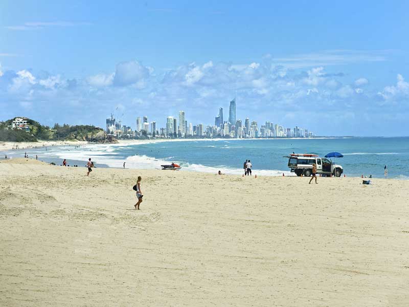
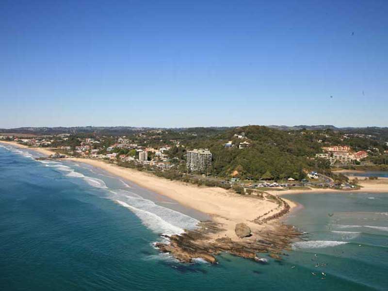
Burleigh Heads
Burleigh Beach is well known as a fine surfing venue and, as such, it hosts major international surfing tournaments.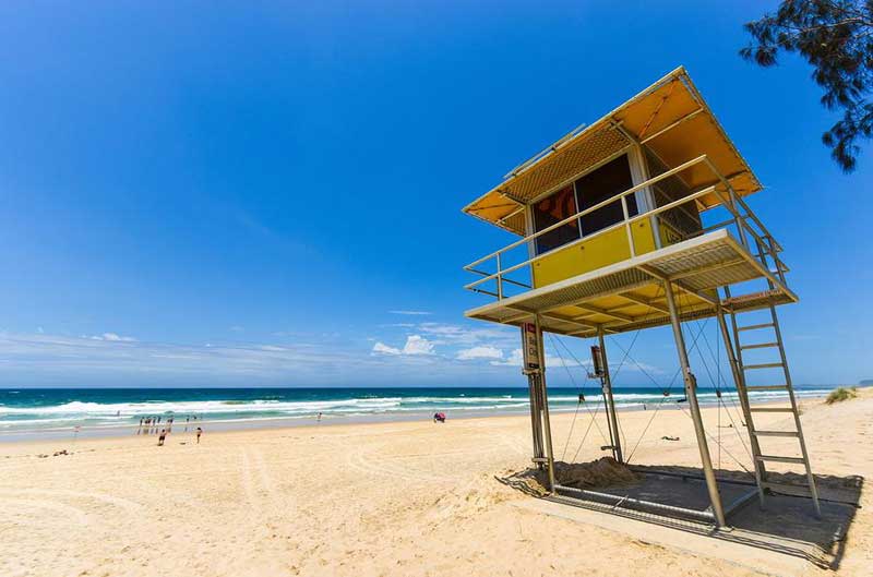
Nobby Beach
Nobby Beach, immediately north of Burleigh Heads, has a surf lifesaving club with picnicking facilities opposite Lavarack Rd. At the southern end of Nobby Beach there is a strip of foreshore parkway (missing at the northern end) and a caravan park at the southern end of Marine Parade, which follows the foreshore. Picnic facilities are located adjacent Marine Parade, almost opposite the end of Santa Monica Rd.South Nobby marks the end of Nobby Beach and to its south is North Burleigh Beach. A narrow strip of foreshore parkland, decorated with pandanus palms and pines, abuts the beach on one side and The Esplanade on the other. It extends southwards along Burleigh Beach to the actual headland (after which the suburb is named) at the mouth of Tallebudgera Creek. There are barbecue, picnic and parking facilities at several points, and toilets opposite Second Ave. There is a surf lifesaving club opposite Kratzman Ave and another at the southernmost end of the beach, on Goodwin Terrace, which runs past an ocean pool, more toilets and picnic/barbecue facilties, to a parking area at the northern end of the National Park.
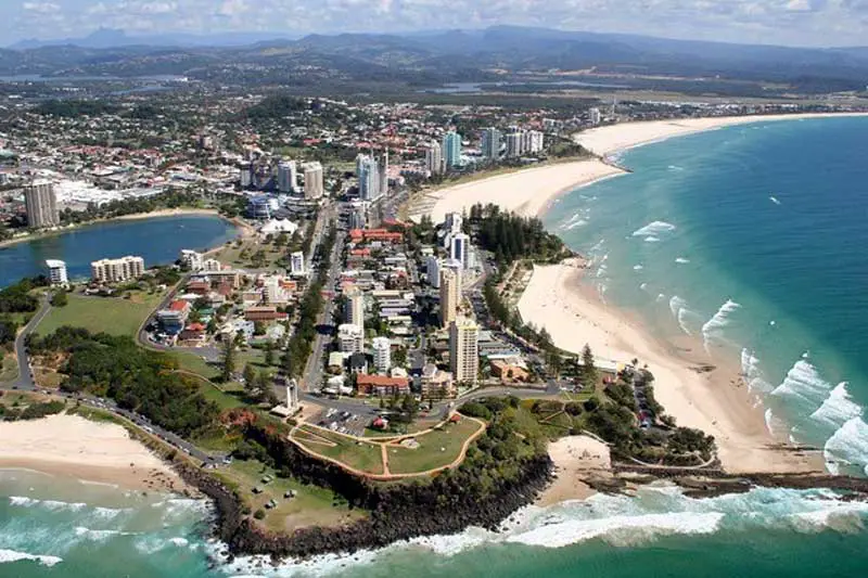
Coolangatta Beach
Coolangatta Beach and Greenmount Beach form a continuous strand backed by some foreshore greenery with picnic tables, a public telephone and markets along the foreshore on the second Sunday of the month. Greenmount forms the eastern end of the beach and Coolangatta the west. However, both have their own surf lifesaving clubs: the Coolangatta Beach club is on the foreshore, off Marine Parade.To the immediate east of Greenmount Beach is a small rocky elevated headland topped by Pat Fagan Parkwhich offers fine views and picnic tables.
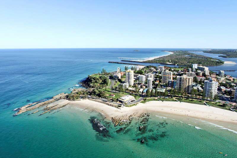
Rainbow Bay
On the eastern side of a headland is Rainbow Bay which is a smallish cove, although it has a surf lifesaving club and toilets. On its eastern side is Snapper Rocks, at which point the coast veers southwards again, opening out to Duranbah Beach which is a noted surfing location.Behind the beach is a foreshore area atop the rugged headland of Point Danger (named by Lt. James Cook in 1770), on which sits a lighthouse (at the end of Boundary St which forms part of the state border) that lays claim to being the first in the world to experiment with laser technology but the experiment – carried out in 1971 – proved unsuccessful and it returned to the more conventional mirrors, magnifying glass and powerful electric lamps. There are picnic spots and a walk along the cliff-edge. Dolphins can sometimes be seen out to sea. There are views of the coastline from Surfers Paradise to Byron Bay.
Kirra Beach
At the western end of Coolangatta Beach is Kirra Point with its long breakwater forming a protective barrier for Coolangatta Beach. On the western side of Kirra headland is Kirra Beach which is the district’s most notable surfing area, offering challenges for the expert, and smaller waves closer in to shore for beginners who can hire a long board for the day.From this point the coastline veers in a north-westerly direction. The beach is continuous between here and the small mouth of Flat Rock Creek, although its name changes from Kirra Beach to North Kirra Beach to Bilinga Beach to Tugun Beach. There is a narrow foreshore area which slims to a sliver then virtually disappears at Bilinga Beach.
Each of these four designated beaches has its own surf lifesaving club: the Kirra Beach club is adjacent Marine Parade in Coolangatta, with toilets and public telephones nearby; the North Kirra club is on Pacific Parade, in Bilinga, with toilets and picnic tables nearby; the Bilinga Beach club is next to Golden Four Drive, in Bilinga, and the Tugun club is on O’Connor St, in Tugun, with toilets and telephones adjacent.