


There is
only one active volcano on Australian
Territory – Big Ben – located on Heard Island, an Australian
territory in the southern Indian Ocean.
Big Ben has erupted as recently as 2001.
Continental Australia is travelling
northward and has been drifting over a hot
spot that at present is believed to be
under Bass
Strait. The features detailed here are significant
examples but not neccessarily all the
examples of extinct or dormant volcanoes
in Australia. They have been included
either for their geological
significance.
Vic/SA southern district
The volcanic plains of the Western District of Victoria are recent in age and illustrate a variety of well preserved terrestrial volcanic landforms. Local aboriginal legends record the eruption of some of the volcanoes of the area. The volcanic plains of the western Victoria have numerous conical hills that comprise scoria cones. The Sugarloaf is a classic example that is found near Mt Leura. These scoria cones are produced by fire-fountaining and where vesicular pyroclastics are deposited around the vent. The district also features numerous maars.

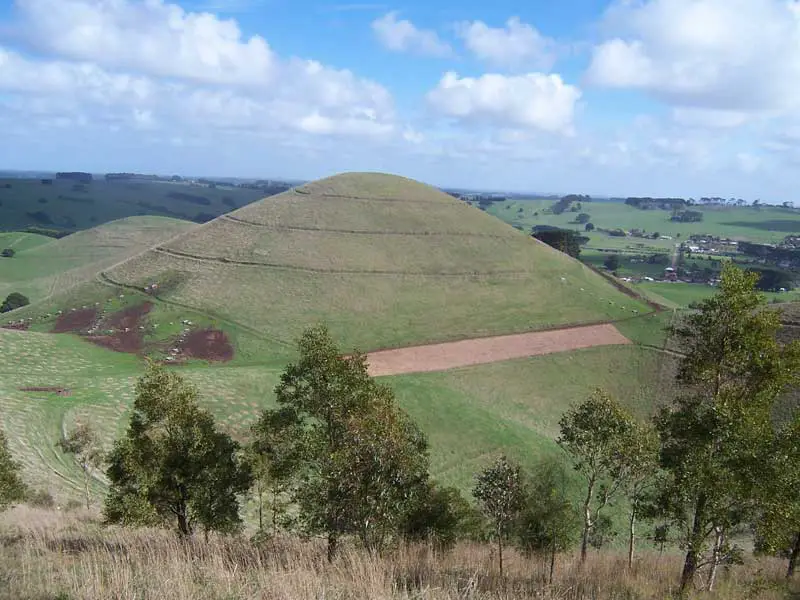
Mount Sugarloaf, Camperdown
The volcanic features in the Camperdown district in Victoria were formed within the last 20,000 years making them some of the youngest of their type in Victoria and the whole of Australia for that matter. The basement rocks of the district are mostly marine sediments laid down in the later part of the Miocene Period roughly 15 to 20 million years ago.
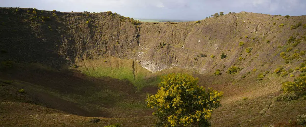
Camperdown was established at the foot of Mount Leura and Mount Sugarloaf which are actually part of a much larger volcanic complex known as the Leura Maar. The Leura Maar is a shallow oval shaped depression about 2.5 kilometres long, 1.7 kilometres wide and up to 50 metres deep which originated from a series of major volcanic explosions, possibly 22,000 years ago. The Leura Maar may have been formed in just a few months.
Inside the Leura Maar are many younger eruption points marked by craters and mounds of scoria. These are said to be nested inside the maar. Leura therefore is a nested marr. These younger volcanic features include Mount Leura, Mount Sugarloaf, the deep crater which separates the two mountains, and several smaller craters and mounds in the southern part of the maar. Although not as explosive as the activity which produce the maar the growth of Mount Leura and Mount Sugarloaf would have provided a grand spectacle, similar to the present day activity of volcanoes on the island of Hawaii.
Mount Sugarloaf is basically a steep conical accumulation of scoria rising as a high point on the same crater rim as Mount Leura. It formed as a result of perhaps sever, months of lava fountaining from the same point in the crater continuously building an ever increasing pile of scoria. Scoria volcanoes can achieve height quickly and Mount Leura could have been built in less that 20 years.
Organ Pipes (Vic)
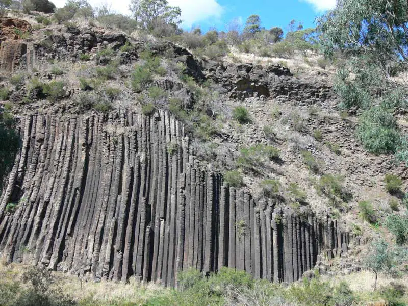
The Organ Pipes near Sunbury, north-west of Melbourne, are a spectacular example of basaltic columns. Rising to 20 metres in height, the Pipes are up to one metre across and are hexagonal in cross section. Very few of the columns are straight or vertical; a number of the smaller columns around the Pipes are very much tilted, some almost horizontal. The Organ Pipes were so named because of their resemblance to a pipe organ.
For about 20 million years, volcanic activity was widespread in south western Victoria. The lava covering the Organ Pipes area is a recent flow, only about a million years old. The source of this lava was probably the group of low volcanic hills which may be seen about 6 km to the north of the park. These volcanoes are now extinct, or at least dormant.
Although each individual lava flow was quite thin, the plain was built up by successive flows from many volcanoes over a wide area. The lava plain extends from the foot of Mount Macedon to Williamstown and Laverton and is part of the third largest lava plain in the world, that of the western district of Victoria.
The carpark at Organ Pipes National Park is on the remains of a very weathered scoria cone. At about the same time as the larger volcanoes to the north were producing lava (800,000 to a million years ago) this cone ejected molten rock in a series of explosions, producing scoria. Scoria is brownish in colour and is filled with air-pockets.
Five hundred metres upstream of the Organ Pipes, overhanging the northern bank of the stream, is a large outcrop of basalt with a radial array of columns resembling the spokes of a giant wheel. It was formed by the radial cooling of a pocket of lava, probably in a spherical cave formed from an earlier lava flow.
Mount Napier (Vic)
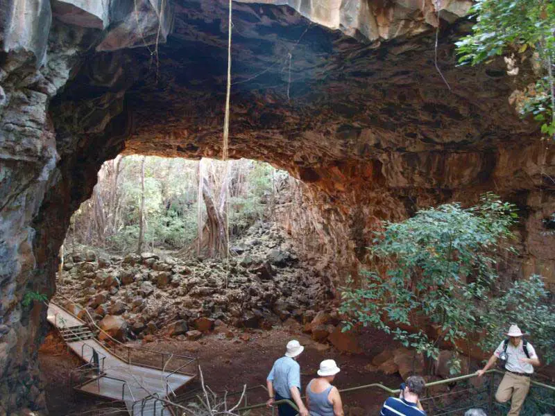
Believed to be one of the youngest volcanoes in Australia, Mount Napier is a composite lava shield with a superimposed scoria cone. The cone rises 150 m above the surrounding plains to an elevation of 440 m, making it the highest point on the Western District Plains of Victoria. It erupted about 5,290 BC. The main crater has a spatter rampart 30 m long and 15 m high. The crater is about 50 m in diameter and 20 m deep. In the Harman Valley, lava from Mount Napier flowed for over 15 km to a depth of over 30 m. The entrance to Bridge Cave in the Harman Valley flow of Mount Napier is one of a series of aligned lava tubes, presumably formed from the same flow. The lava tubes descend to over 20 m below the surface of the Harman Valley.
Mt Gambier (SA)
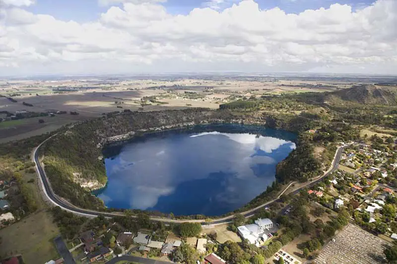
The famous Blue Lake of Mt. Gambier in South Australian was formed out of a volcanic crater, which last erupted 5000 years ago, making it the youngest group of volcanoes on the continent of Australia. The Blue Lake mysteriously turns from a winter grey colour to a brilliant azure blue in the month of November, lasting till April. This has been a mystery for many, many years, until it was finally scientifically explained to be attributed to a special algae that grows in the lake. The lake is one of four similar lakes near the town of Mt Gambier which supply the town with its water as well as attracting tourists to the productive farming communities in South Australia’s south-east corner.
The volcanic plains of the Western District of Victoria are recent in age and illustrate a variety of well preserved terrestrial volcanic landforms. Local aboriginal legends record the eruption of some of the volcanoes of the area. The volcanic plains of the western Victoria have numerous conical hills that comprise scoria cones. The Sugarloaf is a classic example that is found near Mt Leura. These scoria cones are produced by fire-fountaining and where vesicular pyroclastics are deposited around the vent. The district also features numerous maars.
Mount Sugarloaf, Camperdown
The volcanic features in the Camperdown district in Victoria were formed within the last 20,000 years making them some of the youngest of their type in Victoria and the whole of Australia for that matter. The basement rocks of the district are mostly marine sediments laid down in the later part of the Miocene Period roughly 15 to 20 million years ago.
Camperdown was established at the foot of Mount Leura and Mount Sugarloaf which are actually part of a much larger volcanic complex known as the Leura Maar. The Leura Maar is a shallow oval shaped depression about 2.5 kilometres long, 1.7 kilometres wide and up to 50 metres deep which originated from a series of major volcanic explosions, possibly 22,000 years ago. The Leura Maar may have been formed in just a few months.
Inside the Leura Maar are many younger eruption points marked by craters and mounds of scoria. These are said to be nested inside the maar. Leura therefore is a nested marr. These younger volcanic features include Mount Leura, Mount Sugarloaf, the deep crater which separates the two mountains, and several smaller craters and mounds in the southern part of the maar. Although not as explosive as the activity which produce the maar the growth of Mount Leura and Mount Sugarloaf would have provided a grand spectacle, similar to the present day activity of volcanoes on the island of Hawaii.
Mount Sugarloaf is basically a steep conical accumulation of scoria rising as a high point on the same crater rim as Mount Leura. It formed as a result of perhaps sever, months of lava fountaining from the same point in the crater continuously building an ever increasing pile of scoria. Scoria volcanoes can achieve height quickly and Mount Leura could have been built in less that 20 years.
The Organ Pipes near Sunbury, north-west of Melbourne, are a spectacular example of basaltic columns. Rising to 20 metres in height, the Pipes are up to one metre across and are hexagonal in cross section. Very few of the columns are straight or vertical; a number of the smaller columns around the Pipes are very much tilted, some almost horizontal. The Organ Pipes were so named because of their resemblance to a pipe organ.
For about 20 million years, volcanic activity was widespread in south western Victoria. The lava covering the Organ Pipes area is a recent flow, only about a million years old. The source of this lava was probably the group of low volcanic hills which may be seen about 6 km to the north of the park. These volcanoes are now extinct, or at least dormant.
Although each individual lava flow was quite thin, the plain was built up by successive flows from many volcanoes over a wide area. The lava plain extends from the foot of Mount Macedon to Williamstown and Laverton and is part of the third largest lava plain in the world, that of the western district of Victoria.
The carpark at Organ Pipes National Park is on the remains of a very weathered scoria cone. At about the same time as the larger volcanoes to the north were producing lava (800,000 to a million years ago) this cone ejected molten rock in a series of explosions, producing scoria. Scoria is brownish in colour and is filled with air-pockets.
Five hundred metres upstream of the Organ Pipes, overhanging the northern bank of the stream, is a large outcrop of basalt with a radial array of columns resembling the spokes of a giant wheel. It was formed by the radial cooling of a pocket of lava, probably in a spherical cave formed from an earlier lava flow.
Believed to be one of the youngest volcanoes in Australia, Mount Napier is a composite lava shield with a superimposed scoria cone. The cone rises 150 m above the surrounding plains to an elevation of 440 m, making it the highest point on the Western District Plains of Victoria. It erupted about 5,290 BC. The main crater has a spatter rampart 30 m long and 15 m high. The crater is about 50 m in diameter and 20 m deep. In the Harman Valley, lava from Mount Napier flowed for over 15 km to a depth of over 30 m. The entrance to Bridge Cave in the Harman Valley flow of Mount Napier is one of a series of aligned lava tubes, presumably formed from the same flow. The lava tubes descend to over 20 m below the surface of the Harman Valley.
The famous Blue Lake of Mt. Gambier in South Australian was formed out of a volcanic crater, which last erupted 5000 years ago, making it the youngest group of volcanoes on the continent of Australia. The Blue Lake mysteriously turns from a winter grey colour to a brilliant azure blue in the month of November, lasting till April. This has been a mystery for many, many years, until it was finally scientifically explained to be attributed to a special algae that grows in the lake. The lake is one of four similar lakes near the town of Mt Gambier which supply the town with its water as well as attracting tourists to the productive farming communities in South Australia’s south-east corner.
- More
- More
- More
- More
- More
- More
- More
- More
- More
- More
- More
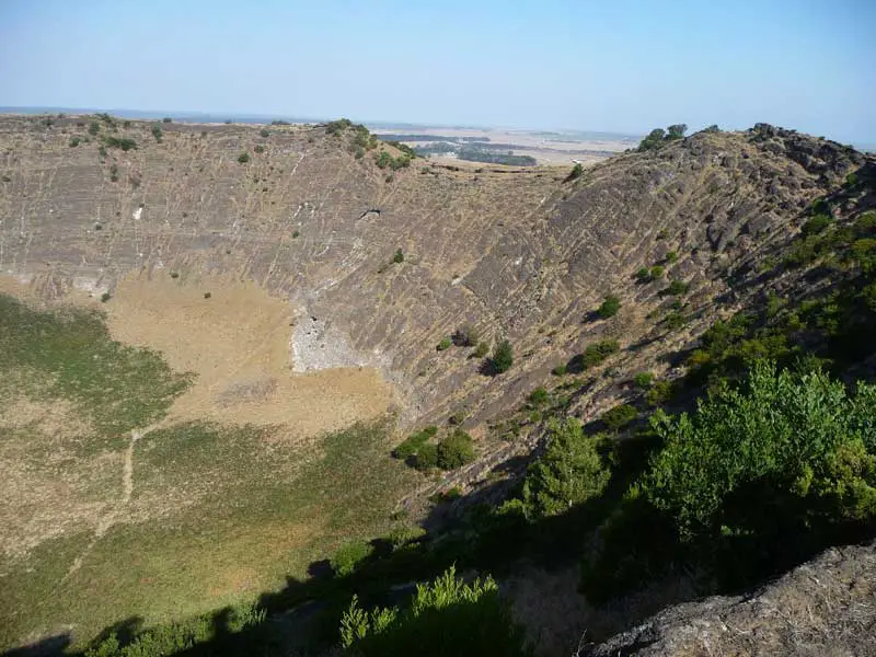
Mount Schank is a volcanic cone formed by explosive eruptions, pyroclastic flows and lava flows. Mount Schank is a highly prominent volcanic cone located 17 kilometres south of Mount Gambier on route to Port MacDonnell in South Australia. It is generally regarded as the youngest volcano in Australia and is believed to have been active as recently as 2,000 years ago. It is thus still classified as dormant and not extinct. A State Heritage area of national significance, Mount Schank is 158 metres in height, it has a walking track to the crater rim with views over the surrounding district. The track continues down into the central core of the volcano.
Elevation: 1,011 metres.
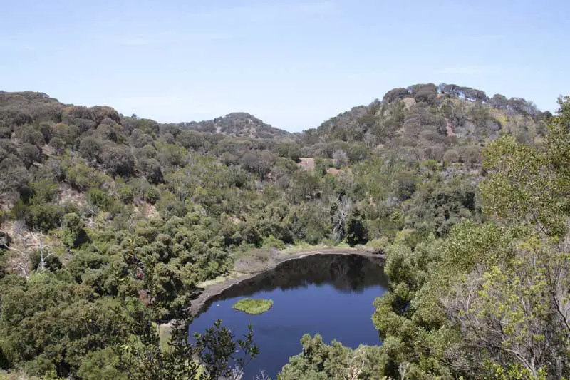
Tower Hill State Game Reserve near warnnambool, Victoria, sits snugly inside an extinct volcano, a beautiful haven for wildlife with koalas, emus, kangaroos and many species of waterbirds roaming freely. Located only 15 kilometres west of Warrnambool, Tower Hill is popular with people of all ages for picnics, bushwalking and wildlife watching. It formed some 25,000 years ago in a violent volcanic eruption that created a funnel shaped maar – later filled by a lake – and the islands.
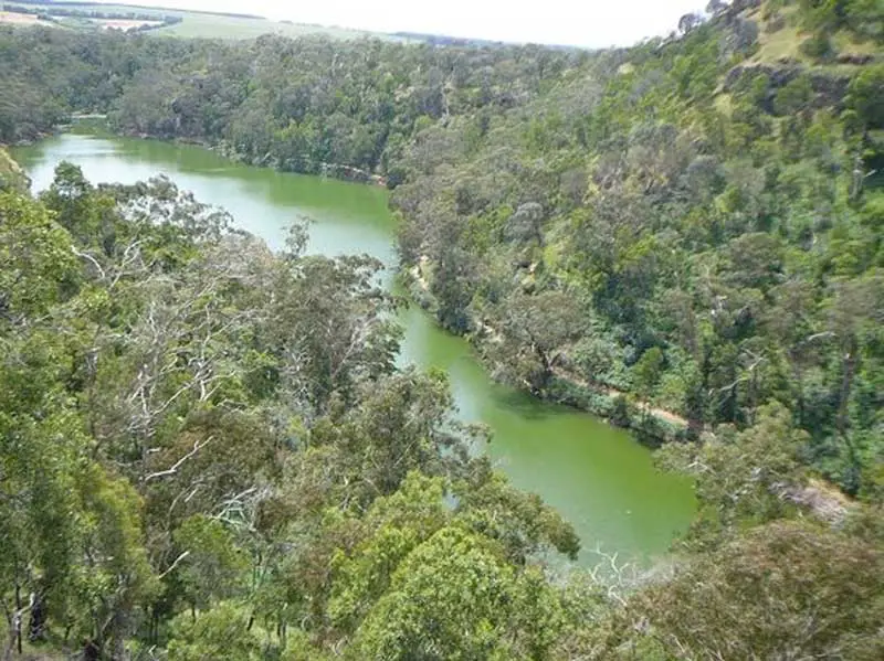
Mt Eccles is believed to be one the most recent volcanic sites in western Victoria. Lake Surprise now fills the crater and is fed by underground springs. It is believed that three craters combined to form the depression shown. Boulders of vesicular basalt (which contains numerous gas holes) are seen near the lookout tower. Basalt is believed to have flowed from here to the sea, some dozens of kilometres away. Scoria, a rock formed from lava thrown into the air, also occurs; this rock has been quarried from the eastern slope. This attractive national park offers walks around the crater rim and lake shore, and to nearby lava canals and caves. In a relatively small area many features illustrating relationships between rock characteristics and resultant landforms can be found. Bird life is prolific in the crater vegetation.
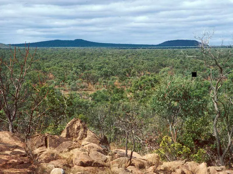
During the Tertiary period of geological time (65-2 million years ago), eastern Australia was the scene of extensive volcanic activity, which left as its legacy large areas of basalt. The various volcanoes did not erupt all at the same time; activity was spread over a long period, from at least 32 million years to as little as 4000 years ago. The volcanic magma, at least for the larger shield volcanoes, is believed to have been generated at a “hot-spot” in the Earth’s mantle, deep beneath the crust. The age of these larger volcanic centres seems to be related to the drift of the Australian continent northwards towards New Guinea, which has been going on since the early Tertiary. As the continent passed over the stationary hotspot, basalt lavas were periodically forced up through weaknesses in the crust. The ages of the volcanoes decrease progressively to the south by the amounts expected from the speed of the northward drift of the continent (about 65mm per year). Southeast Queensland apparently passed over the hot-spot about 25-23 million years ago.
Undara volcano erupted 190,000 years ago and spewed 23 cubic kilometres of molten lava onto the surrounding country. Streams of sulphurous lava flowed over the land, spilling out like boiling treacle into various creek beds and other depressions. The surface soon cooled and crusted but the molten lava inside continued to flow, leaving behind the huge hollow pipes, the unique lava tubes. From the air, these rich canopies create a distinct path following the lava flow that occurred 190,000 years ago, when the Undara Crater, one of many on the McBride Plateau, erupted.
Kinrara erupted in the last 20,000 years, making it the youngest volcano in the McBride Volcanic Province (see Undara volcano). The cone is 400 m in diameter. The steep crater is 300 m in diameter and 60 ) deep. It contains an inner crater. Older basalt lava on which the Kinrara cone was built is exposed in the inner crater. Kinrara is made of basanite lavas.
Toomba volcano is one of the youngest in the Nulla Volcanic Province. The province is about 150 km west of Townsville and just east of the crest of the Great Dividing Range. At least 45 volcanic centres have been active in the province during the last 5.2 million years. The Toomba flow is well exposed at Basalt Corner where the Burdekin River has cut under the flow. The flow was confined in the Burdekin River valley but there is no evidence it interacted with water. The flow was probably emplaced during the dry season. The Toomba flow is about 13,000 years old.
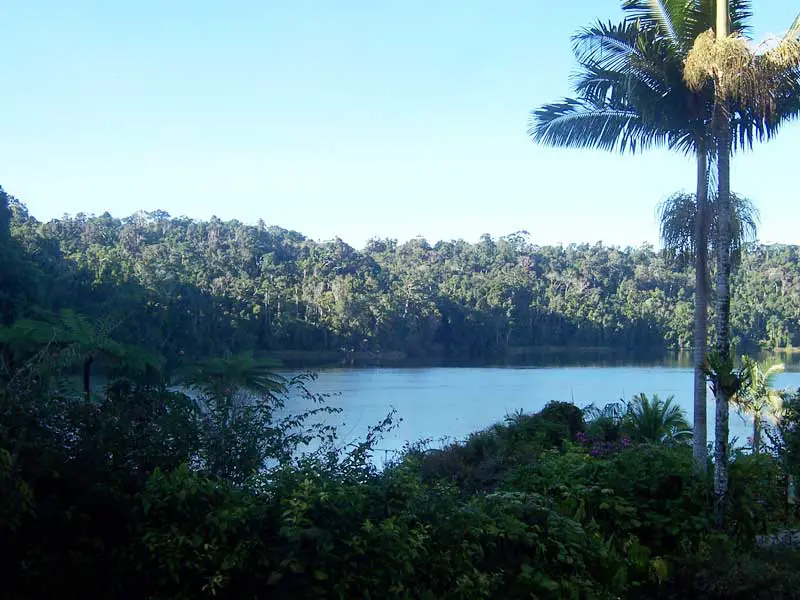
The Atherton Tablelands encompass picturesque villages like Yungaburra and Mareeba, the world’s most photographed waterfall at Millaa Millaa and other wonders of nature like the Curtain Fig, which needs to be seen to be believed. The surrounding countryside is influenced by extinct volcanoes and some spectacular rocks dotted through crisp clear mountain streams. The Lakes which make this area famous include Lake Eacham and Lake Barrine, and Tinaroo Dam. Yungaburra, surrounded by extinct volcanoes, crater lakes, waterfalls, and world heritage rainforest is an area of outstanding beauty. Known as the gateway to the Tablelands, Yungaburra is set 720 metres above sea level and 70 km inland from Cairns.
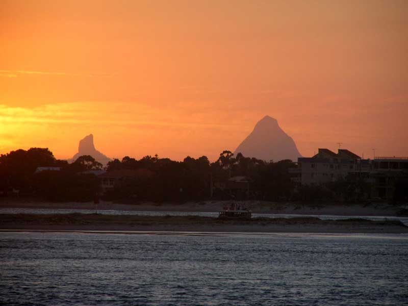
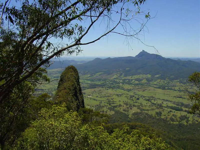
These mountains in the hinterland of Queensland’s Sunshine Coast are the remnant cores of volcanoes active about 25 million years ago. The mountains, with their distinctive peaks ranging in height from 100 to 556 metres, were formed as molten rock was forced out of vents from within the earth. As these flows of magma cooled over a period they solidified into conal shapes of hard rocks. (rhyolite and trachyte). Erosion of the surrounding softer sand stone over millions of years has lowered the ground level to where we live to day. The only testimony to this violent volcanic era are the mountains we see. Mount Beerwah at 556 metres high is the “Mother by legend” and the grandest of all the mountains.
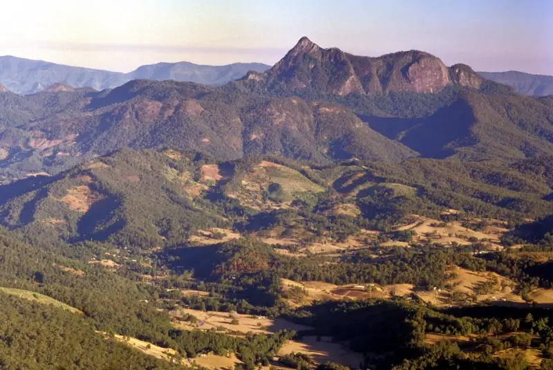
The Bunya Mountains, on the Main Divide north of Toowoomba, are the remains of a broad dome or “shield” shaped volcano which was built from numerous basalt lava flows about 23-24 million years ago. The volcano formed part of a wider area of volcanic activity which extended from the southern Main Range on the NSW border, northwards to Kingaroy and beyond. Other major volcanoes of similar age in the region include the Focal Peak Volcano near Mount Barney, and the well known and much larger Tweed Volcano (see below) whose remains form the Lamington Plateau and the Border Ranges.
The first lavas of Bunya Mountains flowed out over a land surface consisting of eroded older rocks (sedimentary rocks of Mesozoic age (200-180 million years) and some even older Palaeozoic rocks). The lava flows show a generally outward radial slope from the summit region, and their sources are assumed to have been either fissures or a number of small vents in or buried beneath the summit ridge. No craters remain visible. At Mount Kiangarow, about 700m of basalt are estimated to be present, suggesting the original volcano was more than 1100m above sea level.
This now extinct volcano and the associated landscape complex has several names in common use. It is referred to as the “Mount Warning Volcano”, “Tweed Volcano”, “Mount Warning Shield Volcano”, the “Tweed Caldera”, the “Tweed/Focal Volcano series”, and in World Heritage literature – the “Border Group” or “Tweed Volcano Group”. The huge size of the Tweed Valley, the caldera (a bowl shaped depression caused by the collapse or erosion of a volcanic cone) of the Mt Warning shield volcano, gives us an inkling of what a monster it was. Today the caldera valley is over 1000 meters deep and has a diameter of over forty kilometres, making it larger even than the famous Ngorongoro Crater in Tanzania.
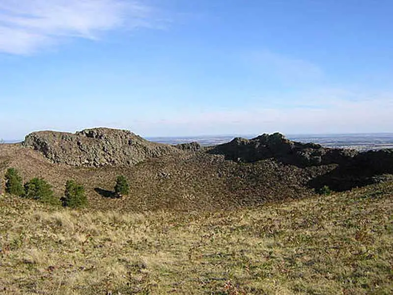
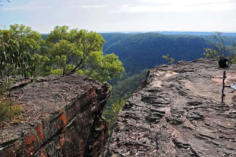
The Warrumbungle Volcano is found in central northwestern NSW. It is one of many sites associated with the former ‘hot spot’ volcanic activity of eastern Australia. The volcanic rocks were intruded, extruded and deposited over sedimentary rocks about 17-13 million years ago. The basement, Pilliga Sandstone, has been exposed by Spirey Creek’s downward erosion through relatively soft pyroclastic rocks. The Breadknife, a trachyte dyke, is the best known landform of the Warrumbungles. It formed when magma was intruded vertically into volcanic tuff and breccia, and set into a hard, narrow mass. Crater Bluff is a ‘classic’ volcanic plug (or neck) of hard trachyte and its faces are used regularly for rock climbing.
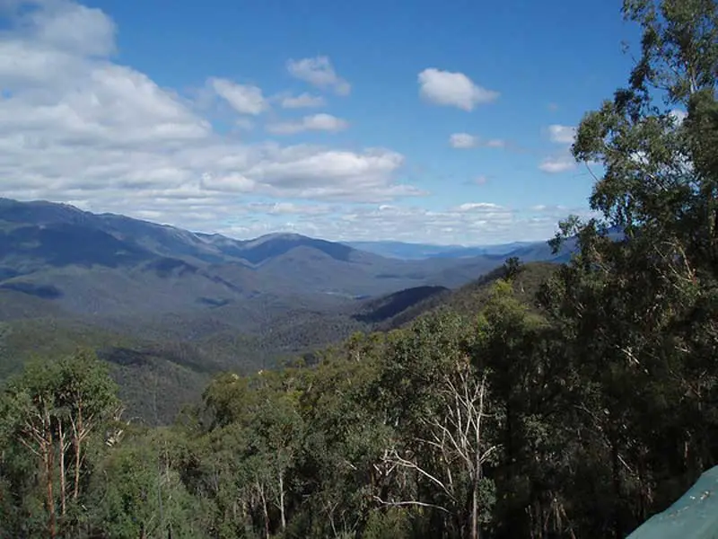
The Monaro Volcanic region in south eastern New South Wales is an ill-defined area extending roughly from Canberra in the north to the Victorian Border in the south. The Snowy Mountains form the western boundary and the coastal Kybean range forms the eastern limits. Covering 1.6 million hectares, the Monaro includes the headwaters of the Snowy and Murrumbidgee rivers. At least 630 cubic km of lava and pyroclasts were erupted during the 20 million-year long history (57.5 – 34.0 million years ago) of the region. Erosion has cut deeply into the volcanic rocks. In some areas 100-200 m of material has been removed from the top of the volcanic province. The region is characterized by broad volcanic plains separated by flat-topped hills made of stacks of lava flows and round-topped hills centered on volcanic plugs.
The Monaro has unique geographical features – its elevation of 800-1000 metres above sea level and its location in the lee of the Snowy Mountains. The topography ranges from large river valleys to alpine and sub-alpine regions of the Snowy Mountains. This includes parts of tablelands and upper slopes that run along the spine of the Great Dividing Range. Also part of the area is the Monaro plains, which is an elevated plateau. The Brothers (right) are excellent examples of the round-topped hills produced by deep weathering of volcanic plugs. They are one of the most prominent landmarks in the Monaro Volcanic Province.
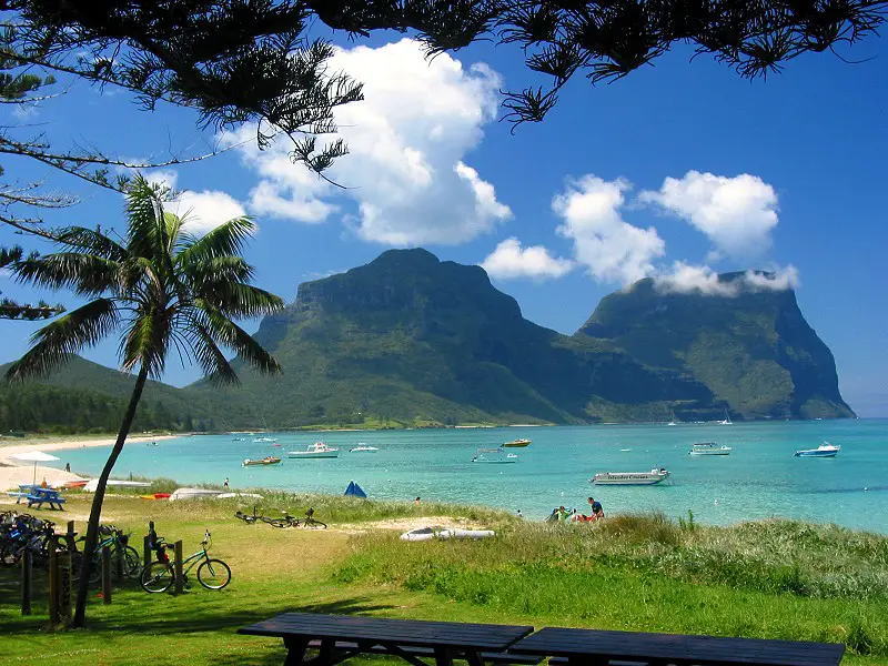
Lord Howe Island is the erosional remnant of a 6.9 million-year old shield volcano. Mount Gower and Mount Lidgbird (777 m) dominate the south end of the island. The island is 600 km east of the continent of Australia and near the boundary between the Lord Howe Rise and the Tasman Basin. The Lord Howe Rise is made of continental crust that was rafted eastward as volcanism at a mid-ocean ridge formed new seafloor and opened the Tasman Basin. Seafloor spreading was active from 80 to 60 million years ago. The Lord Howe seamount chain, defined by coral-capped guyots, continues to the north for 1000 km and is probably the result of the Australia plate moving northward over a stationary hot spot. The Tasman Basin is greater than 4,000 m deep.
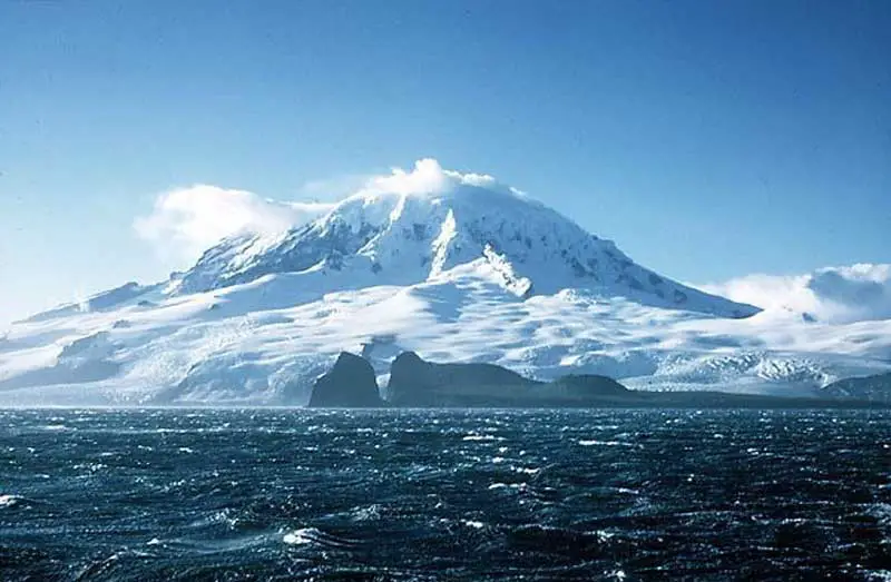
Heard Island, in the southern Indian Ocean, is the location of the only active volcano in Australian territory. With an area of about 160 square miles (400 sq km), the island is dominated by the magnificent Big Ben massif (2,745 metres), with the volcanically active Mawson Peak. About 85-90% of the island is covered by glaciers and permanent snow despite its relatively modest latitude of 53° S, a testament to the continual foul weather and heavy precipitation of the Southern Oceans. The volcano itself is extremely active, with a historical record of eruptions reaching back to the late 1800’s. The main cone is topped by a broad plateau about 3 miles (5 km) across at about 7500 ft (2300 m), which is an eroded ice-filled caldera breached to the southwest, and the newer summit cone of Mawson Peak rises above this in the western part. A crater about 150 ft (50 m) in diameter is located atop Mawson Peak, and this was observed to have an active lava lake within it in 1986.
Photo: Bruce Hull, Australian Antarctic Division