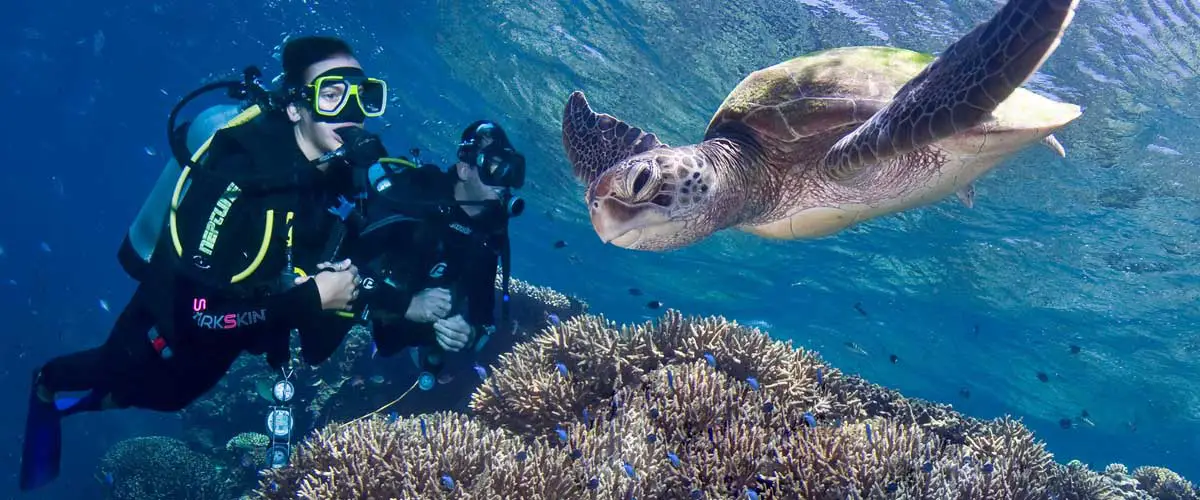
The Great Barrier Reef is one of the largest and most significant reef systems in the world, comprising some 3,400 individual reefs, including 760 fringing reefs, which range in size from under 1ha to over 10,000ha and vary in shape to provide the most spectacular marine scenery on earth. It includes the world’s most extensive stretch of coral reef and is teeming with marine life, all of which is easily accessible to see and experience from a variety of towns and islands along the Queensland coast between Bundaberg in the south to the tip of Cape York in the north.
- More
- More
- More
- More
- More
- More
- More
- More
- More
- More
- More
- More
- More
- More
- More
- More
- More
- More
- More
- More

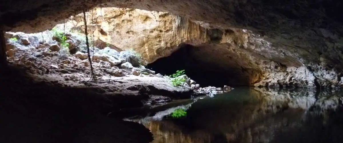
Tunnel Creek, situated 36km east of Windjana Gorge in Tunnel Creek National Park, takes its name from the 750 metre long tunnel carved by flowing water out of the limestone of the Napier Range. Western Australia’s oldest cave system, it is famous as a hideout used late last century by an Aboriginal leader known as Jandamarra. He was killed outside its entrance in 1897.

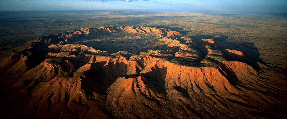
Gosses Bluff is located west of Alice Springs and south of the Macdonnell Ranges, in the arid Missionary Plain in the Northern Territory. The bluff itself is a circular ring of hills 5km in diameter and 200m high, in the centre of a crater. It was formed 142 million years ago by the impact of an asteroid or comet up to 2km in diameter.

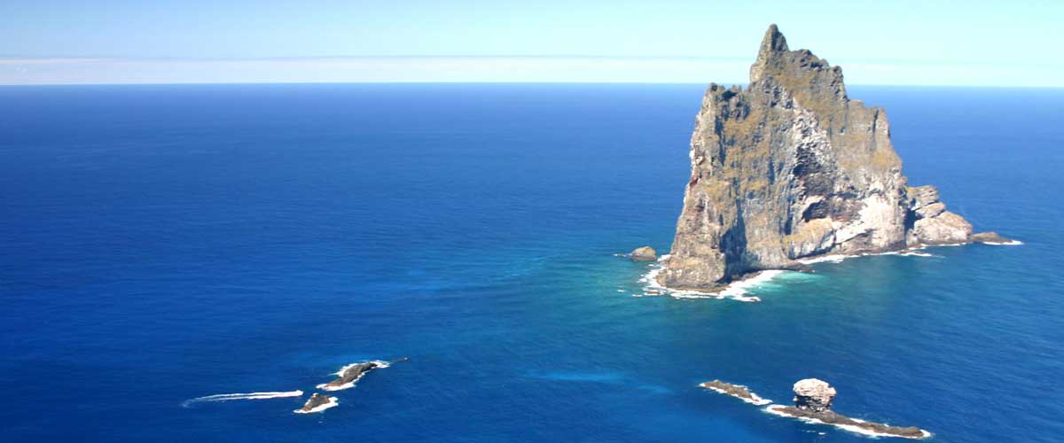
Ball’s Pyramid is the erosional remnants of a shield volcano and caldera that formed about 7 million years ago. Ball’s Pyramid is 20 km (13 miles) southeast of Lord Howe Island. It is 562 m high, while measuring only 200 m across. It is part of the Lord Howe Island Marine Park. The first successful climb to the summit was made on 14th February 1965.

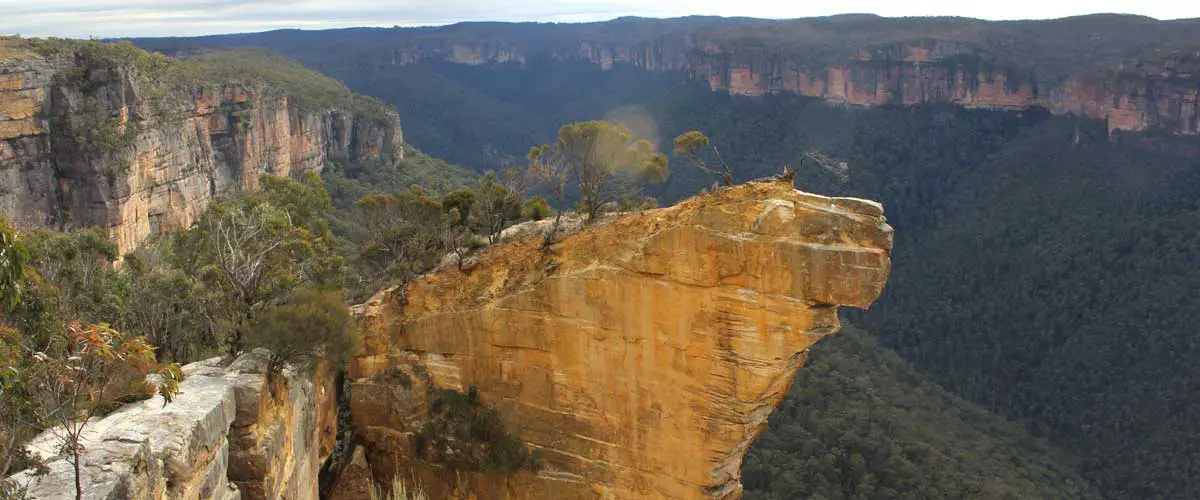
One of the Blue Mountains’ most spectacular lookouts, Hanging Rock is somewhat off the beaten track. Though just 7km from Blackheath, it requires a little dirt road driving, walking and hiking, but the effort is well worth the view both of the rock, or from it if you are game enough to climb out. So, is it really hanging? The answer is yes. The rock is separated from the cliff by a 80cm gap that narrows to a crack way down below.

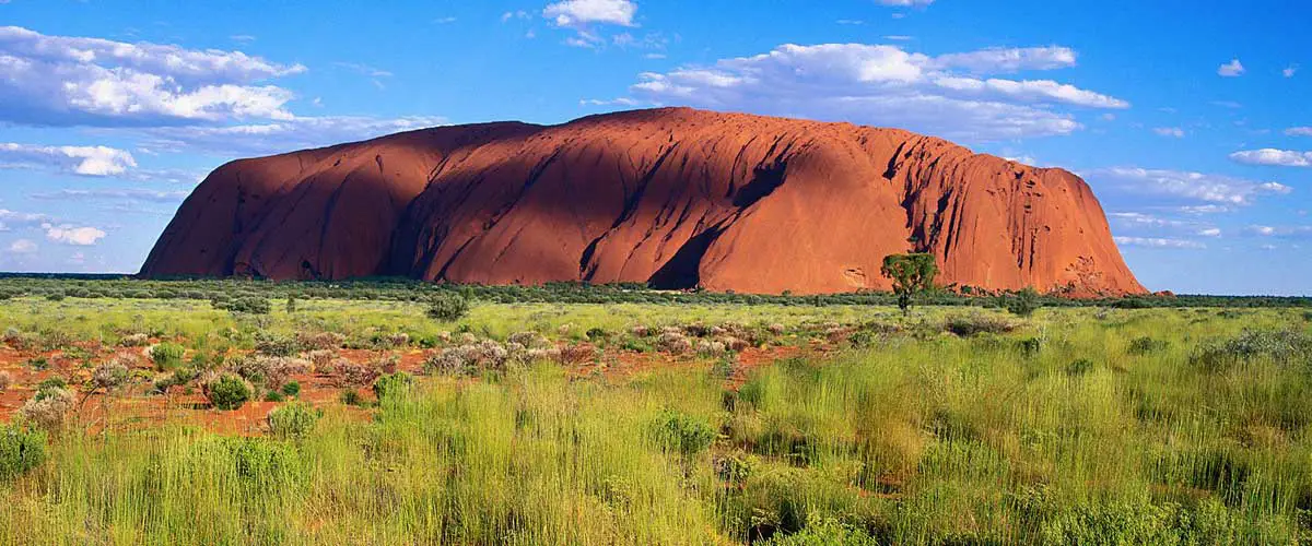
Uluru, also referred to as Ayers Rock, is an iconic sandstone rock formation one of Australia’s most recognisable natural icons. The world-renowned sandstone formation stands 348 metres high (863 metres above sea level) with most of its bulk below the ground, and measures 9.4km in circumference. Uluru is listed as a World Heritage Site.

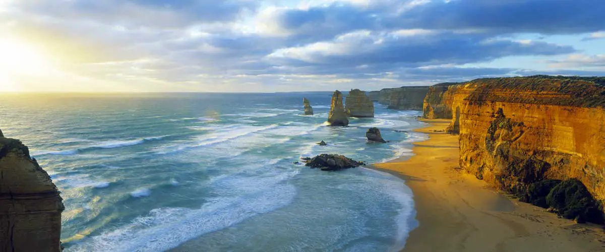
It is the sheer scale of the offshore stacks that make The Twelve Apostles, on Victoria’s Shipwreck Coast, the most photographed features on the Australian coastline. Dusk and dawn provide the best viewing opportunities with opportunity to view penguins from the cliff top viewing area (about 15 – 20 minutes after sunset). 6km west of Princetown.

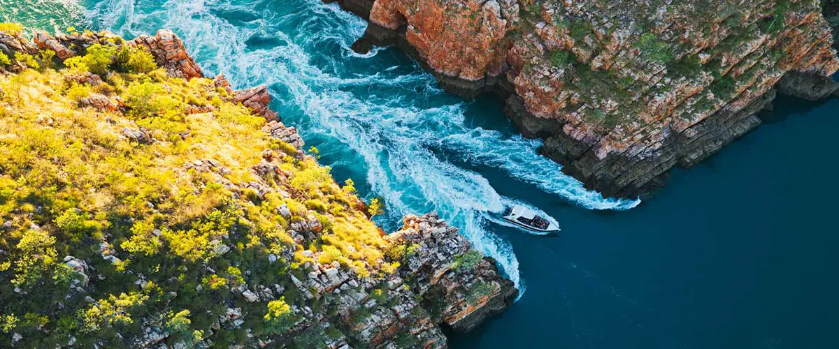
What is described as a horizontal, reversible waterfall at Talbot Bay is one of the most unusual of the attractions of Western Australia’s Kimberley region. The falls are formed by the massive tides in the Buccaneer Archipelago, north of Derby, which rise at such a speed, large volumes of water are trapped behind the rock walls. The water is released again when the tide turns, causing the ‘waterfall’ to operate in reverse.

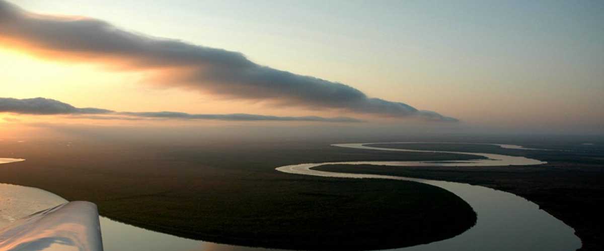
The Morning Glory, a spectacular propagating roll cloud which frequents the sparsely populated southern margin of the Gulf of Carpentaria, is one of the world’s most exotic and interesting meteorological phenomena. Morning Glories are frequently observed during the spring months near dawn over the southern Gulf area in northern Queensland. They often appear in the form of one or more, rapidly advancing, rather formidable roll cloud formations which extend from horizon to horizon in a long arc as far as the eye can see.

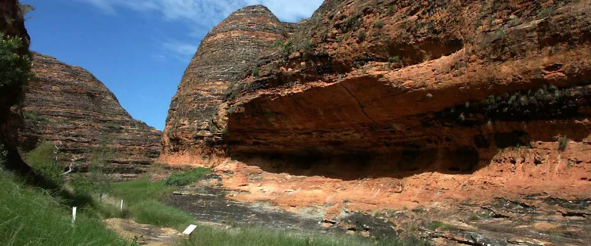
The Bungle Bungle Ranges, contained within Purnululu National Park, is an incredible landscape of tiger-striped, beehive-shaped sandstone domes rising 300m out of the arid landscape, interspersed with deep chasms with palm trees, and long, deep gorges with miniature fan palms adorning the rocks. There are a number of ways to experience the Bungle Bungles. To appreciate the overall aspect of this weird landscape, one has to take to the air. A hike through this landscape with its sandstone domes is unforgettable. There are breathtaking gorges like Cathedral Gorge and Piccaninny Gorge.

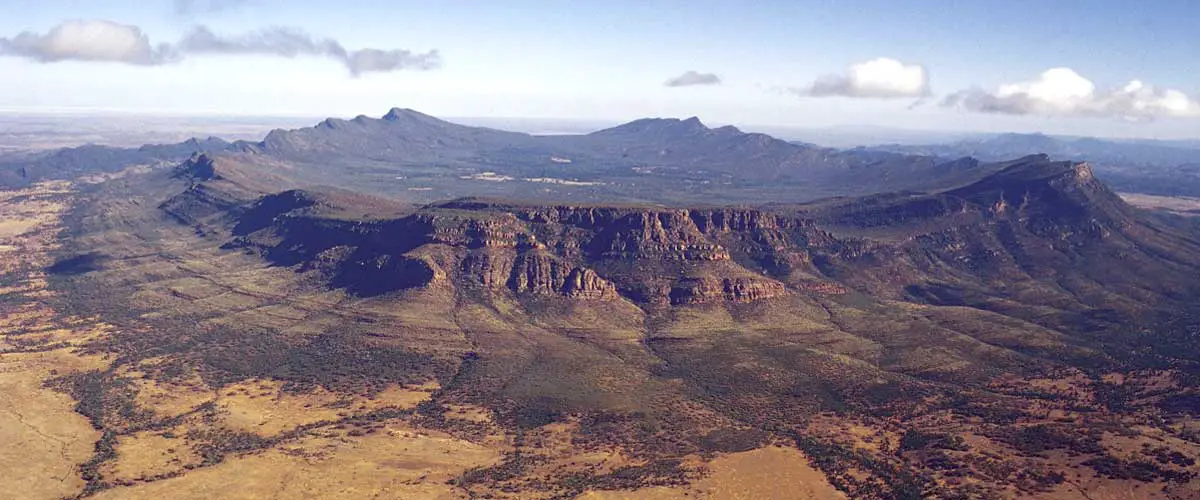
Amidst the vibrant colours of the 800 million-year-old quartzite and limestone outcrop that is the Flinders Ranges lies Wilpena Pound, a natural amphitheatre 17km long and 7km wide. Located 429 kilometres north of Adelaide, SA in the heart of the Flinders Ranges National Park, the Pound is the most northern point with access via a sealed road in this part of the Flinders Ranges.

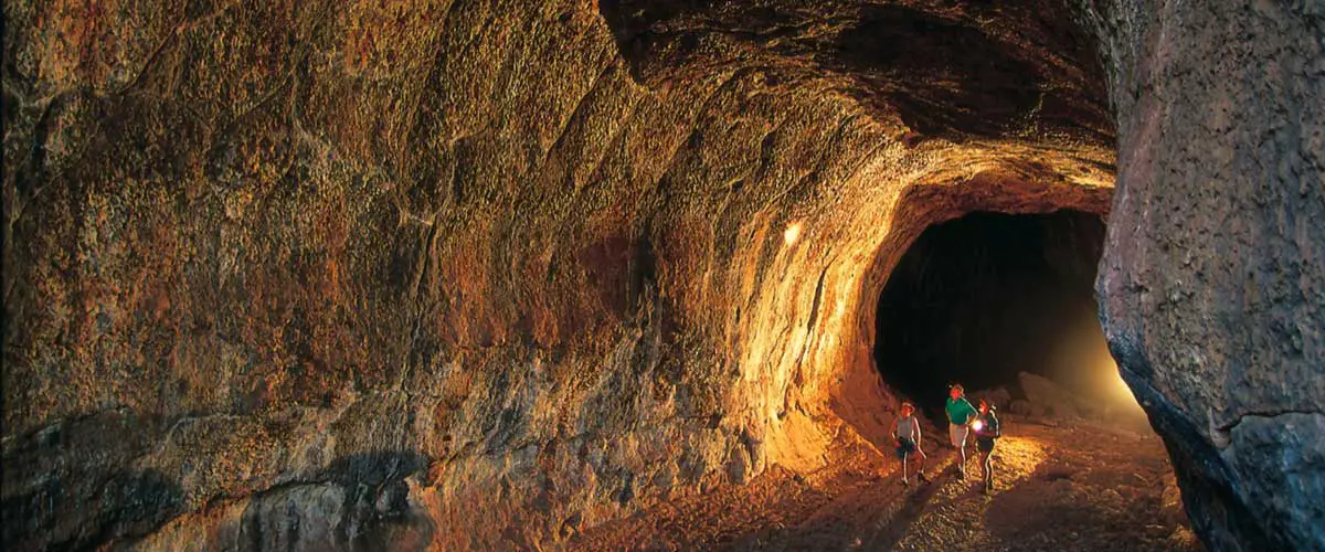
Undara Lava Tubes (Undara Volcanic National Park) near the small town of Mount Surprise 275 km south-west of Cairns, are one of Australia’s great geological wonders. They are the largest, longest and most accessible lava tubes on earth. Several of the tubes, or “caves” as they are often called now, are open to the public (others are still the subject of scientific research) but only on guided tours.

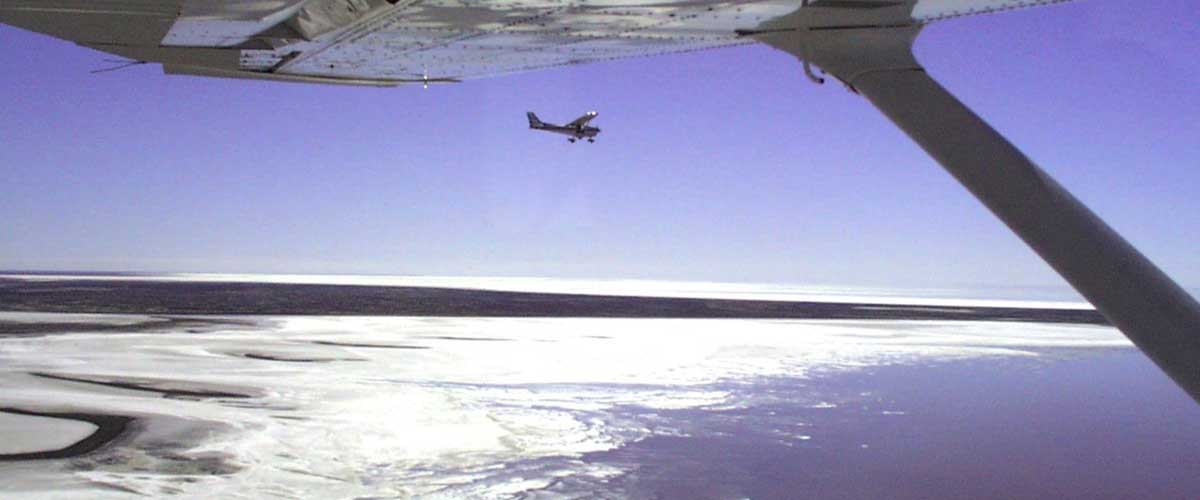
Famous for being the saltiest lake in Australia, Lake Eyre only fills up once or twice every century. The lake itself, at 15 metres below sea level, is Australia’s lowest point. It is also the fifth largest (9,690 square kilometres) terminal lake in the world although it usually contains little or no water. The highest recorded level in Lake Eyre was in 1974 but it would take the average flow of Australia’s largest river, the Murray to maintain that level.

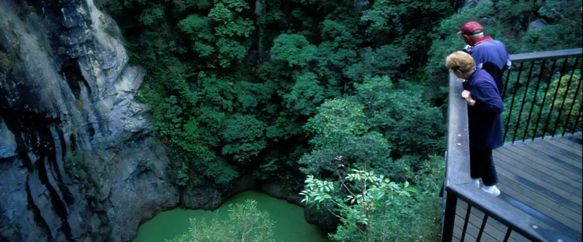
Mount Hypipamee National Park is centred around a diatreme or what is commonly referred to as a volcanic pipe or vent, thought to have been created by a massive gas explosion. The crater is less than 70m across with sheer granite walls. Fifty-eight metres below the rim is a lake about 82m deep covered with a thick green layer of native waterweed. Underneath live perch-like fish and small crustaceans.

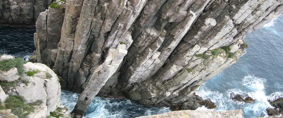
The Totem Pole and The Candlestick are two sea stacks at Cape Hauy on the eastern coast of the Tasman Peninsula in Tasmania’s south-east corner. They were named by Tim Christie in 1965 when he climbed them. A 65 metre high slender column of natural dolerite, the Totem Pole is in a deep, shady, chasm between the first of The Lanterns formations and the headland of Cape Hauy. The Candelstick is a thicker, shorter chunk of dolerite which stands at the far entrance to the same chasm.

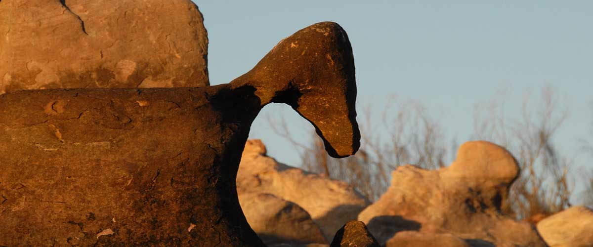
Many small cruising vessels sail past the rocky inlet named Langgi – to the south of Hall Point and Deception Bay on the eastern side of Collier Bay – without realising the beauty and significance of this special place. On arriving ashore, the scene that unfolds from the beach is nothing short of amazing. One side of the inlet is a maze of three metre-high remarkably life-like, naturally sculptured sandstone pillars. Beyond them, a path leads up the gorge to some rock art and a burial cave.

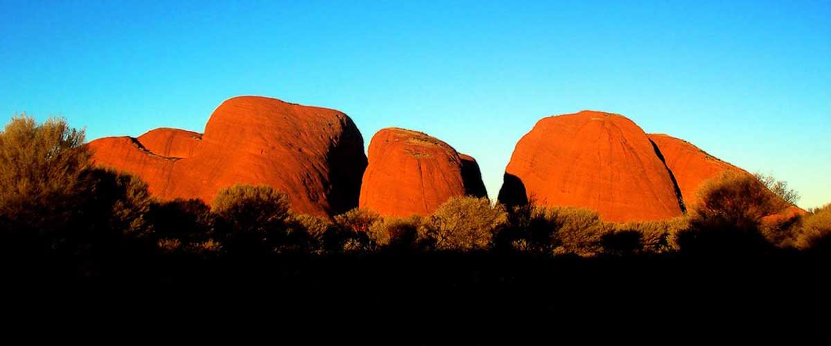
Kata Tjuta are a group of large domed rock formations located about 365km southwest of Alice Springs in the southern part of the NT.The 36 domes, covering an area of 21.68km2, are composed of conglomerate, a sedimentary rock consisting of cobbles and boulders of varying rock types including granite and basalt, cemented by a matrix of sandstone. The highest point, Mount Olga, is approximately 546 m above the surrounding plain (203 m higher than Uluru).

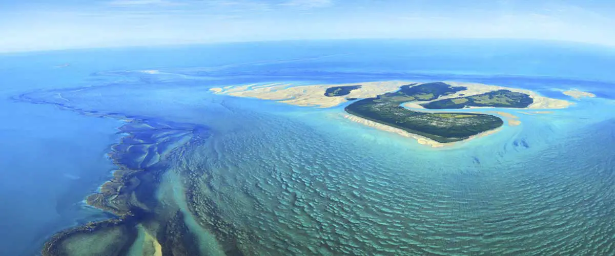
Montgomery Reef, to the south of Yawajaba Island in the Kimberley region of Western Australia, is subject to one of the most significant and unusual tidal movements in the world. It is an extraordinary panorama of vast lagoons, tiny sandstone islets and a central mangrove island – but only when the tide is out. As the tide falls right before your eyes, along a navigable channel running deep into the eastern reef, a stunning horizon of white water rapids is created. Suddenly, a loud, raging torrent of water erupts around you as Montgomery Reef appears to rise out of the ocean.

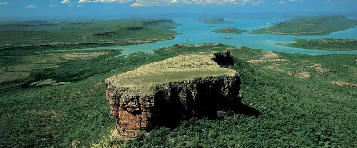
Mount Trafalgar, situated in the Prince Regent Nature Reserve, is one of Australia’s most remote places, with the only access by air or boat. The top of the massive bluff can only be reached by boat or helicopter. A Kimberley region tourist company offers helicopter flights to the area which take visitors to the top of the mountain where they can enjoy a champagne breakfast as the sun comes up over the ocean.

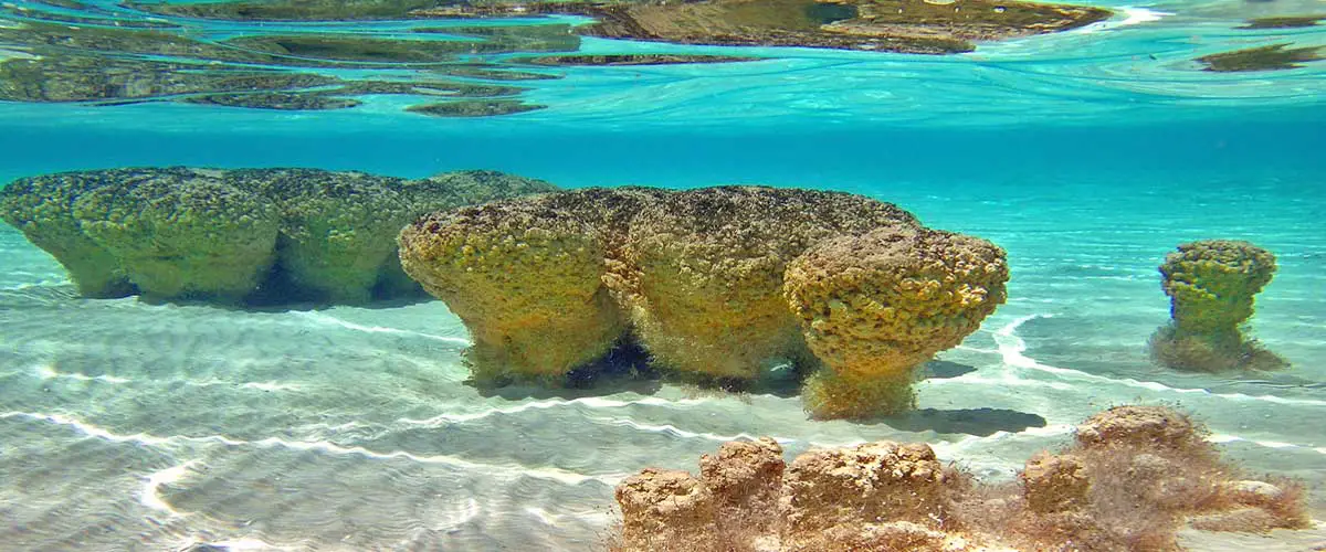
At Hamelin Pool, which is a bay within the Shark Bay World Heritage Area on the Western Australian Coral Coast, the world’s oldest organisms can be seen – stromatolites. Stromatolites are believed to be the result of primitive life forms that are believed to have first existed on earth 3.5 billion years ago. They are the earliest known form of life on earth. The dome shaped structures reach up to 60cm in height and are formed by single celled organisms called cyanobacteria. The process continues today.

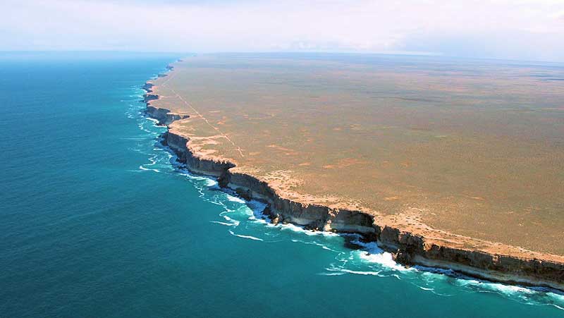
The vast treeless Nullarbor Plain isolates the inhabited areas of Western Australia from those of South Australia. The plain is generally considered to extend 400km west and 300km east of the Western Australia-South Australia boundary, and up to 250km inland from the Great Australian Bight. Formed of a single giant piece of limestone, the Nullarbor Plain is fairly porous so that any rainfall drains underground, resulting in no surface watercourses and few distinguishing features.


