
A fascinating outback town located in a low rainfall area on the northern fringes of the Great Sandy Desert. Halls Creek is not the town it used to be. This is true both literally and metaphorically as, in 1948, the town was physically removed from its original site to its present location. Thus, like so many towns in the Kimberley, there are two Halls Creeks.
Today Halls Creek is a small, predominantly Aboriginal settlement. It services the ever-increasing tourist trade with a hotel, motel, caravan park, two roadhouses and a number of tours to the Bungle Bungles and Wolfe Creek Crater.

Windjana Gorge National Park
The walls of Windjana Gorge rise abruptly from the wide alluvial floodplain of the Lennard River, reaching about 100 metres high in some places. The 3.5-kilometre long gorge cuts through the limestone of the Napier Range; part of an ancient barrier reef, which can also be seen at Geikie Gorge and Tunnel Creek National Parks. This gorge offers excellent long walks; it is also great location to observe freshwater crocodiles.

Wolfe Creek Meteorite Crater
(15 km south): Known to the Djaru Aborigines as Kandimalal it was named Wolf Crater after Robert Tennant Stowe Wolfe, a digger and storekeeper who lived in Halls Creek in the late 1880s. There is some dispute as to the crater's status with some sources claiming that it is the second largest meteorite crater on earth (the other being in Arizona) while others claim it as the fourth largest. Regardless, Wolf Crater, with a diameter of 853 metres and a depth of 61 metres it is still very big and was probably as much as 200 m deep when it was originally formed.

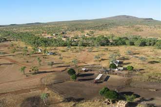
Old Halls Creek
The remnants of the original town (14 km) are worth a look, but there is nothing more than some remnants of buildings, some street signs, the ruins of the old mud brick Post Office, a recently built well to celebrate the discovery of gold in the area, a graveyard, and a modern restaurant.
Many of the graves in the Old Hall's Creek cemetery are quite recent dating from the 1940s and 1950s; many are a grim reminder that the surrounding desert area is still unforgiving to those who make even the slightest mistakes.

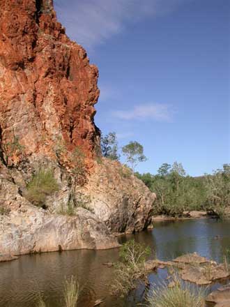
China Wall
(15 km): a strange limestone formation which rises from a creek up over a small hill, this natural formation of white quartz looks like a small version of the famous Great Wall of China. The stream below is surrounded by trees and in the 'green season' it is an ideal location for swimming.
Palm Springs
Palm Springs is nestled amongst hills, just east of the Black Elvire River Crossing on the Duncan Rd. There is a reasonable sized pool, which is boarded by long grass and trees and a few palms. An old weir has been constructed, which cuts the pool into sections. In the back section where the spring is located, the water is clear and full of small fish, it is also a good place for a swim any time of the year. In June the water is tepid but warm enough to have an early morning dip.
In the years gone, the Palm Springs area was the local market garden for the old Halls Creek and even today, you can find reminders of this, with banana's growing wild across the road near an old deserted cattle station out camp. There are nice spots between the road and water hole to camp, however caution is advised with the possibility of crocs in the nearby Black Elvire River and snakes in the long grass around Palm Springs.
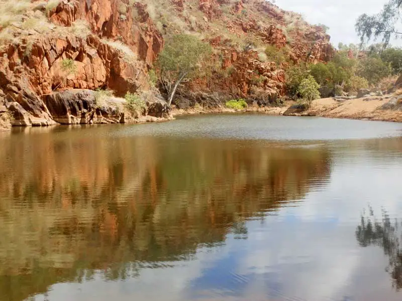
Sawpit Gorge
The gorge is located on the Black Elvire River where flood waters have cut through a range.�� There is a towering rock wall on one side and sandy shaded banks. This is a popular swimming place. Fresh water crocodiles can be seen in this gorge. Sawpit is located 52 km from Halls Creek a few kilometres off the Duncan Highway.
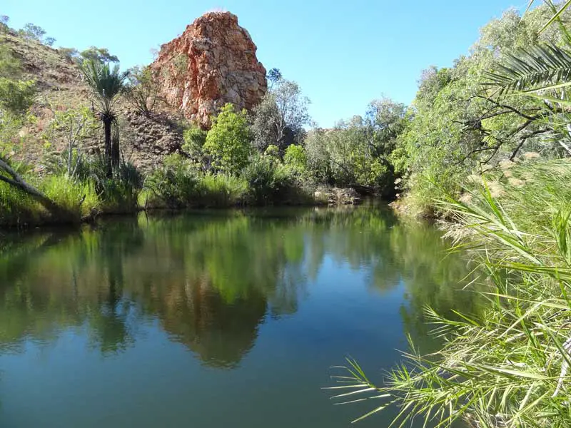
Caroline Pool
This is a picnic, swimming and bush walking place set amongst cool shady trees and wide sandy creek banks. Swimming is best following rains when the water level is high. Caroline Pool is known as Wimirri in the Jaru language. Older residents fondly remember Caroline Pool as the place where families would go on the weekend to swim and play sport on the river sand. It was also an important water source in the days of the early gold rush. Caroline Pool is located15km from Halls Creek.
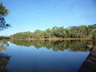
Mary Pool
This is a permanent sandy pool on the Great Northern Highway east of Halls Creek. It is a popular swimming, camping and picnic place. The pool forms part of the Mary River which flows into the Margaret River. Please note:�� freshwater crocodiles can be found here.
Moola Bulla
Moola Bulla, located just to the north of Halls Creek, has a central place in the hearts and minds of Aboriginal people in the central and east Kimberley. It was originally established in 1910 by the Aborigines Department. It was hoped the establishment of Moola Bulla might alleviate some of the conflict with pastoralists and reduce the incidence of cattle spearing. The idea was to congregate Aboriginal people in a place that was part institution and part cattle station.
When Moola Bulla was closed in 1955, people who had grown up there and regarded it as home were forcibly relocated, once again suffering loss and disconnection. Since that time the station has been run as a privately owned pastoral lease. This place still conjures mixed emotions. The Moola Bulla lookout, a few kilometres just to the north of Halls Creek, provides a commanding sunset view over the town.�� Ask a local for directions.
Where is it?
2,832 km north of Perth; 322 km east of Fitzroy Crossing on the Gt. Northern Highway.
Lake Komaterpillar
Lake Komaterpillar is a man made lake situated off the road, along the Duncan Highway near the old abandoned Ruby Queen Mine. Local people named this lake after the machinery that was used to create it and the mine. It's name is derived from the merging of two words, Komatsu and Caterpiller. Lake Komaterpillar is a great place for bird watching, however as this lake is situated on Koongie Park land, permission must be sort before venturing to this lake. Sawtooth Gorge Campground is a remote camp not too far away on the bank of the Black Elvire River. It is unsuitable for caravans and large rigs.
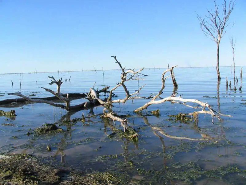
Paruku (Lake Gregory)
The spectacular wetlands of Paruku lie on the northern edge of the Tanami and Great Sandy deserts. Tjurabalan (Sturt Creek) primarily feeds this extensive lake system. Other creeks feeding into the system are Parnkupirti and Jalywarn. Traditional owners believe the system was formed when a star fell from the sky into the lake and then transformed itself into a man becoming the very first Traditional Owner of this place.
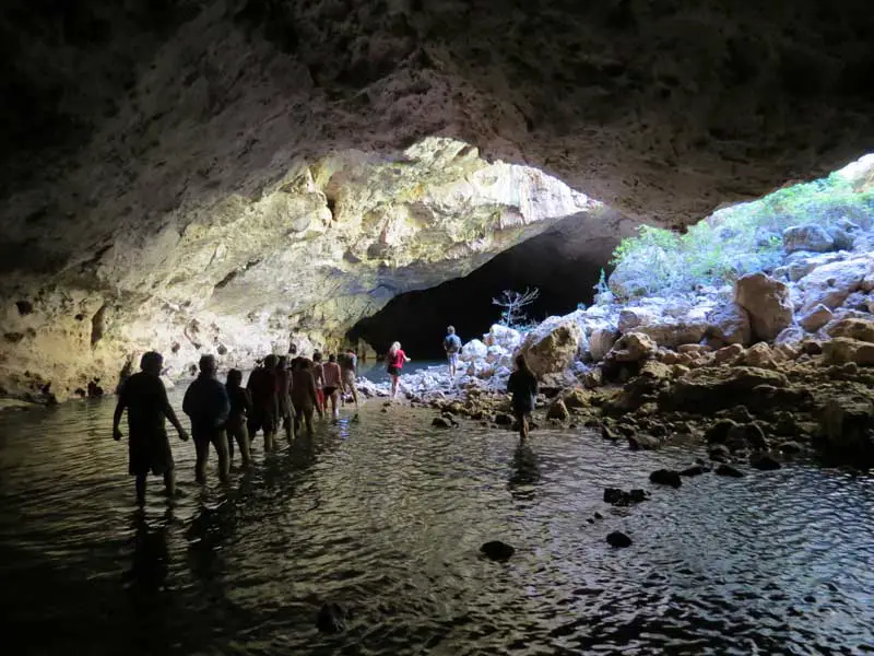
Mimbi Caves
These spectacular caves are located west of Halls Creek just off the Great Northern Highway. They form part of a 400 million year old Devonian Reef system. The cave system contains ancient rock art galleries, an important fish fossil site, crystal clear rock pools and rock formations. The Mimbi Caves can only be visited by contacting Girloorloo Tours, an Aboriginal owned and operated business. This excellent tour includes an introduction to local culture, bush tucker and medicine. Bookings Ph (08) 919 15 355.

Laarri Gallery Yiyili
The Aboriginal art gallery was established in 1999 by the Yiyili Community Aboriginal Corporation in collaboration with Yiyili Community School. Bush tucker, medicine and Gooniyandi dreamtime stories are common themes. The gallery provides a place for artists to work as well as supplies for artists to take home and use. It offers locally produced books and postcards as well as paintings. Laarri is situated in the Yiyili Aboriginal Community between Halls Creek and Fitzroy Crossing, about 5 km off the Great Northern Highway. The gallery is open during Western Australian school term, and at other times by appointment.

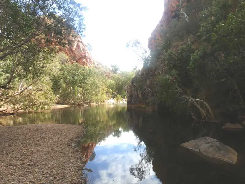
Caroline's Gorge and Pool
Another popular local swimming spot, which is reminiscent of the gorges along the MacDonnell Ranges in Central Australia. The river comes between two cliffs and forms a deep pool in the gorge.

Bungle Bungles
Known to the local Aborigines as Purnululu, the Bungle Bungles are located north east of Halls Creek (take the Great Northern Highway 109 km north from Halls Creek and turn east on the Spring Creek Track) on a road which is so bad that the RAC has this to say about it: 'The distance from the highway to the Three-Ways intersection is only 55 km, however, the trip will take two or three hours and the track is suitable only for 4WDs with good clearance. Caravans will not survive the trip.' Reaching the campsites involves further travelling for at least another hour.

Canning Stock Route
One of the toughest and most remote tracks in the world, it runs from Halls Creek to Wiluna in the central mid-west. With a total distance of around 1,850��km it is the longest historic stock route in the world. The stock route was created as a way of breaking a monopoly that west Kimberley cattlemen had on the beef trade at the beginning of the 20th century.
Brief history
Following the discovery of gold here in 1885, the first in Western Australia, over 15,000 miners descended on the area between Wyndham and Derby in the late 1880s, seeking their fortune. Scores perished from thirst, hunger, heat exhaustion and epidemic diseases.
Though it was never a rich gold field, mining and prospecting has continued on a small scale. In 1955 the Halls Creek townsite relocated 15 kms to the north-west, to less rugged terrain and adjacent to the newly constructed Great Northern Highway.
The town's name recalls Charles Hall who, with James Slattery, found gold 16 km from the site of the original settlement in 1885. On their return to Derby the two men were rewarded ��5,000 by the State Government and the gold rush had begun.
Book Vehicle Hire

Book Accommodation

Design by W3Layouts | Content © 2013 Phoenix Group Co. | Sales: phone 1300 753 517, email: [email protected]