WALKS
WALKS
Inner City Part Day Walks
- Walking & Cycling in Melbourne: The Visit Victoria website has numerous suggested trails to follow when walking or baking in Melbourne. They cover inner city and suburban areas and are of varying lengths. More ...
- Melbourne City Heritage Walking Tours: Discover the city by foot with a National Trust qualified guide. Choose from four walks that uncover Melbourne's great landmarks, introduce hidden treasures, tell fascinating stories and give an overview of the city and its development. $33.00. Duration: 2 hours. Choice of four guided tours. More ...
- Melbourne's Golden Mile: The trail highlights the places, characters and events that made Melbourne 'Marvellous' as a result of the city's wealth from gold. Guide yourself following the brass discs in the footpath. Guided tour. $20.00. Duration: 2 hours. More ...
- Yarra River and History of Inner Melbourne: Discover the shape and nature of the landscapes around the Yarra River and explore the natural history of our inner city. Guided tour. $39.00. More ...
- Spring & Collins Street: From Parliament House and the Windsor Hotel, view all the grand 19th Century buildings. Includes the Melbourne Club, Heidelberg studios and The Olderfleet to the Rialto. Guided tour. More ...
- Cathedrals, Churches & Synagogues in CBD: This tour reflects the attitudes of the clergy of the various denominations in the nineteenth century towards the type of building which best served their congregations needs in worship. We visit both the grand and the humble. Guided tour. More ...
- Lanes and Arcades: East: Explore the network of hidden lanes and alleyways from Swanston to Spring Sts. Guided tour. More ...
- Melbourne City: West End: Discover the bluestone warehouses from the 1850's and elaborately decorated taller 19th Century buildings of the city's west end- including the Supreme Court building. Guided tour. More ...
- Lanes & Arcades: CBD: Explore the hidden lanes and arcades, learn of the exploits of their interesting characters. Guided tour. $39.00. More ...
- Aboriginal Heritage Walk: Melbourne's Gardens rest on a traditional camping and meeting place for the local custodians of the area - the Boonwurrung and Woiworung people. Share in the wealth of local plant lore and land through the eyes of your Aboriginal guide. $16.00. Duration: 2 hours. More ...
Suburban Melbourne Part and Full Day Walks
- Heidelberg Artists Trail: Trace the footsteps of famous Heidelberg School artists, including Arthur Streeton, Tom Roberts, Walter Withers and Clara Southern. See the landscape that they grew to love as they painted - rolling hills, river valleys and rustic architecture. More ...
- Brighton: Brighton's history dates from 1841. Explore 19th Century mansions; an ironstone church/school and St. Andrews church graveyard. Guided tour. More ...
- Canterbury: The Victorian and Edwardian architecture of the streets of Canterbury belong to a gracious era. Explore charming Maling Village. Guided tour. More ...
- Carlton: Regarded as Melbourne's most cosmopolitan suburb. Discover its architecture - from grand buildings, to working class cottages. Guided tour. More ...
- Clifton Hill: As industrial Collingwood became overcrowded in the late nineteenth century the more affluent moved northwards to Clifton Hill where the prosperity is reflected in its building stock of fine double storey terraces, churches and impressive banks. Guided tour. More ...
- Collingwood: Collingwood was once regarded as Melbourne's most underprivileged suburb, housing many impoverished families in tiny working men's cottages. Most of Melbourne's boot and shoes were made there and Foy and Gibson built a huge complex of factories to make goods for their department store. These factories and warehouses have undergone a new lease of life and have been converted to trendy apartments. Guided tour. More ...
- Fitzroy: Originally New Town, Fitzroy was Melbourne's first suburb but in the 1920's gangster Squizzy Taylor lowered the tone. Explore the streets, buildings and colourful history. Guided tour. More ...
- Hawthorn: Hawthorn attracted wealthy businessmen whose factories were situated across the Yarra River. View the many fine mansions built by the Germans. Guided tour. More ...
- Kew: Kew was settled by men of learning and substance and the homes they built in the nineteenth century reflect that, most particularly in Molesworth Street. Guided tour. More ...
- North Carlton: Explore Carlton North including Rathdown Street and the area around Lee Street where once stood a convict stockade, later used as an asylum! This is a charming area, with rows of terraces most of which have been painstakingly restored. Guided tour. More ...
- North Fitzroy: Survey the domestic architecture of the late 19th Century and Edwardian eras and uncover the colourful history of North Fitzroy. Guided tour. More ...
- Port Melbourne: Conversion of factories and warehouses to apartments, together with foreshore development have altered life dramatically and the tough waterfront image has disappeared. Guided tour. More ...
- Prahran: The interesting feature of Prahran's Chapel Street is its many large furniture and department stores built when the cable trams serviced the area in the late 1880's. We view these stores as well as a court house, a fire spotting tower and the Prahran Market. Guided tour. More ...
- Richmond: Being positioned so close to the Yarra, Richmond was the location chosen for the early industries requiring water, including tanneries. Basically a working class suburb, with pockets of nineteenth century grandeur, Richmond today is a lively commercial area with apartments located in the shells of old factories - and even silos. Guided tour. More ...
- St Kilda: St Kilda's seaside position attracted wealthy 19th Century merchants and the many hotels and guest houses provided holiday accommodation for Melbourne's residents. Guided tour. More ...
Bay & Peninsula Full Day Walks
- Coastal Art Trail: celebrates the lives and work of the many notable Australian artists who have painted the coast in years past. It features more than 50 artworks on 38 signboards along 17 kilometres of coastline. Walk, bicycle ride or skate along Port Phillip Bay from Brighton to Beaumauris More ...
- Coastal Trail, Hobsons Bay: A great way to explore Hobsons Bay is via the cycling and walking trail which follows the coast from Westgate Bridge through to Skeleton Creek. On the way the trail passes through many beautiful parks and natural areas. More ...
- Point Nepean Trail: Walk to the tip of the peninsula with views across The Rip, the treacherous divide between the Mornington and Bellarine peninsulas that has wrecked many ships. More ...
- Bushrangers Bay Trail: Walk along a Bass Strait cliff top to some of the most beautiful coastal scenery near Melbourne. Along the way see natural features, such as flowering banksias, rock spires and rock pools. More ...
- Flinders Peak East West Loop Track: Climb the granite tors of the You Yangs for unparalleled views in every direction, and enjoy close encounters with the abundant native wildlife. Pay a visit to nearby Werribee Park Mansion or continue on to Geelong. More ...
- Bellarine Rail Trail: Ride or walk along the route of an old railway, through scenic farmland and valleys with sweeping coastal views, to the historic town of Queenscliff. Combine a visit to the trail with a steam train ride on the Bellarine Peninsula Tourist Railway. More ...
- Dunball's Walking Tours: Half-day, full-day or two-day guided walks along ocean beaches, bay beaches and tracks with views over Bass Strait and Port Phillip Bay are available. $30-$80pp. More ...
- Williamstown Self Guided Historic Walks: catch the ferry from South Bank to the historic maritime village of Williamstown. More ...
- Truganina Park, Altona: the 100 Steps to Federation is one of the key destinations along the cycling and walking trail, known as the Bay Trail, which now extends from West Gate Bridge through to Skeleton Creek. More ...
- Port Phillip Walks: Self guided walks around the shores of Port Phillip Bay. All walks available in PDF format. More ...
SUBURBAN HALF DAY BY PUBLIC TRANSPORT
- Albert Park & St Kilda: The inner bayside suburb of St Kilda is known less for its seedier side and more for the alternative and quirky, which gives the inner suburb its air of cosmopolitan cool. More ...
- Botanical Gardens: superb, secluded gardens on the banks of the Yarra River. More ...
- Yarra Bend Park: see the Yarra River in its original, natural state not far from the city centre. More ...
SUBURBAN FULL DAY BY PUBLIC TRANSPORT
- Kings Domain & Surrounds: extensive parklands near the city centre. Great for a quiet day day off from travelling. More ...
- Williamstown: historic suburban port on Port Phillip Bay. Includes Williamstown village (historic village; HMAS Castlemaine); Jawbone Flora & Fauna Reserve; Point Jellibrand Heritage Park (timeball tower; historic fort); Craft Market (1st Thurs. every month); Science Works; . More ... | Guided Walks
- Royal Park - tranquil gardens and Australia's oldest yet most modern zoos. More ...
- Yarra Bend Park: see the Yarra River in its original, natural state not far from the city centre. Walk through Natural bushland; visit Melbourne's only waterfall on the Yarra River. More ...
- Warringal Parklands: enjoy the parklands and natural beauty of Melbourne's northern suburbs - Warringal Parklands; Banyule Flats; Heildelberg Park.
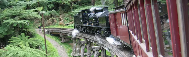
- Puffing Billy/Dandenong Ranges: explore the picturesque Dandenong Ranges aboard Melbourne's famous steam tourist railway. More ...
SUBURBAN & REGIONAL FULL DAY DRIVES
Bayside Beaches Drive
This trip commences at Station Pier at Port Melbourne and follows the coast all the way to Point Nepean on the tip of Mornington Peninsula. Making for a pleasant day's drive, the route passes the suburban beaches of Port Melbourne, St Kilda, Brighton, Sandringham, Mordialloc, Mentone, Edithvale and Frankston. Upon reaching the peninsula there is plenty of higher ground and a few lookouts to stop at and take in the views across Port Phillip Bay. The bayside townships from Frankston on all have cafes that serve lunches and afternoon teas. The peninsula is a trendy place to live, so the quality and variety of the food on offer is excellent. If time permits make your return journey via the ocean beaches, Cape Schank, the towns of Flinders and Hastings on the peninsula's east coast, then north to Dandenong and Melbourne's south-eastern suburbs. Highlights and activities that can turn this drive into a 2-day trip: chairlift ride to the top of Arthur's Seat at Dromana; Mornington Peninsula wineries; beachcombing at Sorrento's ocean beach and Cape Schank; walk the tip of Cape Nepean past historical forts; take a cruise from Stony Point (Crib Point) on Western Port or guide tour to French Island. Distance: 235 km
Port Phillip Circuit
Follow the Bayside Beaches Drive (above) to Portsea, then take the car ferry from Portsea to Queenscliff (from $69.00 one way with car and 2 adults). Return to Melbourne via the Bellarine Peninsula on the western side of Port Phillip Bay. Pass through the beachside towns of Barwon Heads, Ocean Grove and Torquay, the peninsula towns of Portarlington and Queenscliff and the City of Geelong on Corio Bay. Highlights and activities that can turn this drive into a 2-day trip: chairlift ride to the top of Arthur's Seat at Dromana; Mornington Peninsula wineries; ride the Bellarine Peninsula Tourist Railway (Sundays and school holidays only); visit the historic Fort Queenscliff on Shortland's Bluff and nearby lighthouses, cliffs and the Rip View Lookout on Point Lonsdale; visit the surfing beaches or scuba dive the waters of the marine National Park off Point Lonsdale; view the mangrove swamps of Lake Connewarre State Game Reserve; walk the Ocean Grove Nature Reserve or Jirrahlinga Koala and Wildlife Sanctuary; tour Victoria's Open Range Zoo at Werribee. Distance: 210 km
Dandenong Ranges Drive
Gently rolling hills covered in at times dense forest, interspersed by farms, orchards and picturesque villages is what the Dandenongs are all about. There are plenty of things to see and do along the way, just keep your eyes open and follow the signs to wherever takes your fancy. Travel by car via either Cotham Rd/Maroondah Hwy or the Eastern Fwy. to Ringwood and then Lilydale. Take Hereford Rd to Mt. Evelyn, then follow the road through the Dandenongs by the villages of Montrose, Kalorama, Mt. Dandenong (633 metres; don't miss the lookout for panoramic views over Melbourne), Olinda, Monbulk, Sherbrooke (enjoy a picnic in Sherbrooke Forest) and Kallista to Belgrave. If you have more time, drive or take the Puffy Billy steam train to Selby, Menzies Creek, Clematis and Emerald. Otherwise return to Melbourne via Burwood Hwy from Belgrave. Highlights: Caribbean Gardens & Market, Scoresby; various arts and crafts galleries; various show gardens, garden centres and nurseries (bulbs; daffodils; Mount Dandenong Arboretum; Karwarra Australian Plant Garden; National Rhododendron Gardens, Olinda); trout and lavender farms; fruit orchards; tearooms, cafes and restaurants; lookouts (Mount Dandenong - lookout, Sky High Restaurant, a cafe, BBQ and picnic areas; Mount Corhanwarrabu lookout). Distance: 134 km
SUBURBAN & REGIONAL 2 DAY DRIVES
Western Port Drive and Phillip Island
This drive, to the south-east of Melbourne, takes in the rugged, rocky coastline and wild surf beaches found on the Ocean Side of Mornington Peninsula, the tranquil waters of Western Port and its islands, including Phillip Island on Bass Strait. Wildlife abounds on Phillip Island. The Penguin Parade - the nightly trek made by Fairy Penguins from the waters edge to their burrows in the sand dunes - is very popular. Not far from the Penguin Parade at the far south-western tip of Phillip Island is Seal Rocks – home of a colony of up to 16,000 fur seals. At the other end of the island you can walk down the road and be watched by dozens of koalas sitting in the trees above. The sound you hear, like that of twigs rubbing together, is actually the koalas. Distance: 372 km.
|
Approx. cost for 2 people in a compact or sub-compact car (meals etc. not included)
| Car hire |
2 days |
$140.00
|
| Accommodation |
1 night |
$100.00
|
| Fuel |
7 litres/100km |
|
|
Travellers' notes: Central and South Gippsland region
Day 1: Leave Melbourne and head to Frankston via Dandenong either via Dandenong Rd or Monash Freeway. Take the Mooroorduc Hwy south, turning right at the end of the Hwy into Borneo Rd to Cape Schank (great views, walking path to waters edge, clambering over the rocks). Follow the coast east to Flinders, Shoreham, Crib Point and Hastings. A variety of tours of French Island leave from Stony Point (Crib Point). Follow the shore of Western Port via Western Port Hwy, then Baxter Tooradin Rd (follow the signs in San Remo or Phillip Isld) to Tooradin. Continue on the South Gippsland Hwy to San Remo and Phillip Island. 230 km
Day 2: There's plenty to do on Phillip Island to warrant at least one night's stay on or around the island. These activities include visiting nature parks; the nightly Penguin Parade (fairy penguins coming shore); koala spotting in the trees above as you drive or walk through the Oswin Roberts Koala Reserve; coastal wildlife observation from land or boat cruises; golf; ocean diving and fishing; fun maze; watch racing at the Phillip Island motor racing circuit (on race days); Churchill Island Heritage Farm. Return to Melbourne via Bass Hwy and South Gippsland Hwy via Cranbourne and Dandenong. Websites of Phillip Island accommodation, activities and tour operators. 142 km
SUBURBAN & REGIONAL 3-5 DAY DRIVES
Great Ocean Road Drive: 2 - 3 days
Travel one of the world's most scenic roads through an extended area that includes the world-famous Twelve Apostles, the Otways rainforest, Bells Beach, on the Surf Coast, and the Great Ocean Road itself. This drive has been planned over three days but can easily be cut down to two days. Provided you get an earlier enough start, it is possible to condense the first two days into one, if you leave the drive around the Bellarine Peninsula to be completed on your way back to Melbourne on the second day. Distance: 634 km.
|
Approx. cost for 2 people in a compact or sub-compact car (meals etc. not included)
| Car hire |
3 days |
$210.00
|
| Accommodation |
2 nights |
$200.00
|
| Fuel |
7 litres/100km |
|
|
Travellers' notes: Gt Ocean Road and south west coastal region | Western Agricultural District
Day 1: Leave Melbourne via the West Gate Bridge and head for Geelong via Princes Fwy. If you are limited to a 2 day drive, head south from Geelong for Torquay via the Surfcoast Hwy. Otherwise, head for Portarlington for a round trip of the Bellarine Peninsula, taking in the Bellarine Peninsula Tourist Railway (Sundays and school holidays only); visit the historic Fort Queenscliff on Shortland's Bluff and nearby lighthouses, cliffs and the Rip View Lookout on Point Lonsdale. If time permits, you can surf the wave of Ocean Grove or Barwon Heads beaches or scuba dive the waters of the marine National Park off Point Lonsdale, view the mangrove swamps of Lake Connewarre State Game Reserve or walk the Ocean Grove Nature Reserve. Heading south beyond Torquay are more of Victoria's favourite surfing beaches (Torquay; Jan Juc; Bells Beach) and the oceanside resort towns of Anglesea, Aireys Inlet, Fairhaven (wild koalas have been photographed on the beach here by travellers) and Lorne. Inland from Lorne are some mountainous rainforests with interesting bushwalks and waterfalls. Lorne is a good place for an overnight stay if you took the time out to explore the Bellarine Peninsula. The Falls Music & Arts Festival is held at Lorne during the New Year long weekend every year. 195 km
Day 2: Continue south along the Great Ocean Rd through the stunning scenery of the Otway Coast. After Apollo Bay and Marengo, the road heads inland through Otway National Park, which is a bushwalkers haven - dense rainforests with waterfalls, volcanic lakes and craters. Check out the views from Cape Otway lighthouse if you have the time, otherwise continue westward through the hills to Lavers Hill, Wattle Hill, touching the south coast again at Princetown, which marks the beginning of the strip of coastal scenery for which this drive is famous. The coastal features between Princetown and Peterborough, contained within Port Campbell National Park, are too numerous to mention here, but include Loch Ard Gorge, the giant rock stacks known as The Twelve Apostles, Gibsons Beach (the walk down to the beach is well worth the effort). In the middle of all of this, in a picture-postcard setting, is the tiny village of Port Campbell, a great place for a break before continuing your journey. Beyond Peterborough, the road passes Bay of Islands Coastal Park before heading inland as it winds its way towards Warrnambool. The regional centre for the Victorian west coast, Warrnambool is an ideal overnight stopping place. 170 km
Day 3: Return to Melbourne via the way you came, but take Princes Hwy towards Terang after passing through Allansford. When you reach Camperdown you are in the heart of western Victoria's crater and lakes district. Camperdown has some interesting old buildings and a drive to Lake Bullen Merri and the top of the Mt. Leura crater for a view of the countryside is well worth the effort. Continue along Princes Hwy to Colac and Lake Colac, then to Geelong and back to Melbourne. 269 km
Gt Ocean Road and Western Districts Drive: 4 days
Travel one of the world's most scenic roads through an extended area that includes the world-famous Twelve Apostles, the Otways rainforest, Bells Beach, on the Surf Coast, and visit the Grampians mountain range in the heart of western Victoria. Distance: 877/1002 km.
|
Approx. cost for 2 people in a compact or sub-compact car (meals etc. not included)
| Car hire |
4 days |
$280.00
|
| Accommodation |
3 nights |
$300.00
|
| Fuel |
7 litres/100km |
|
|
Travellers' notes: Gt Ocean Road and south west coastal region | Western Agricultural District | Central Agricultural Region
Day 1: Leave Melbourne via the West Gate Bridge and head for Geelong via Princes Fwy. If you are limited to a 2 day drive, head south from Geelong for Torquay via the Surfcoast Hwy. Otherwise, head for Portarlington for a round trip of the Bellarine Peninsula, taking in the Bellarine Peninsula Tourist Railway (Sundays and school holidays only); visit the historic Fort Queenscliff on Shortland's Bluff and nearby lighthouses, cliffs and the Rip View Lookout on Point Lonsdale. If time permits, you can surf the wave of Ocean Grove or Barwon Heads beaches or scuba dive the waters of the marine National Park off Point Lonsdale, view the mangrove swamps of Lake Connewarre State Game Reserve or walk the Ocean Grove Nature Reserve. Heading south beyond Torquay are more of Victoria's favourite surfing beaches (Torquay; Jan Juc; Bells Beach) and the oceanside resort towns of Anglesea, Aireys Inlet, Fairhaven (wild koalas have been photographed on the beach here by travellers) and Lorne. Inland from Lorne are some mountainous rainforests with interesting bushwalks and waterfalls. Lorne is a good place for an overnight stay if you took the time out to explore the Bellarine Peninsula. The Falls Music & Arts Festival is held at Lorne during the New Year long weekend every year. 195 km
Day 2: Continue south along the Great Ocean Rd through the stunning scenery of the Otway Coast. After Apollo Bay and Marengo, the road heads inland through Otway National Park, which is a bushwalkers haven - dense rainforests with waterfalls, volcanic lakes and craters. Check out the views from Cape Otway lighthouse if you have the time, otherwise continue westward through the hills to Lavers Hill, Wattle Hill, touching the south coast again at Princetown, which marks the beginning of the strip of coastal scenery for which this drive is famous. The coastal features between Princetown and Peterborough, contained within Port Campbell National Park, are too numerous to mention here, but include Loch Ard Gorge, the giant rock stacks known as The Twelve Apostles, Gibsons Beach (the walk down to the beach is well worth the effort). In the middle of all of this, in a picture-postcard setting, is the tiny village of Port Campbell, a great place for a break before continuing your journey. Beyond Peterborough, the road passes Bay of Islands Coastal Park before heading inland as it winds its way towards Warrnambool. The regional centre for the Victorian west coast, Warrnambool is an ideal overnight stopping place. 170 km
Day 3: From Warrnambool, continue travelling in a westerly direction through Tower Hill, Port Fairy and Tyrendarra to Portland, the major port of West Victoria. Nearby Cape Bridgewater, which has some of the highest coastal cliffs in Victoria and protects a bay that stretches in a perfect crescent around the rim of a huge, ancient volcano crater. The scenery is quite stunning - hang gliding is a popular sport here, scenic walks lead to a sand-petrified forest, freshwater springs and lakes, rugged cliffs, a blowhole and a lookout above mainland Australia’s largest breeding colony of fur seals. Join a boat tour for a closer look at these playful animals. Head north from Portland along Princes Hwy to the agricultural centre of Hamilton, then on the Dunkeld where you'll get your first views of The Grampians. Drive north from Dunkeld into the ranges; less that 2 km from town you are given the choice of the more travelled, shorter route (turn right into Grampians Rd) or the longer more scenic route through Victoria Valley that scales the heights of the mountains then plunges into the valley below. Either way, follow the signs to Halls Gap where a visit to the Brumbuk National Park & Cultural Centre is essential. Here you can find out everything you need to know about Grampians National Park, and work out what you can and can't see in the time you have available (there's a lot of it) and where to stay if you need accommodation. Essential natural attractions are Boroka Lookout; MacKenzie Falls; The Balconies; Ngamadjidj Shelter Aboriginal rock art site. 325 km
Day 4: Leave The Grampians from Halls Gap via Grampians Rd to Stawell. Take Western Hwy south to Ararat, the first of many old goldrush towns you'll will visit. You'll pass through Gt Western, with its historic underground cellars for making sparkling white wines - a tour of the place is an interesting experience. From Ararat, take the Pyrenees Hwy to the Avoca and you are in the heart of the Pyrenees Wine Region, known for its classic styles of red wine, full-bodied dry whites and for sparkling wines made by the authentic Champagne method. If you are in the mood for a winery crawl, book yourself some accommodation in the area and spend a day exploring the wineries around Avoca, St Arnaud and Landsborough. From Avoca you have a choice of routes back to Melbourne: the longer route heads east through the centre of Victoria's historic goldfields district along the Pyrenees Highway through Maryborough and Castlemaine, before returning to Melbourne via Calder Hwy. This route will particularly appeal to anyone who wants to do a bit of gold fossicking or wander through some of the many old gold mining towns on the way, like Maldon (heritage steam railway, goldmining museums), Tarnagulla, Inglewood, Dunolly, Clunes, Malmsbury and Talbot. The shorter route - south via Sunraysia Hwy - passes through the old goldmining city of Ballarat with its heritage buildings, historic sites and Sovereign Hill, an award-winning history-themed park that is a recreation of a goldmining town. From Ballarat, take Western Fwy. past Kyral Castle to Melbourne. On the way you'll pass Werribee Gorge State Park. Popular among bushwalkers and rock climbers, it has a walking track through a gorge alongside the Werribee River, leading to a picnic area and popular swimming holes. 187km/312 km
Goldrush Country Drive: 3 - 4 days
The discovery of gold in the 1850s and 60s was the most significant event in the evolution of the state of Victoria. Fuelled by extravagant stories of wealth gained at the 1849 Californian gold rush, gold fever hit Victoria following the early gold discoveries in and around Clunes, Warrandyte and Ballarat. This drive takes you into the heart of where it all happened - the town and cities that the rush created. Provided you don't want to stop and look at too many things, this drive can be condensed into two days, with the overnight stop being at Castlemaine or somewhere in that vicinity. Distance: 432 km.
|
Approx. cost for 2 people in a compact or sub-compact car (meals etc. not included)
| Car hire |
4 days |
$280.00
|
| Accommodation |
3 nights |
$300.00
|
| Fuel |
7 litres/100km |
|
|
Travellers' notes: Central Agricultural Region
Day 1: Leave Melbourne via Citylink to the east of the Melbourne CBD or enter Calder Fwy. at Keilor Park. Opposite Calder Park Raceway is the Organ Pipes National Park, with a set of basalt columns as straight and regular as organ pipes in a deep gorge. Proceed to Macedon where you can make a diversion to the eerie Mt. Macedon, the setting for the acclaimed novel and movie, Picnic at Hanging Rock. Macedon is wine country, and home to a number of boutique family-run wineries specialising in cool-climate varieties - mainly sparkling whites, chardonnay, pinot noir and reisling. Continue north to Woodend and Kyneton, both of which feature historic bluestone architecture. When you reach Malmsbury you are entering goldrush country, but the gold most visitors come and seek today is in bottles on the shelves of the local wineries. Upon reaching the quaint goldmining town of Elphinstone where time appears to have stood still, stay on Calder Hwy and head for Harcourt. Once an apple growing centre, Harcourt is today the hub of a fast-growing cool-climate wine region. The Taste of Gold Food and Wine Trail brochure, available from the Harcourt Visitor Information Centre, will guide you to the wineries nearby offering cellar door tastings and sales. From Harcourt, continue north to Bendigo, a rich goldmining city that services the agricultural region around it. 158 km
Day 2: Bendigo's attractions include numerous gold related museums, a vintage tram ride through town, a real gold mine with an authentic deep-shaft mine experience, and Australia's best regional gallery. After seeing what Bendigo has to offer, head west to Marong, then south to Lockwood and Maldon via Bendigo-Maldon Rd. An 1850s' goldmining town that still looks like the frontier town it was during the goldrush, it has everything from Heritage buildings, Antique shops, Art Galleries, Speciality and Craft shops, Gold mine tours, Vintage steam train rides on weekends and more cool climate wineries. If you can pull yourself away, head down to Castlemaine (18 km) for the night, otherwise have fun exploring this genuine goldmining town, stay the night there, and move on to Castlemaine in the morning. 70 km
Day 3: Renowned for the arts, Castlemaine and the region is abuzz with quality cafes, eclectic shops, historic homes, festivals, gracious gardens and art galleries. Castlemaine's Visitor Information Centre has plenty of information about the places worth visiting before you head south along the Midland Hwy to Daylesford, another former goldmining town in a region that contains Australia's largest concentration of natural mineral springs. Every Sunday a restored heritage train journeys through the scenic countryside and forests around Daylesford; a Sunday Market is held each week at the Daylesford Station. Hepburn Regional Park contains natural mineral springs and significant relics of the gold mining era, all set in bush surroundings. Hepburn Bathhouse & Spa has a range of indoor heated pools, spas and bathing environments, all providing the health-giving benefits of using water from the abundant local mineral springs. Passing through Hepburn Springs on its route between Daylesford and Castlemaine is the Dry Diggings Track, a 57 km section of the Great Dividing Walking Trail which traverses Victoria. When you leave Daylesford, if you are ready to return to Melbourne, head south along the Daylesford-Ballan Rd to Ballan, then take the Western Fwy. If you find you are still struck with gold fever, you may like to take a detour via Midland Hwy through Creswick to another major goldmining city - Ballarat, but you'll need to add an extra day into your itinerary to do it justice. 89 km
Day 4: Ballarat is full of heritage buildings, goldrush-related historical sites and regional Victoria's biggest attraction, Sovereign Hill, an award-winning history-themed park that is a recreation of a goldmining town. From Ballarat, take Western Fwy. past Kyral Castle to Melbourne. On the way you'll pass Werribee Gorge State Park. Popular among bushwalkers and rock climbers, it has a walking track through a gorge alongside the Werribee River, leading to a picnic area and popular swimming holes. 115 km
Further information on the region: Central Victorian Goldfields Tourism | Buildings, relics and artifacts left behind by the Victorian goldrush | Tales of Gold
North East Victoria Drive: 2 - 3 days
This tour passes through the northern section of the Dandenong Ranges and the Yarra Valley before following the Goulburn River through some of Victoria's richest fruit growing country. After staying at the historic paddlesteamer port of Echuca on the Murray River, we head for the Rutherglen wine region and a number of rustic goldmining towns. There is then the option of a day's drive into the high country of north-eastern Victoria before returning to Melbourne via the Milawa gourmet food region and the Goulburn Valley on the final day. Distance: 955/1,164 km.
|
Approx. cost for 2 people in a compact or sub-compact car (meals etc. not included)
| Car hire |
3 days |
$210.00
|
| Accommodation |
2 nights |
$200.00
|
| Fuel |
7 litres/100km |
|
|
Travellers' notes: North-Eastern Victoria & High Country
Day 1: Depart Melbourne via the Maroondah Hwy through Lilydale, Coldstream and Healesville in the Yarra Valley. Proceed north through the tall forests to Taggerty and Alexandra. If time permits, you can make a detour at Alexandra to Eildon Weir, one of Melbourne's major water catchment dams that is well used for boating and fishing. Return to Alexandra and continue on the Maroondah Hwy, following the signs to Mansfield. It is near Mansfield that notorious bushranger Ned Kelly had his first major brush with the law when he shot dead three policemen from Mansfield. The town has become a popular inland holiday resort because of its closeness to the Victorian high country and the Mt. Buller ski resort. In the cooler months, snow often caps the mountains around Mansfield. Drive north on the Midland Highway to Benalla, a regional centre on the Hume Hwy. Continue on the Midland Hwy to Shepparton, a centre for fruit growing and canning in the Goulburn Valley. Continue in a north-westernly direction through the fruit orchards of the area to the former Murray River port of Echuca. 422 km
Day 2: The the old timber wharves of Echuca are now a big museum and well worth a visit. Paddlesteamer trips up the river, as well as houseboats for hire, all centre around the wharf area. A museum dedicated to Holden cars is also in town. Head east from Echuca to the river towns of Cobram and Yarrawonga. Take the Corowa Rd for a short drive into NSW around Lake Mulwala. At Corowa, cross back into Victoria over the historic Ford's Bridge to Wahgunyah, which is the gateway to the Rutherglen wine region, which produces Australia's best fortified wines (port, muscat, tokay). All wineries have cellar tastings and sales (Campbells is a personal favourite); don't leave the area without having lunch, afternoon tea ... anything at All-Saints restaurant under a vine-shaded terrace, it's a simply heavenly experience (no pun intended). Once you find the willpower to drag yourself away, head for the quaint goldmining village of Chiltern and on to Beechworth. Another goldmining town that seems frozen in time, Beechworth has strong associations with Bushranger Ned Kelly who had a couple of sojourns in Beechworth Gaol during his short life. 243 km
Day 3: The itinerary for Day 3 is optional, depending on how much time you have. The day's itinerary takes us in a big loop into the high country of NE Victoria, and brings us back to Beechworth or somewhere else in the vicinity should you so choose for the overnight stay. If you do not wish to take up the extra day option, proceed to Day 4 and continue your journey back to Melbourne. If taking the Day 3 option, proceed south from Beechworth to Australia's foremost tobacco growing town of Myrtleford. Continue on to the charming village of Bright, which is the northern gateway to the Victorian snowfields. On the way you'll pass numerous cool-climate wineries whose dry whites are superb and inexpensive considering their high standard. Bright is enhanced by oaks, chestnuts, poplars, elms and maples which drape the town in a cloak of orange, red and gold in the autumn. You are now in high country, so be aware that weather conditions may not be ideal in winter. The chances of getting snow-bound are slim but not beyond the realms of possibility. Head towards Mt. Beauty, have your camera ready as you traverse Tawonga Gap - the views of Mt. Beauty and the Kiewa Valley are stunning. Mt. Beauty was built to house the workers on the Hydro-Electricity schemes in the area. It is today the starting point for walks and drives into the snow-capped mountains around it (More information). From Mt. Beauty, head north down the pretty Keiwa Valley to Wodonga. You may wish to check out the twin-cities of Albury-Wodonga and stay their the night, or proceed back to Beechworth. 209 km
Day 4: We highly recommend breakfast at the Beechworth Bakery; it is somewhat of an institution in these parts. Take the Beechworth Wangaratta Rd out of Beechworth, and follow the signs to Milawa. A tiny village, Milawa has earned itself a reputation for its produce - there's Brown Brothers winery, a cheese factory and mustard factory in the town, with more cool-climate wineries and olive groves dotted around the region. Join the Hume Fwy. at Wangarratta and head towards Melbourne. A short way along, take the Glenrowan exit. It is here that bushranger Ned Kelly was finally captured by police in a shootout. The tiny village has numerous attractions celebrating the event, or you can walk over the railway tracks to where it all happened (all about Ned Kelly). Signs identify who was where and how that fateful morning's events unfolded. Glenrowan has a number of wineries; Baileys of Glenrowan is always a favourite of mine for a bottle of tokay or muscat. Back on the highway, you can stay on the freeway all the way to Melbourne if you like, but we recommend a few detours on the way. Benalla, a recommended detour, is another town associated with Ned Kelly. The court house where he was tried is here, as is an old butcher's shop where he tried to hide after making a run for freedom outside the court house over the road. The town has some lovely gardens (ideal for a picnic lunch) and an interesting museum which focuses on Ned Kelly. Euroa is another interesting little place that the highway has bypassed. It was here that Ned Kelly robbed a bank. Further down the highway, the town of Seymour is the starting place for a wide variety of activities and attractions in this part of the Goulburn Valley, including wineries, rail & military memorabilia, art and antiques, boutique cafes & shops, historical buildings & scenic heritage parks. Melbourne is about 90 minutes further down the highway, so if there is time left in the day to do things, this is as good a place as any to do them. Drop in to the Visitor Centre for more details of what's on offer. Rejoin Hume Fwy. at Seymour and return to Melbourne. 290 km
Ned Kelly Bushranger Trail
Take a tour through Victoria's Kelly country and visit the towns of North Eastern Victoria where one of Australia's most famous bushrangers spent his short life. The Ned Kelly Trail website follows the events in the life of Ned Kelly, stopping at each town to identify the various localities where events in his life took place. As most of the places on the Ned Kelly Trail are visited in our North East Victoria Drive (above), it is possible to incorporate the two drives into one.
Visit the Trail website ...
Gippsland Drive: 3 - 5 days
Gippsland is one of the few unique and diverse (yet relatively compact) regions in Australia. It comprises of snow fields, wilderness, rainforests, beaches, mining and industrialised areas, farm land, and some of the country's most spectacular coastal scenery, including Wilsons Promontory and Phillip Island all of which is easily reach driving the average motor car. This drive can be shrunk to three days or extended to five days depending on your budget and/or time restraints. Distance: 766 km.
|
Approx. cost for 2 people in a compact or sub-compact car (meals etc. not included)
| Car hire |
4 days |
$280.00
|
| Accommodation |
3 nights |
$300.00
|
| Fuel |
7 litres/100km |
|
|
Travellers' notes: Central and South Gippsland region
Day 1: Leave Melbourne either via Dandenong Rd or Monash Freeway. From Dandenong take the Old Princes Hwy (to visit the towns on the way) or the Princes Fwy. (to bypass the towns on the way). Just before Drouin is the turnoff to Mt. Baw Baw, the closest ski resort to Melbourne. Proceed east on the Princes Fwy. to Warragul and the cities and towns of Gippsland's open-cut coal mining belt - Moe, Morwell and Yallourn. At Moe, there is a turnoff to more snow country and the fascinating goldmining ghost town of Walhalla (50 km each way). Take Hyland Hwy south from Traralgon. If you are towing a caravan or you are not too keen driving on windy mountainous roads, stay on Hyland Hwy when you reach the Traralgon South-Callignee-Mt Tassie turn-off (Traralgon Creek Rd) 6 km south or Traralgon. Then, turn night at Willung South and proceed to Tarra-Bulga National Park and Balook. Otherwise, proceed along Traralgon Creek Rd through the Strzelecki Ranges wilderness area and Mt. Tassie to Balook and Tarra-Bulga National Park. Allow some time to visit Tarra-Bulga National Park (rainforest, tree ferns, waterfalls, suspension bridge and nature trails). Proceed from Balook to Tarra Valley and Yarram. Stay the night at Yarram or Port Albert 15 km to the south on the coast. 235 km
Day 2: Return from Port Albert to South Gippsland Hwy, travelling east via Port Welshpool (picturesque coastal village; views to Wilsons Promontory) and Toora. Agnes Falls is Victoria's highest waterfall. To see it, take Silcocks Hill Road at Toora, past the wind farm (views to Wilsons Promontory), along Hazel Park Road and Agnes Falls Road. Return to Toora, then continue along South Gippsland Hwy to Foster. If you have limited time and want only a brief look at Wilsons Promontory, drive south on the Foster Promontory Rd and check out Tidal River and Squeaky Beach on The Prom (National Park entry fees apply). Return to Foster for the night or choose accommodation on the way to The Prom (see accommodation directory). If you would rather spend the whole of Day 3 seeing the sights of The Prom, drive to Fish Creek on the afternoon of Day 2, and follow the signs to Walkerville (Cape Liptrap Coastal Park) and Walkerville South, and view the remnants of the small township and bustling port of Waratah, its brick lined-kiln ruins and town cemetery. Cape Liptrap lighthouse is on the cliffs at the end of the cape. Return to Foster for the night or choose accommodation on the way to The Prom (see accommodation directory). 190 km
Day 3: If you are making the day trip to Wilsons Promontory, put on your walking shoes because the locations with the most interesting and spectacular views can only be reached on foot. Drive to Tidal River and park (National Park entry fees apply). The park contains the largest coastal wilderness area in Victoria and there are plenty of walking trails to take you there from Tidal River (view some South Gippsland walks online). The Visitor Centre at Tidal River has informative displays about the park with walking maps. Return to Foster for the night or choose accommodation on the way to The Prom (see accommodation directory). If you are not visiting Wilsons Promontory for the day, skip Day 3 and continue following Day 4. 120 km
Day 4: Our next destination is Venus Bay. If you spent Day 3 at Wilsons Promontory, you can follow the directions in Day 2 above for a visit to Walkerville (Cape Liptrap Coastal Park) and Walkerville South. Cape Liptrap lighthouse is on the cliffs at the end of the cape. From Walkerville South, follow the coast road to Tarwin Lower and Venus Bay. If you visited Walkerville on the previous day, head straight for Venus Bay by travelling east from Foster on the South Gippsland Hwy, turning left at Tarwin and travelling south along the Lower Tarwin Rd to the holiday town of Venus Bay. Return to the main road, turn left towards Inverloch. Proceed along Bass Hwy through Inverloch to Wonthaggi, a former coal mining town with an excellent Coal Mining Historic Reserve (entry fees apply). Continue along Bass Hwy to Kilcunda, which has a vintage railway trestle bridge beside the ocean (excellent walking trail along former railway path). At Anderson is the turn-off to Phillip Island; allow at least 24-hours on the island to see the sights if you want to include Phillip Island in this drive (add 70 km). Otherwise, continue north along Bass Hwy, join South Gippsland Hwy and follow the signs back to Melbourne via Dandenong. 221 km