| North Qld
![]()
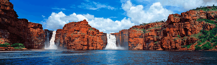
Babinda Boulders
The Boulders, also known as Babinda Rocks, is a delightful picnic and recreational spot where a series of waterfalls, rapids and mountain streams flow into caverns, swimming holes of various depths as they wend their way through large granite boulders.
Location: Boulders Road near Babinda.
![]()
Murray Falls
Murray Falls is one of north Queensland's prettiest waterfalls, with large volumes of water racing over naturally sculpted pink granite boulders. Rain forested mountains and tropical lowlands meet in the attractive foothills of the Kirrama Range.
Location: Murray Upper National Park, 42 kilometres north-west of Cardwell, 38 kilometres south of Tully.
![]()
Jourama Falls
Jourama Falls is a popular camping and picnic area beside rainforest fringed Waterview Creek. A 1.5 kilometre walking track winds along the creek and down into the rainforest where you walk through wide the rocky creek bed to the other side with the aid of a fixed chain. There are breathtaking views of the waterfall cascading over salmon coloured granite cliffs, particularly in the wet season. There are numerous opportunities to swim in the waterholes along the walk.
Location: via Bruce Highway, 24 kilometres south of Ingham or 90 kilometres north of Townsville
![]()
Josephine Falls
At the base of Mt. Bartle Frere, the waters of Josephine Creek tumble over granite boulders, forming the picturesque Josephine Falls. The 30 minute walk to the viewing platform is through a mesophyll vine forest, the most complex rainforest type in Australia.
Location: 75km south of Cairns. From Innisfail, turn off Bruce Highway 2km before Miriwinn.
![]()
Wallerman Falls
At 268 metres, Wallaman Falls has the distinction of being Australia's tallest single-drop permanent waterfall. The overlook at the top of the falls is near the car park, however there is a steep 4km return walk to the base of the falls. Stoney Creek, which tumbles over the falls, flows all year round, but it can be little more than a trickle in the dry season.
Location: Girringun (Lumholtz) National, 50km west of Hinchinbrook Island and the town of Ingham.
![]()
Tully Falls
The falls only run in a big wet season, but the walls of raw rock and rainforest which plunge 300 metres (984 feet) down to the Tully River are still an awe-inspiring sight. An 800 metre track takes walkers to the Tully River above the falls.
Location: Tully Gorge Lookout, via Tully Falls Road, 35km north-west of Tully
![]()
Cannabullen Falls
This walk to these falls is part of the newly opened Misty Mountain Trails which is situated between the towns of Innisfail, Tully, Ravenshoe and Millaa Millaa. Cannabullen Falls Lookout is a 12.2km return walk from Hinson Creek trail head on Sutties Gap Road. The Cannabullen Falls access track heads south-east, gently descending the basaltic plateau to the eastern edge of the gorge where the sheer drop at Cannabullen Falls is about 70m.
Location: near the Palmerston Highway in the Cardwell Range, 30km south of Millaa Millaa.
Elizabeth Grant Falls
![]() This walk to these falls is part of the newly opened Misty Mountain Trails which is situated between the towns of Innisfail, Tully, Ravenshoe and Millaa Millaa. Accessible via the Cochable Creek trail head. Scenic views of Elizabeth Grant falls, cascading over 300m onto Koolmoon Creek track, can be experienced from a lookout. Follow the Koolmoon Creek track (orange track markers) for approximately 3km until you reach the turn off to the falls lookout. The falls themselves are not accessible. This walk to these falls is part of the newly opened Misty Mountain Trails which is situated between the towns of Innisfail, Tully, Ravenshoe and Millaa Millaa. Accessible via the Cochable Creek trail head. Scenic views of Elizabeth Grant falls, cascading over 300m onto Koolmoon Creek track, can be experienced from a lookout. Follow the Koolmoon Creek track (orange track markers) for approximately 3km until you reach the turn off to the falls lookout. The falls themselves are not accessible.
Location: off Tully Falls Road in the Cardwell Range, 40km north of Tully.
|
Central Qld
![]()
Moss Garden, Carnarvon Gorge
There are many waterfalls and cascades within Carnarvon Gorge, many of them unnamed, but the most well known is one at a location called Moss Gardens. Moss Gardens is in one of the most scenic areas of the Gorge; it features an incredible moss-draped wall adjacent to the Gorge's prettiest waterfall.
Location: Carnarvon Gorge National Park,
![]()
View from the top of Two Mile Falls
Two Mile Falls
The spectacular gorges of Blackdown Tableland National Park rise boldly above the plains at the north-eastern edge of the Central Queensland sandstone belt. Two Mile Falls, which only runs after rain, is where one of a number of watercourses enter the gorges.
Location: Blackdown Tableland, 2·5 hours’ drive west of Rockhampton via the Capricorn Highway.
![]()
Stony Creek Falls
Stony Creek, within Blackdown Tableland National Park, tumbles into Stony Creek Gorge in a single drop, but is dry for most of the year.
Location: Blackdown Tableland, 2·5 hours’ drive west of Rockhampton via the Capricorn Highway.
![]()
Rainbow Falls
At 25 metres, Rainbow Falls is among the biggest (if not the biggest) falls in a 100km radius around Blackdown Tableland. The falls nestles is a gorge surrounded by tropical plant and wildlife, a truly beautiful, natural setting. Above the main falls, there are several smaller cascades, and a number of swimming holes. To get to the very bottom of the gorge you then have to go down 240 stairs.
Location: Blackdown Tableland, 2·5 hours’ drive west of Rockhampton via the Capricorn Highway.
![]()
Wheel of Fire Falls
These falls are on the Wheel of Fire Track, which branches off the Araluen Cascades Track. It is a 4.2km return trip.
Location: Finch Hatton Gorge, Eungella National Park, Eungella, west of Mackay, Qld
![]()
Araluen Falls
The falls is one of the highlights of a walk through the rainforests of Finch Hatton Gorge. It is in Eungella National Park, which is set within the spectacular Clarke Range which reaches a height of 1280 at the summit of Mt. Dalrymple. The rock pool at the falls is a popular swimming spot.
Location: Eungella National Park, Eungella, west of Mackay, Qld
![]()
Cedar Creek Falls
These falls are set in a natural rock amphitheatre, and are particularly spectacular in the wet season. There is a year-round natural swimming pool at the base of the falls.
Location: 19km from Proserpine on Conway Beach Road
![]()
Kooroorinya Falls
A natural waterhole surrounded by high rock walls on one side and sandy, shaded banks on the other. Visitors can go swimming, fishing, birdwatching or just take a walk. The falls are quite spectacular falls during the wetter months.
Location: Muttaburra Road, 65 kilometres south of Prairie, Qld
|